Download
Preview
Add to list
More
14.3 km
~3 hrs 9 min
181 m
Loop
“Slip into a quiet, wooded loop of pondside birdsong and gentle rises—muddy spots may challenge some.”
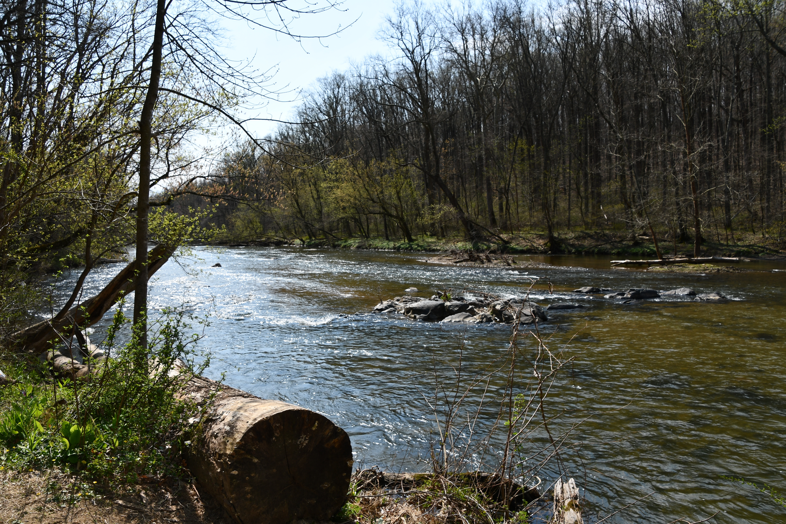
This easy, mostly-wooded loop strings together three of the park’s quieter footpaths—Sawmill, Lost Pond, and Sweathouse—into a long, low-stress day that feels remote without being far from town. Expect a mix of packed dirt, leaf litter, and short rooty sections, with a few gentle rises that add up to roughly 14 km (8.7 mi) and about 200 m (656 ft) of climbing overall. After rain, the low areas near the river and pond can stay muddy, and a couple of shallow drainages may require careful footing on slick rocks or roots.
Getting to the trailhead (car + public transport)
Because “near” is incomplete, the most reliable access point for this trail combination is typically within Gunpowder Falls State Park (Hammerman Area / Kingsville–Joppa corridor), where multiple trailheads connect into the Sawmill/Lost Pond/Sweathouse network. If you share a pin (lon/lat) or the exact parking lot name, I can convert it to the nearest address/landmark precisely; for now, plan around these common start options:
- By car: Aim for Gunpowder Falls State Park – Hammerman Area (near Kingsville, MD) and use the main park entrance/parking as your staging point. Arrive early on weekends—this is a popular river park and lots can fill quickly in warm weather.
- By public transport: From downtown Baltimore, the most practical approach is usually MTA bus service toward the Parkville/Carney area, then a short rideshare/taxi hop to the park entrance. Transit coverage right to the trailhead is limited, so budget extra time and confirm schedules the day before.
If you provide the intended start point coordinates, I’ll translate them to the nearest known address or landmark and tailor the approach directions to that exact lot.
You’ll start on broad, friendly tread that eases you into the forest. The first couple of kilometers/miles are typically the most “civilized” feeling—wider path, fewer obstacles—before the loop settles into a quieter rhythm of mixed hardwoods and streamside corridors. The elevation gain is spread out in small increments rather than one big climb, so it’s a good choice for newer hikers who want distance without steep grades.
As you transition onto Sawmill Trail, the character often becomes more intimate: narrower singletrack, more roots, and occasional short, punchy rises. Keep an eye out for subtle junctions—this is where people most often wander onto a connector path. Use HiiKER to confirm you’re staying on the intended trail at each intersection, especially where unofficial footpaths braid off toward the river.
Landmarks, terrain, and what to watch for
Lost Pond Trail is the centerpiece for many hikers: the terrain tends to flatten and the forest opens in places, with wetter ground and a noticeable change in plant life. Around pond edges and low wetlands, you’ll often see: - Ferns, skunk cabbage, and moisture-loving understory plants - Songbirds in the canopy and woodpeckers along dead snags - Amphibians (especially in spring) near saturated ground
The pond area is also where you’ll want to be most careful with footing. Mud can be slick, and boardwalks (if present on your exact line) can be slippery when damp. In warm months, this is prime mosquito and tick habitat—long pants or gaiters and a tick check afterward are smart.
On Sweathouse Trail, expect a return to gently rolling forest walking. The name hints at the “humid” feel you can get in sheltered woods on still days, especially in summer. This segment often includes the loop’s most consistent undulation—nothing steep, but enough to notice late in the hike. If you’re pacing effort, plan your snack/water break before this section so you’re not trying to refuel while navigating junctions.
Wildlife is typical of Maryland’s Piedmont/coastal-plain edge forests: white-tailed deer, gray squirrels, chipmunks, and a variety of warblers and thrushes. You may also encounter non-venomous snakes sunning near open patches; give them space and they’ll usually move off. If you’re hiking at dawn/dusk, be extra alert for deer on wider park roads and near parking areas.
History and sense of place
Gunpowder Falls and the surrounding river corridor have long been valued for water power and industry. The broader region supported mills and small industrial sites that relied on steady flow from the Gunpowder and its tributaries—many trails in the park pass through landscapes shaped by that era, even when the structures themselves are gone or reduced to subtle earthworks and old alignments. The park today protects a mosaic of river, wetland, and upland forest that would otherwise be heavily fragmented by development in the Baltimore suburbs.
Plan on 2.5–4.5 hours depending on pace and stops (8.7 miles is “easy” by grade, but still a solid distance). Carry at least 1–1.5 L of water, more in humid weather, and consider light traction-friendly footwear if rain is forecast—mud and wet roots are the most common “gotchas” on this loop. If you send the start-point coordinates (or the exact parking lot name), I can lock in the nearest address/landmark and describe the loop direction-by-direction with more accurate segment distances and the key junctions to watch on HiiKER.

Surfaces
Unknown
Ground
Dirt
Grass
Gravel
Unpaved
Concrete
Comments and Reviews
User comments, reviews and discussions about the Gunpowder Falls via Sawmill Trail, Lost Pond Trail and Sweathouse Trail, Maryland.
average rating out of 5
0 rating(s)