Download
Preview
Add to list
More
32.2 km
~2 days
288 m
Multi-Day
“Explore the historic and scenic Torrey C Brown Trail, a 20-mile haven for hikers and nature enthusiasts.”
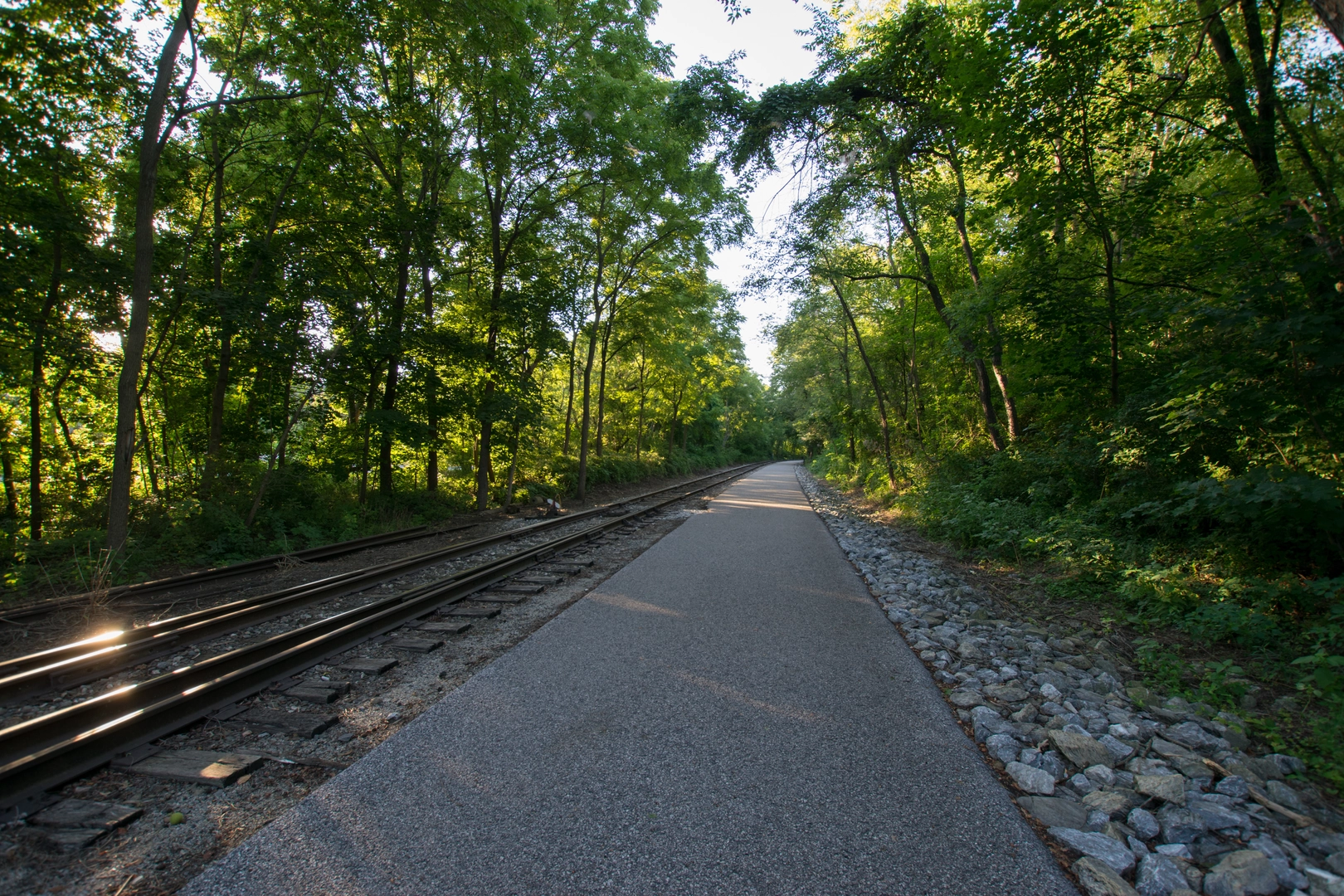
The Torrey C Brown Trail, formerly known as the Northern Central Railroad Trail (NCR Trail), stretches approximately 32 kilometers (20 miles) from Ashland Road in the Hunt Valley area to the Maryland-Pennsylvania state line. With an elevation gain of around 200 meters (656 feet), the trail offers a relatively flat, crushed stone surface that makes it accessible for hikers of varying skill levels, though it is rated medium due to its length.
Getting to the Trailhead
To reach the trailhead near Baltimore County, Maryland, hikers can drive and park at the Ashland Road area where parking is available. For those opting for public transportation, local bus services can be used to get closer to the area, followed by a short walk to the trailhead itself.
Navigating the Trail
As you embark on your hike, using HiiKER as your navigation tool will help you stay on track and provide you with real-time updates on your location along the trail. The app also highlights points of interest and can be a valuable resource for planning rest stops or identifying nearby amenities.
Historical Significance and Landmarks
The trail follows the abandoned Northern Central Railway line, which played a significant role in the Civil War and was later used for commercial purposes. Along the route, you'll pass through several small towns and historical landmarks, including the Monkton Station, which now serves as a museum and visitor center. This is a great place to stop and learn about the area's rich history, approximately 13 kilometers (8 miles) from the start.
Nature and Wildlife
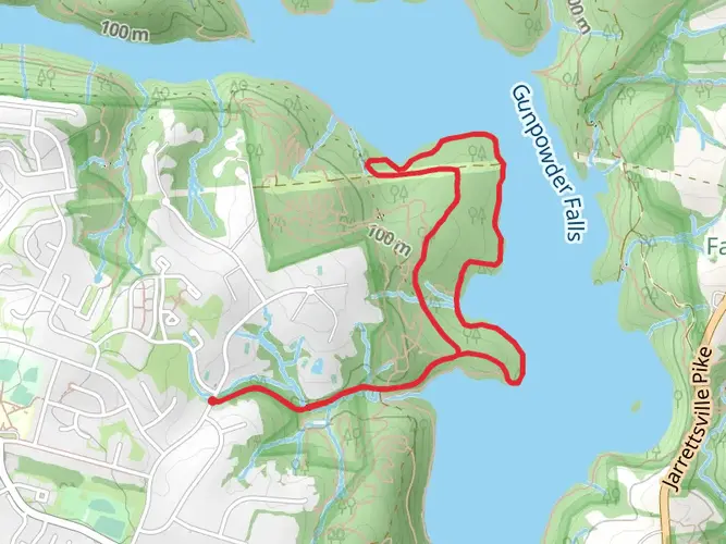
The surrounding landscape is characterized by picturesque countryside, with opportunities to spot local wildlife such as deer, foxes, and a variety of bird species. The trail also meanders alongside the Gunpowder River, offering serene views and the chance to see beavers at work if you're lucky.
Trail Features and Amenities
Several bridges and boardwalks dot the trail, providing scenic overlooks and convenient crossings over streams. Restrooms and picnic areas can be found at regular intervals, making it easy to take breaks and enjoy the natural beauty of the area.
Preparing for Your Hike
Before setting out, ensure you have enough water and snacks for the journey, as the trail's length can take several hours to complete. Dress in layers to accommodate changing weather conditions, and consider bringing a camera to capture the stunning scenery you'll encounter along the way.
Remember, the Torrey C Brown Trail is a point-to-point hike, so you'll need to arrange transportation back to your starting point or be prepared for a round trip of 64 kilometers (40 miles) if you plan to return on foot.

What to expect?
Activity types
Frequently asked questions
How long is the Torrey C Brown Trail and how much elevation gain does it have?
The Torrey C Brown Trail is 32.18 km long, or about 20 miles, with roughly 288 m of elevation gain. It follows a former railroad corridor from Ashland in northern Baltimore County to the Maryland-Pennsylvania state line, so the grade stays gentle for most of the route despite the full-day or multi-day distance.
Is the Torrey C Brown Trail easy enough for beginners and families?
The Torrey C Brown Trail is generally considered easy because it follows an old rail bed with a flat, gradual profile and a crushed-stone surface. The main challenge is length rather than steep climbing, so shorter out-and-back walks from access points such as Phoenix, Monkton, Sparks, White Hall, or Freeland are often more manageable for beginners and families.
Are dogs allowed on the Torrey C Brown Trail in Maryland?
Dogs are allowed on the Torrey C Brown Trail, and Maryland park rules require pets to stay on a leash. The trail is part of Gunpowder Falls State Park, and the route also has dog-friendly amenities including drinking fountains along the corridor, which helps on warmer days.
Where can you park for the Torrey C Brown Trail?
Parking for the Torrey C Brown Trail is available at several access points along the route, including Ashland, Sparks, Phoenix, White Hall, and Freeland. Maryland lists parking at 1302 Paper Mill Road in Cockeysville, at 1207 Sparks Road in Sparks-Glencoe, and at 1349 Wiseburg Road in White Hall, with no fee to park or access the trail.
What is the surface like on the Torrey C Brown Trail?
The Torrey C Brown Trail has an improved crushed-stone rail-trail surface rather than a rugged dirt or rocky footpath. That makes it smoother and more predictable underfoot than many hiking trails, and the route stays relatively flat for more than 20 miles because it follows the former Northern Central Railway line.
What towns and landmarks do you pass on the Torrey C Brown Trail?
The Torrey C Brown Trail passes through Ashland, Phoenix, Monkton, White Hall, Bentley Springs, and Freeland on its way to the state line. One of the best-known stops is the restored 1898 Monkton Train Station, which serves as a museum and ranger station and preserves the trail's Northern Central Railway history.
Can you continue past the end of the Torrey C Brown Trail into Pennsylvania?
Yes. At the Maryland-Pennsylvania border, the Torrey C Brown Trail connects with the Heritage Rail Trail in York County, so the route can continue north beyond the Maryland section. Overnight parking for out-of-state through trips requires advance approval from the park if a vehicle will be left in a Torrey C Brown Trail parking area.
Comments and Reviews
User comments, reviews and discussions about the Torrey C Brown Trail, Maryland.
4.0
average rating out of 5
6 rating(s)