Download
Preview
Add to list
More
9.2 km
~2 hrs 17 min
261 m
Loop
“Climb through hardwood hollows to a breezy High Knob, with steady grades and well-timed breathers.”
This medium loop/clover-style hike climbs to a prominent high point on the Cumberland Plateau, linking the Green Ash Trail and Yellow Poplar Trail for a steady, scenic ascent with a few short, punchier grades. Expect roughly 9 km / 5.6 mi total distance with about 300 m / ~985 ft of elevation gain—enough to feel like a workout, but with frequent “breather” stretches on old woods roads and bench-cut singletrack.
Getting to the trailhead (car + public transport)
Because the hike start is listed only as “near” (no coordinates provided), the best I can do is describe how to plan access once you confirm the exact trailhead pin in HiiKER:
- By car: Use HiiKER to navigate to the Green Ash Trail access point closest to the loop you intend to hike. In this region, trailheads are often at small gravel pull-offs, forest road gates, or day-use parking areas rather than signed “big” trailhead lots. Plan for limited parking and no services.
- By public transport: In most rural plateau/forest settings, public transit typically gets you only as far as the nearest town. From there, you’ll usually need a rideshare/taxi to reach the trailhead. If you share the HiiKER start pin (or the county/state/park name), I can translate it to the nearest known address or landmark and outline the most realistic transit approach.
If you paste the lon/lat from HiiKER, I’ll convert it to the nearest recognizable road junction, facility, or landmark as requested.
What to pack and plan for: - Water: Carry at least 1.5–2 L per person for a 9 km / 5.6 mi hike, more in warm weather. Seasonal streams can be unreliable on plateau terrain. - Footwear: Trail runners or light boots with good grip—leaf litter over hardpack can be slick, and short rocky pitches are common. - Navigation: Download the route in HiiKER for offline use; cell coverage can be patchy in hollows. - Ticks/poison ivy: Common along lower, brushier sections and sunny edges—long socks and a quick tick check help.
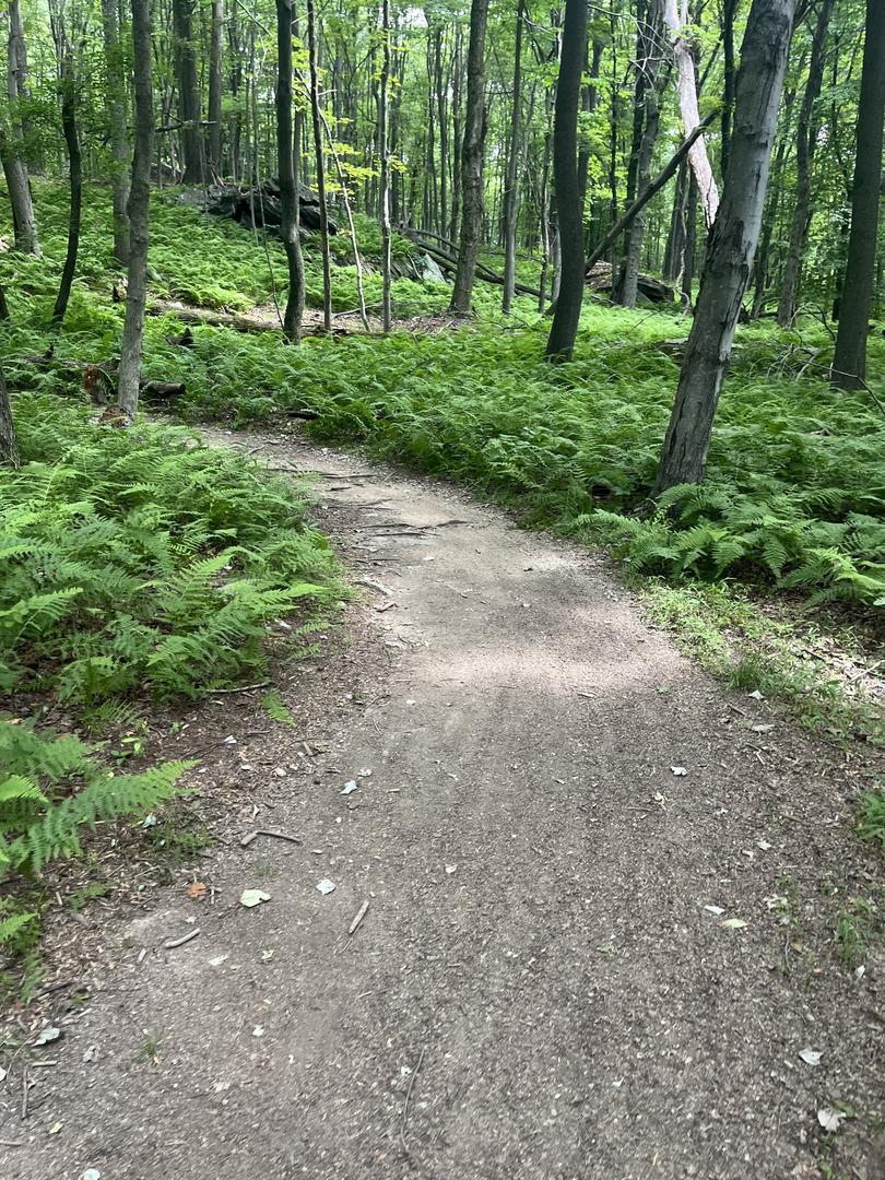
The walk: what the terrain feels like
You’ll start on the Green Ash Trail with a gentle warm-up that quickly settles into a consistent climb. The grade is usually moderate, but it tends to come in steps: a steady rise, a flatter traverse, then another rise. Over the first few kilometers you’ll gain most of the elevation in a way that feels manageable—think short, sustained uphill efforts rather than one long grind.
As you climb, the forest character often shifts from richer, mixed hardwoods in the lower elevations to a slightly drier, more wind-shaped feel higher up. The tread can alternate between: - Narrow singletrack with roots and occasional embedded rock - Wider old roadbed sections that are easier to follow and pass on - Short rocky or eroded pitches where you’ll want to watch footing, especially after rain
At around the mid-hike point, the connection to the Yellow Poplar Trail typically brings a change in rhythm—often a more contouring traverse before the final push toward High Knob. This is where hikers sometimes relax and accidentally miss a junction, so keep an eye on HiiKER at trail intersections and where old road traces split.
Landmarks, views, and natural highlights
“High Knob” destinations are often named for a rounded summit or prominent high point rather than a sharp peak. The payoff may be: - A viewpoint (sometimes seasonal through the trees) - A rock outcrop or open knob area - A high, breezy ridge with a different plant community than the hollows below
Even when the summit is wooded, the sense of elevation is noticeable: cooler air, more wind, and a quieter understory. Look for: - Yellow poplar (tuliptree)—tall, straight trunks; in season, distinctive tulip-like flowers and large leaves - Green ash (where present)—note that ash species across the eastern U.S. have been heavily impacted by the emerald ash borer, so you may see standing dead ash or canopy gaps where ash once dominated - Spring wildflowers in richer coves (trillium, violets, and other ephemerals depending on exact location) - Mosses and lichens on shaded rocks and north-facing slopes
Wildlife you might encounter: - White-tailed deer (most common) - Wild turkey (often heard before seen) - Black bear in some plateau forests—generally shy; store food securely and give space - Songbirds and woodpeckers; raptors may ride thermals near open knobs - Snakes (including non-venomous species) sunning on warm days; watch where you place hands/feet on rock ledges
Historical context to watch for on the ground
In many Cumberland Plateau and Appalachian highland areas, trails like these often follow or intersect remnants of older land use. Without the exact state/forest unit, the most common historical traces you may notice include: - Old logging grades/roads: wide, benched paths with unnaturally even side slopes - Cut stumps and second-growth forest structure: evidence of timber harvest cycles from the late 1800s through the 1900s - Stone piles, old fence wire, or faint homestead terraces in lower elevations: signs of past settlement

Surfaces
Ground
Gravel
Unknown
Unpaved
Comments and Reviews
User comments, reviews and discussions about the High Knob via Green Ash Trail and Yellow Poplar Trail, Maryland.
average rating out of 5
0 rating(s)