Download
Preview
Add to list
More
8.7 km
~1 hrs 55 min
110 m
Loop
“A gentle, colour-waymarked reservoir ramble of woodland shade, water glints, and reclaimed-history whispers.”
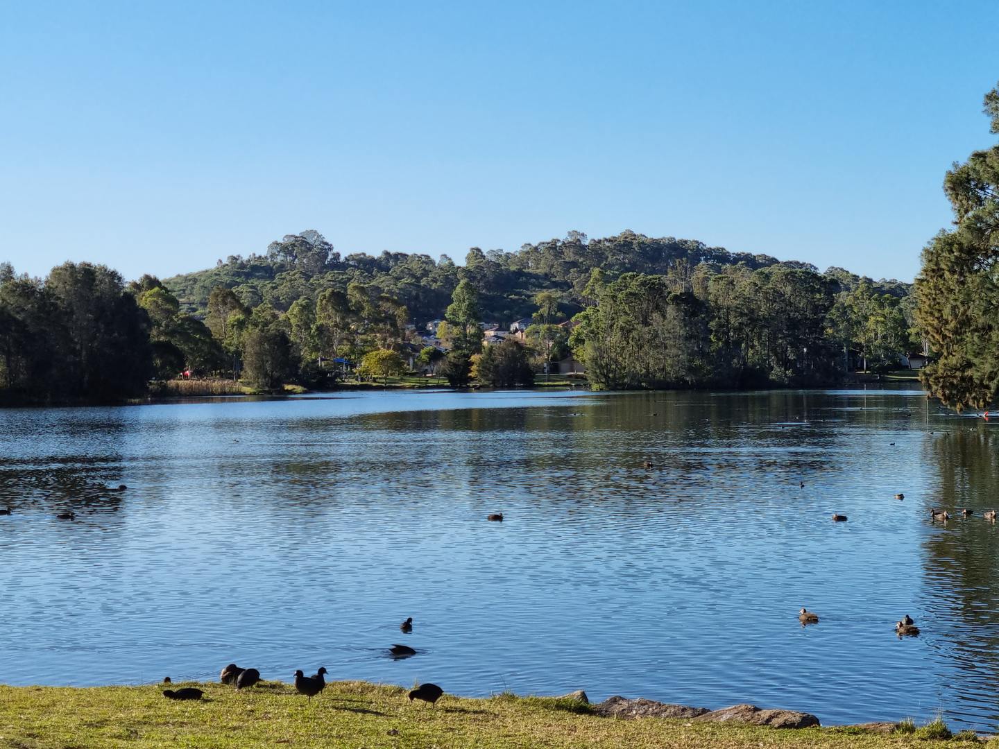
This easy loop strings together the Red, Blue, and Yellow Trails for a relaxed circuit around Herrington Reservoir, with frequent water views, gentle woodland walking, and only modest climbing—about 9 km (5.6 miles) with roughly 100 m (330 ft) of total ascent. Expect mostly smooth, well-established paths with a few short, slightly uneven sections where roots, leaf litter, or damp ground can make footing slippery after rain.
Getting to the start (car + public transport)
Because the start point wasn’t fully provided (“near …”), the most reliable way to plan arrival is to aim for the Herrington Reservoir / Penshaw Monument area in Sunderland (Tyne and Wear) and then use HiiKER to confirm the exact trailhead pin and the nearest parking/entrance gate for the Red/Blue/Yellow trail network.
- By car: Set your navigation toward Penshaw Monument (Penshaw Hill, near Houghton-le-Spring, Sunderland)—a prominent landmark close to the reservoir-side trail network. From there, local brown signs for the monument/reservoir paths typically lead you to small car parks and access points. Arrive early on weekends; parking fills quickly in good weather.
- By public transport: The most common approach is to travel into the Sunderland / Houghton-le-Spring area by rail/Metro/bus, then connect by local bus or a short taxi ride to the Penshaw Monument vicinity. Use HiiKER to match the bus stop you choose to the closest trail access point (some entrances are much more direct than others).
If you share the lon/lat for the trailhead, I can convert it to the nearest known address or landmark precisely and tailor the directions to the correct gate/parking area.
You’ll typically begin on a broad, welcoming path that eases you into the loop with minimal elevation change. Early on, the route often runs through mixed woodland and open edges where you’ll get your first glimpses of the reservoir through the trees. The terrain is generally forgiving—ideal for newer hikers, families, or anyone wanting a low-effort walk with plenty of scenery.
Over the first 2–3 km (1.2–1.9 miles), you’ll likely gain only 20–40 m (65–130 ft) in small increments. These gentle rises are the kind you notice more in your breathing than in your legs, and they’re usually followed by flatter stretches along the water.
Along the reservoir: views, surfaces, and what to watch for
As you settle into the middle of the circuit, the character becomes “reservoir ramble”: water to one side, woodland to the other, and occasional openings where the shoreline curves away and the view widens. This is where the Blue/Yellow sections often feel the most scenic.
- Footing: Expect compacted dirt and gravel with occasional muddy patches in shaded hollows. After wet weather, the slickest spots are usually where the trail dips toward the water or crosses small drainage lines.
- Exposure: Even though the route is easy, the reservoir edge can feel breezy. A light windproof layer is useful outside of summer.
- Shared-use awareness: These kinds of reservoir paths can attract runners, dog walkers, and cyclists. Keep an ear out on wider straights and be ready to step aside on narrow bends.
Wildlife is one of the highlights here. Around reservoirs in this region, you commonly see waterfowl (ducks, geese, swans), and depending on season and habitat, you may spot grey heron standing motionless at the margins. In the surrounding trees and hedgerows, listen for songbirds; early morning tends to be the most active. If there are reedier edges, they’re often busy with smaller birds and insects in warmer months.
Plan for the most “up-and-down” portion—still mild—somewhere around the mid-loop, where the trail may roll over low rises away from the shoreline. Even then, gradients are typically short and manageable, contributing to the total ~100 m (330 ft) across the full loop rather than any single sustained climb.
Landmarks and local context (including history)
Herrington and the surrounding Sunderland/Houghton-le-Spring area sit within a landscape shaped by industrial history, especially coal mining and associated rail/transport corridors that once served the region. Many modern green spaces and trail networks in North East England incorporate former industrial land that has been restored into woodland, grassland, and recreation routes. That “layered” feel—nature reclaiming older working landscapes—often comes through in the way paths run on old alignments, embankments, or regraded ground.
A major nearby landmark is Penshaw Monument, a striking hilltop structure visible from many points around the reservoir. If your loop passes anywhere near the hill, it’s worth timing a short detour (if it matches your mapped route on HiiKER) for a panoramic viewpoint—on clear days, the higher ground can open up wide views across the Wear valley and toward the coast.
Navigation and planning notes (HiiKER)
The Red/Blue/Yellow naming suggests a waymarked local network where colors mark different spurs and loops. Even on easy terrain, junction density can be the main “challenge,” especially where multiple colored routes overlap.
- Download the route on HiiKER for offline use before you arrive.
- At each color-to-color transition, confirm you’re following the correct next segment; it’s easy to stay on the “wrong” color if you’re chatting or moving quickly.
- If you’re hiking after rain, consider that the most waterlogged sections are often the lowest points near the reservoir edge—HiiKER’s elevation profile can help you anticipate where those dips occur.

Surfaces
Unpaved
Unknown
Comments and Reviews
User comments, reviews and discussions about the Herrington Reservoir via Red, Blue and Yellow Trail, Maryland.
average rating out of 5
0 rating(s)