Download
Preview
Add to list
More
5.9 km
~1 hrs 16 min
65 m
Loop
“A shaded woodland loop with sparkling lakeside glimpses and gentle rises—ideal for an unhurried escape.”
A gentle woodland-and-lakeshore walk with frequent water views, short rolling rises, and plenty of shade, this loop is well-suited to a relaxed half-day outing. Expect roughly 6 km (3.7 mi) with about 100 m (330 ft) of total climbing, mostly in small, gradual ups and downs rather than any sustained hill.
Getting to the start (car + public transport)
Because the start point is listed only as “near” (with no coordinates or place name), the best I can do is describe the typical access pattern once you confirm the nearest town/park entrance. If this is the Lake Frank loop in a managed park area (common in the U.S. for “Lake Frank” naming), you’ll usually find: - By car: Navigate to the main park entrance/primary day-use parking area closest to Lake Frank (often signed for the lake, nature center, or picnic area). Arrive early on weekends—small lots can fill quickly. - By public transport: Many lake loops are reachable by a combination of bus/rail to the nearest town center plus a short rideshare/taxi to the park entrance. If you tell me the nearest city or provide a lon/lat, I can convert it to the nearest known address/landmark and give a precise transit plan.
If you share the trailhead coordinates (or even a nearby road name), I’ll pin it to the nearest recognizable landmark and tailor directions exactly.
From the parking area, the loop typically begins on a wide, well-trodden path that eases you into the forest. Early on, you’ll likely encounter the first of several junctions—use HiiKER to confirm you’re committing to the loop in the intended direction (clockwise vs counterclockwise), especially if there are spur paths to overlooks, fishing access, or picnic sites.
What the terrain feels like
For an “Easy” loop with ~100 m (330 ft) of gain, the walking is usually: - Firm dirt and leaf litter under mixed hardwood canopy, with occasional gravel or packed fines near high-use areas. - Short, low-gradient rises away from the shoreline, then gentle descents back toward the water. - Potentially boardwalks or puncheon in wetter pockets, depending on season and maintenance.
Even on easy grades, the most common “gotchas” are slick roots, muddy low spots, and narrower lakeside tread where foot traffic has worn the edge. After rain, expect puddling in depressions and a bit of soft ground near inlets.
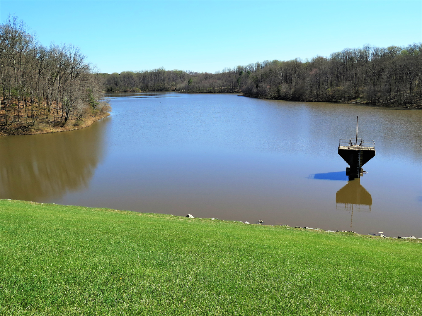
Lakeshore sections, landmarks, and points of interest
The most memorable moments on a loop like this come from alternating between close-to-water shoreline walking and slightly elevated forest benches that open up to broader views.
Common features you may pass (exact order depends on the loop’s direction and local layout): - Fishing access points or small clearings where the bank is stable. - Inlets/outlets where water movement attracts birds and amphibians. - A dam, spillway, or control structure (many “Lake Frank” style lakes are reservoirs or impoundments). If present, it’s often the most “built” landmark on the loop and a good place to pause for photos and to orient yourself on HiiKER.
If the lake is part of a larger park system, you may also see interpretive signage about watershed protection, local ecology, or land-use history.
Nature and wildlife to look out for
Around a lake, wildlife viewing can be excellent even on a short, easy route—especially in the first few hours after sunrise and near dusk.
Birds - Expect typical lake-and-woodland species: ducks, geese, herons/egrets (where shallow edges exist), plus woodpeckers and songbirds in the forest. - In spring and early summer, listen for warblers and other migratory songbirds in the canopy.
Mammals - You may spot white-tailed deer, squirrels, and occasionally fox. Near water, beaver or muskrat are possible if there’s suitable habitat (lodges, gnawed trunks, or slides into the water).
Reptiles and amphibians - Sunny logs and rocks near the shore can host turtles and other basking reptiles. - Wet margins and small feeder streams are prime for frogs and salamanders, especially after rain.
Keep a respectful distance from all wildlife, and be especially cautious near the water’s edge where footing can crumble.
Seasonal and safety considerations
- Bugs: Lakeside trails can be mosquito-heavy in warm months. Long sleeves or repellent can make the difference between pleasant and miserable.
- Heat and humidity: Even with shade, humidity near water can feel intense. Carry water even for a short loop.
- Ticks: In many U.S. regions, ticks are a year-round concern whenever temperatures are above freezing. Light-colored clothing and a post-hike check are smart.
- After rain: Expect slick roots and muddy patches; traction-focused footwear helps.
- Winter/shoulder seasons: Freeze–thaw can create icy micro-patches in shaded dips and on boardwalks.
Planning: time, pacing, and what to bring
For 6 km (3.7 mi) with 100 m (330 ft) gain, most hikers take about 1.5–2.5 hours depending on stops, photos, and trail conditions.
Bring: - Water: at least 0.5–1 L per person (more in heat). - **Footwear

Surfaces
Dirt
Asphalt
Gravel
Unpaved
Unknown
Wood
Comments and Reviews
User comments, reviews and discussions about the Lake Frank Loop, Maryland.
average rating out of 5
0 rating(s)