Download
Preview
Add to list
More
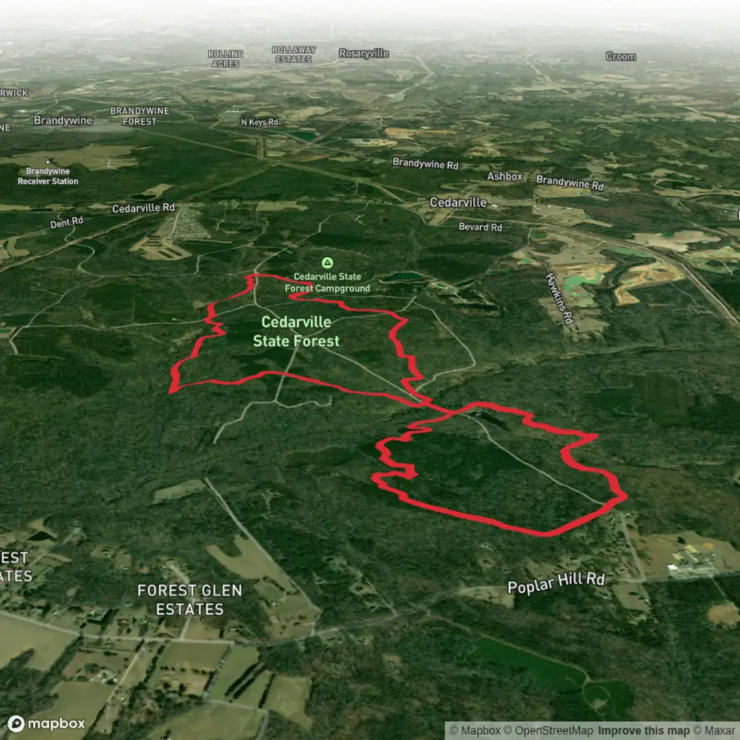
10.5 km
~2 hrs 10 min
49 m
Loop
“Circle Cedarville Pond through whispering woods and shimmering water, with gentle rises for many.”
Cedarville Pond makes for a relaxed, low-elevation loop-style outing with frequent water views, mixed woodland, and a few short, gentle rises that keep things interesting without ever feeling strenuous. At roughly 10 km (6.2 mi) with about 100 m (330 ft) of total climbing, it’s well-suited to newer hikers, families, or anyone looking for a steady-paced walk with classic pond-and-forest scenery.
Getting to the trailhead (car + public transport)
Because the hike start is listed only as “near” (no coordinates or town/state provided), I can’t reliably convert the start point to a nearest address or landmark yet. If you share a lat/long (or even the parking lot name / road name / town), I’ll pin it to the closest known address or notable landmark and tailor the directions precisely.
For planning purposes, here’s how this typically works for pond-trail systems like this:
- By car: Expect a small trailhead pull-off or a modest lot near a conservation area entrance. Arrive earlier on weekends—pond loops are popular for dog-walkers and casual hikers, and parking can fill quickly.
- By public transport: These trailheads are often reachable by a combination of regional rail/bus to the nearest town center, then a short rideshare/taxi to the trailhead. If you tell me the nearest town you’re aiming for, I can outline the most practical transit approach and what to watch for on the last-mile road walk (if any).
What the route feels like underfoot
You’ll be moving through a mix of packed dirt path, leafy singletrack, and occasional rooty or slightly rocky stretches—nothing technical, but enough uneven footing that supportive shoes are worthwhile. With only about 100 m (330 ft) of gain spread across 10 km (6.2 mi), the climbs tend to come as short rollers rather than one sustained ascent.
Because this route uses two named paths—Blue Trail and Brown Trail—it’s usually straightforward to follow if blazes are maintained. Still, intersections around ponds can be surprisingly busy with spur paths and informal fisherman tracks, so it’s smart to have HiiKER ready for quick confirmation at junctions.
Blue Trail: settling into the woods and first water views
Most hikes like this begin by easing you into the landscape: a gentle approach through mixed hardwoods (often oak/maple/beech depending on region) with a gradual transition toward wetter ground as you near the pond. Early on, you may notice:
- Slightly damper soil and more moss as you approach low areas
- Boardwalks or stepping stones in seasonally wet spots (if present, they can be slick after rain)
- The first openings through the trees where the pond begins to appear
If you’re hiking in warmer months, expect insects near the water—bring repellent and consider long sleeves if you’re sensitive to bites. After rain, the lowest sections can hold shallow puddles; waterproof trail runners or light hikers are usually enough.
Around Cedarville Pond: landmarks, nature, and wildlife
As you draw alongside the pond, the character of the hike shifts from forest walk to shoreline ramble. The most memorable moments tend to be:
- Longer pond-edge views where the trail runs close to the water
- Small inlets and reedy margins that attract birds
- Occasional rocky nubs or little clearings that make natural pause points (great for a snack without blocking the trail)
Wildlife you’re most likely to encounter (or hear) around pond habitat:
- Waterfowl (ducks, geese) and seasonal migrants
- Songbirds in the surrounding canopy
- Turtles sunning on logs or rocks (warm months)
- Frogs and other amphibians near shallow edges
- White-tailed deer in the quieter wooded stretches (dawn/dusk most common)
If the pond has a dam or old water-control structure, it’s often a key landmark and sometimes the most “historical” feature you’ll see on a short easy hike like this. Many pond systems in the U.S. Northeast and Mid-Atlantic, for example, were shaped by historic milling, small-scale industry, or water management for agriculture and settlement. If you share the state/town (or coordinates), I can identify what’s known locally—whether it’s tied to mill history, conservation-era land protection, or a named historic property nearby.
Brown Trail: the return leg and the “easy” climbs
The Brown Trail portion commonly feels like the return arc—still scenic, but a bit more interior-woods compared to the pond-edge stretches. This is where you’ll likely pick up most of the day’s modest elevation gain in a few gentle rises. Expect:
- Short inclines that add up to about 100 m (330 ft) total over the full route
- A slightly drier forest floor away from the pond margins
- More roots and leaf litter, especially in autumn (watch for hidden rocks under leaves)
Trail intersections can come quickly in these networks. If you reach a junction that doesn’t feel right, check HiiKER and confirm you’re staying on the Brown Trail rather than drifting onto an unmarked spur.
Conditions and practical prep (what to look out for)
- Mud and slick footing: Most likely near the pond edge and in shaded low spots. After rain, take care on any wooden features or smooth rocks.
- Ticks: Common in brushy edges and leaf litter in many regions.

Surfaces
Unpaved
Unknown
Ground
Dirt
Comments and Reviews
User comments, reviews and discussions about the Cedarville Pond via Blue Trail and Brown Trail, Maryland.
average rating out of 5
0 rating(s)