Download
Preview
Add to list
More
4.7 km
~57 min
7 m
Loop
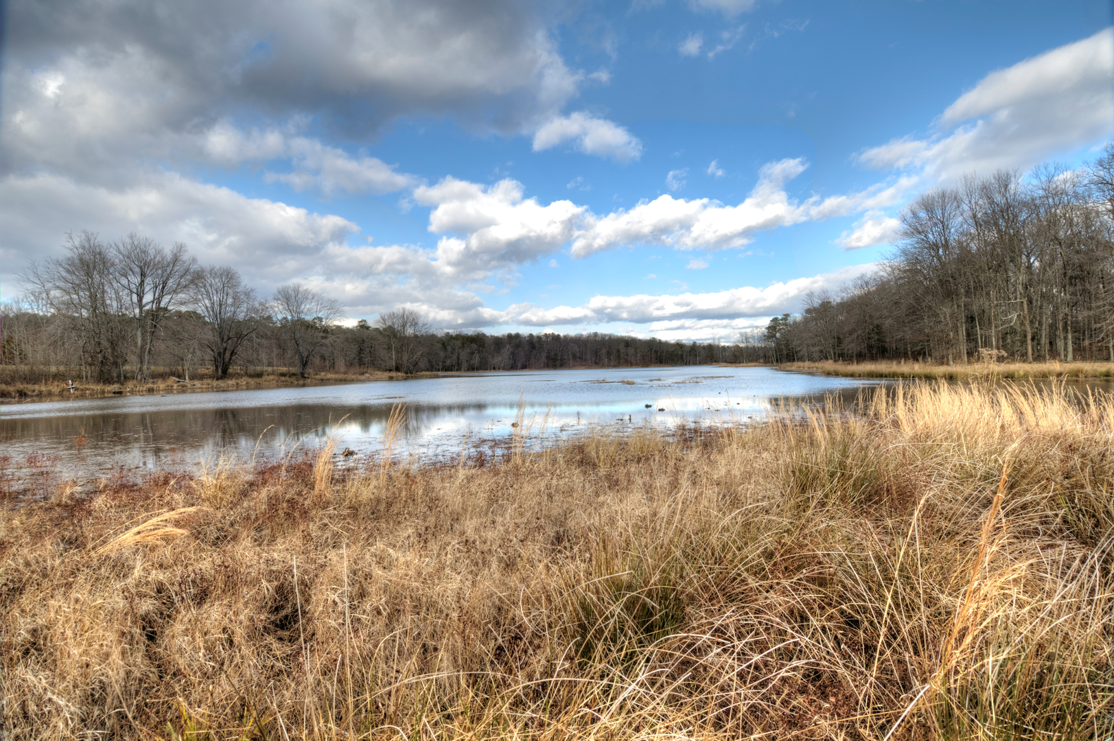
“Follow the gentle fire road to Cash Lake’s hushed shoreline—watch for muddy patches, birds, and busy shared-use moments.”
I’m missing a few key pieces of location data to make this accurate (especially because “Fire Road” and “Cash Lake” exist in multiple regions). If you paste either (a) the start lon/lat, (b) a HiiKER link, or (c) the park/trailhead name + state/province, I can convert the coordinates to the nearest landmark/address and tailor the transport directions, landmarks, wildlife, and any local history.
In the meantime, here’s what to expect on an easy ~5 km / ~3.1 mi, ~0 m / ~0 ft “fire road + lake loop” of this type, and what to plan for—once you confirm the exact location I’ll replace the generic parts with the specific trailhead, transit lines, and named features.
You’ll typically start from a small gravel pull-off, gate, or signed multi-use access point near a park boundary or utility corridor. If you’re driving, plan for limited shoulder parking and watch for “no parking” zones near gates used by maintenance vehicles. If you’re using public transport, these trailheads are often reachable by a bus stop within 0.5–2.0 km (0.3–1.2 mi), but the last stretch is commonly along a road shoulder—bring high-visibility layers if there’s traffic.
The walking itself is straightforward: a wide, gently graded fire road with almost no elevation change, then a narrower lakeside segment that completes the loop. Even with “0 m” listed, expect small undulations and micro-rollers that can add up to a little effort, especially if the surface is soft.
Surface, footing, and what can slow you down
Most of the distance is usually on compacted gravel or hard-packed dirt—comfortable in trail runners in dry weather. After rain, fire roads can hold puddles and develop slick, clay-like patches; the lakeside portion is where you’re more likely to find: - short muddy bottlenecks - roots at the water’s edge - boardwalk planks or small bridges (often damp and slippery) - seasonal flooding that forces a brief detour onto higher ground
On an easy 5 km / 3.1 mi loop, a common breakdown is:
- 0.0–1.5 km (0.0–0.9 mi): wide fire road approach, very gentle grade
- 1.5–3.5 km (0.9–2.2 mi): transition toward the lake, occasional side tracks (stay on the main corridor)
- 3.5–5.0 km (2.2–3.1 mi): lakeside return, narrower tread and more “trail-like” footing
If you’re navigating, load the route in HiiKER before you arrive and download it for offline use—fire roads often have multiple unsigned spurs that look equally “main.”
Landmarks and natural features you’ll likely encounter
A loop like this usually has a few reliable “checkpoints” you can use to confirm you’re on track: - Access gate / fire road marker near the start (often a metal swing gate or bollards) - Junctions with spur roads (these may lead to utility infrastructure, seasonal closures, or maintenance areas) - First clear view of Cash Lake where the trees open up and the shoreline becomes visible - Wetland edges—reeds, sedges, and low shrubs that indicate you’re close to the lake’s outflow or marshy margins
Around the lake, expect a quieter feel: less wind under the trees, more insects in warm months, and more bird activity near the waterline.
Wildlife and seasonal considerations
Even on an easy, family-friendly loop, lakes concentrate wildlife. What you might see depends on region, but typical lake-and-forest species include: - Waterfowl and shorebirds (listen for calls near dawn and dusk) - Turtles sunning on logs (common on calm, warm days) - Amphibians in wetter pockets (especially in spring) - Mammals using the corridor as a travel route—deer are common; smaller mammals are often most active early/late
What to look out for: - Biting insects near still water (bring repellent in late spring through early fall) - Ticks in brushy edges—stay centered on the tread and do a check afterward - Snakes (where present) basking on warm gravel—give them space and step carefully around sunny bends - Dogs and cyclists if the fire road is multi-use—keep right and expect faster traffic on straightaways
Practical planning: time, gear, and safety
For most hikers, 5 km / 3.1 mi on easy terrain takes about 1–1.5 hours, longer if you stop at the lake.
Bring: - 0.5–1 L of water per person (more in heat; fire roads can be exposed) - Sun protection (wide roads often have fewer shade breaks) - Light layers—lakes can feel cooler and breezier - Footwear with decent tread if it’s been wet (the lakeside segment is where slips happen)
If the route passes any active management area (common on fire roads), respect closures and signage—these corridors are used for emergency access and habitat work.
Historical context (what’s commonly true of “fire road” lake loops)
Fire roads are often remnants of older land-use patterns: logging access, utility maintenance routes, or planned firebreaks created for wildfire response. In many regions, lakeside trails also follow older footpaths used for fishing access or

Surfaces
Unknown
Ground
Dirt
Gravel
Wood
Asphalt
Concrete
Comments and Reviews
User comments, reviews and discussions about the Fire Road and Cash Lake Long Loop, Maryland.
average rating out of 5
0 rating(s)