Download
3D Flyover
Add to list
More
1265.0 km
~56 days
46765 m
Multi-Day
The Arizona Trail is an iconic long-distance trail stretching approximately 1265 kilometers (786 miles) from the state's southern border with Mexico to the northern border with Utah. With an elevation gain of around 46,700 meters (153,200 feet), the trail traverses a diverse array of landscapes, offering hikers a unique cross-section of Arizona's natural beauty.
Getting to the Trailhead
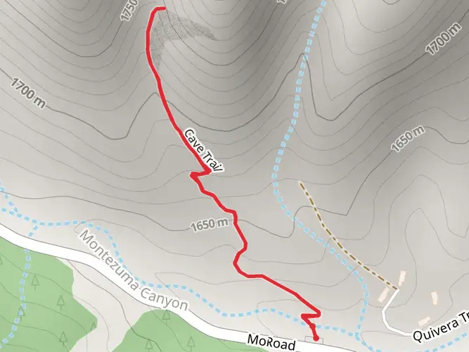
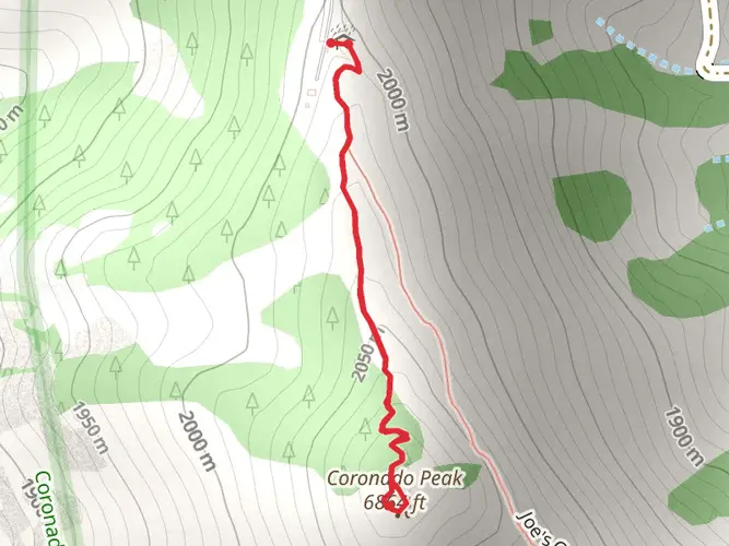
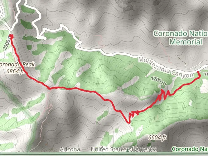
The southern terminus of the Arizona Trail is located near Cochise County, close to the US-Mexico border. To reach the starting point by car, hikers can drive to Montezuma Pass, which is accessible via Coronado Memorial Road near the town of Sierra Vista. For those relying on public transportation, options are limited, but shuttle services may be available from larger cities like Tucson to Sierra Vista, where hikers can then arrange for a taxi or local shuttle to Montezuma Pass.
Trail Overview
The trail is classified as a point-to-point hike and is estimated to have a medium difficulty rating. It is recommended that hikers plan their journey carefully, considering the length and elevation changes. The use of a navigation tool like HiiKER can be invaluable for planning and staying on track.
Notable Sections and Landmarks
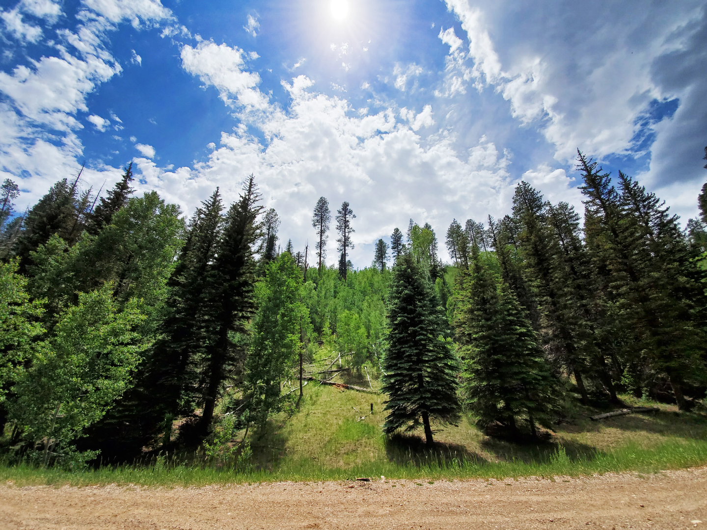
As you embark on the Arizona Trail, you'll encounter a variety of ecosystems, from desert scrub and grasslands to alpine forests and mountain ranges. The trail is divided into 43 passages, each with its own unique characteristics and challenges.
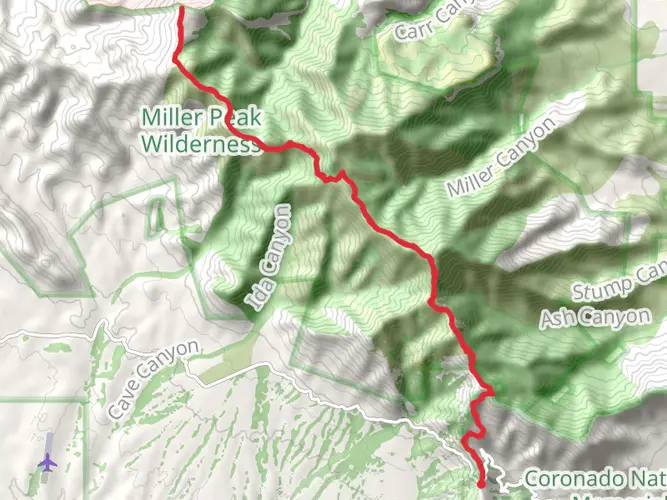
Huachuca Mountains: The trail begins with a climb through the Huachuca Mountains, offering stunning views of the surrounding desert. This section includes Miller Peak, one of the highest in the range, with an elevation of 2,888 meters (9,475 feet).
Santa Rita Mountains: Further north, the trail winds through the Santa Rita Mountains, where hikers can witness the impressive sight of Mount Wrightson, the highest peak in the range at 2,882 meters (9,453 feet).
Saguaro National Park: One of the trail's highlights is the passage through Saguaro National Park, where the iconic saguaro cacti stand tall against the backdrop of the Rincon Mountains.
Mogollon Rim: As the trail progresses, hikers will traverse the Mogollon Rim, a significant geological feature that presents a dramatic escarpment marking the southern edge of the Colorado Plateau.
San Francisco Peaks: Near Flagstaff, the trail skirts the base of the San Francisco Peaks, the remnants of an ancient stratovolcano. Humphreys Peak, the highest in Arizona at 3,851 meters (12,633 feet), dominates the skyline.
Grand Canyon: Perhaps the most awe-inspiring section is the passage through the Grand Canyon. Hikers will descend into the canyon, cross the Colorado River, and climb back out, experiencing one of the world's most magnificent natural wonders.
Wildlife and Flora
The Arizona Trail offers an opportunity to see a wide range of wildlife, including mule deer, elk, black bears, and even mountain lions. Birdwatchers will be delighted by the variety of bird species, especially in riparian areas. The flora is equally diverse, with different plant communities corresponding to the varying elevations and climates along the trail.
Historical Significance
The trail passes through regions rich in history, from ancient Native American sites to remnants of old mining towns. The Arizona Trail also intersects with the historic Mormon Pioneer Trail and the Grand Canyon, which holds cultural significance for several Native American tribes and is a UNESCO World Heritage Site.
Preparation and Planning
Given the trail's length and diverse conditions, hikers should prepare for a variety of weather and terrain. Water sources can be scarce, especially in the desert sections, so careful planning for water and resupply is crucial. It is advisable to check the Arizona Trail Association's website for current trail conditions and water reports.
Seasonal Considerations
The best times to hike the Arizona Trail are in the spring (March to May) and fall (October to November) to avoid the extreme heat of the Arizona summer and the snow in the higher elevations during winter. However, due to the trail's length and varied elevations, hikers may still encounter snow and hot temperatures during these windows.
By taking the time to understand the trail's challenges and wonders, hikers can embark on a memorable journey through the heart of Arizona's diverse landscapes.

What to expect?
Activity types
Frequently asked questions
How long does it take to hike the Arizona Trail end to end?
The Arizona Trail is about 1,264.96 km, or roughly 786 miles, from the Mexican border to the Utah state line. Most thru-hikers take several weeks to a couple of months, depending on pace, resupply strategy, weather, and how much time is spent in difficult sections like the Grand Canyon and higher mountain passages.
Where does the Arizona Trail start and finish in Arizona?
The Arizona Trail runs south to north across the state, beginning at the Mexican border in the Huachuca Mountains and ending at the Utah line on Passage 43 at Buckskin Mountain near Stateline Campground. The southern access commonly used by hikers is Montezuma Pass near Sierra Vista, while the northern end is reached from the Winter Road and Stateline trailheads.
Can you bring a dog on the Arizona Trail for the full thru-hike?
A full dog-friendly thru-hike is not practical on the Arizona Trail. Dogs are prohibited on trail segments in Coronado National Memorial, Saguaro National Park, and Grand Canyon National Park, and the route also has long dry stretches, rocky tread, cactus, and venomous wildlife that make extended travel with dogs especially difficult.
How hard is the Arizona Trail and what makes it so challenging?
The Arizona Trail is an Extra Difficult multi-day route with about 46,765 meters of total elevation gain across 1,264.96 km. Its difficulty comes from the sheer length, repeated climbs and descents, desert heat, long water carries, rugged tread, and the fact that it crosses everything from low Sonoran Desert terrain to high forest and canyon country.
How is the Arizona Trail divided, and do hikers usually complete it in sections?
The Arizona Trail is divided into 43 passages running from the Huachuca Mountains in the south to Buckskin Mountain on the Utah border. Many hikers tackle it section by section rather than all at once, using passage breaks to plan resupply, transportation, and seasonal timing through places like Oracle, Flagstaff, and the Grand Canyon corridor.
What is the best time of year to hike the Arizona Trail?
Spring and fall are the main seasons for long Arizona Trail trips because the route spans hot desert, high mountains, and snow-prone plateaus. Northbound thru-hikes often begin in spring from the southern end near Montezuma Pass, while southbound hikes are commonly timed for fall to avoid lingering snow on the Kaibab Plateau and around the San Francisco Peaks.
Can you start the Arizona Trail at Montezuma Pass near Sierra Vista?
Yes. Montezuma Pass is the standard southern access point used by many Arizona Trail hikers near Sierra Vista and Coronado National Memorial. The official southern terminus is at the border, but the southernmost section has had closures and restrictions at times, so Montezuma Pass is often the practical place to begin or stage a start.
Comments and Reviews
User comments, reviews and discussions about the Arizona Trail, Arizona.
4.83
average rating out of 5
6 rating(s)