Download
3D Flyover
Add to list
More
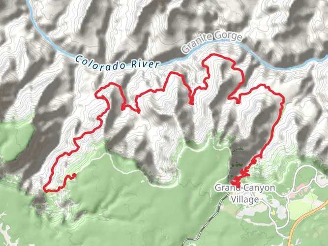
33.2 km
~2 days
1530 m
Multi-Day
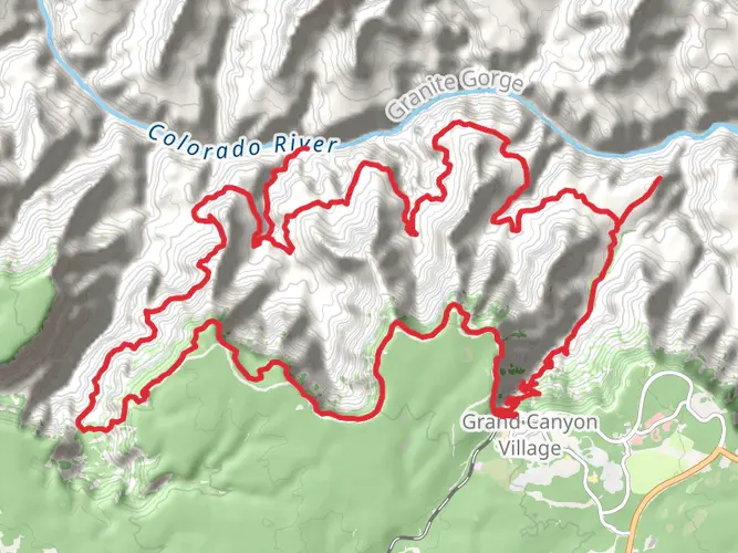
The South Kaibab - Colorado River - Bright Angel Loop is a challenging and rewarding hike that takes you deep into the heart of the Grand Canyon. This approximately 33 km (20.5 miles) loop trail, with an elevation gain of around 1500 meters (4921 feet), offers hikers a comprehensive experience of the Grand Canyon's rugged beauty.
Getting to the Trailhead
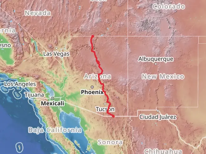
The trailhead for the South Kaibab Trail is located near Yaki Point on the South Rim of the Grand Canyon, Coconino County, Arizona. To reach the starting point, you can drive to the Grand Canyon Visitor Center and then take the park's shuttle bus system, which provides access to Yaki Point. Personal vehicles are not allowed at the South Kaibab Trailhead, making the shuttle bus the most convenient option.
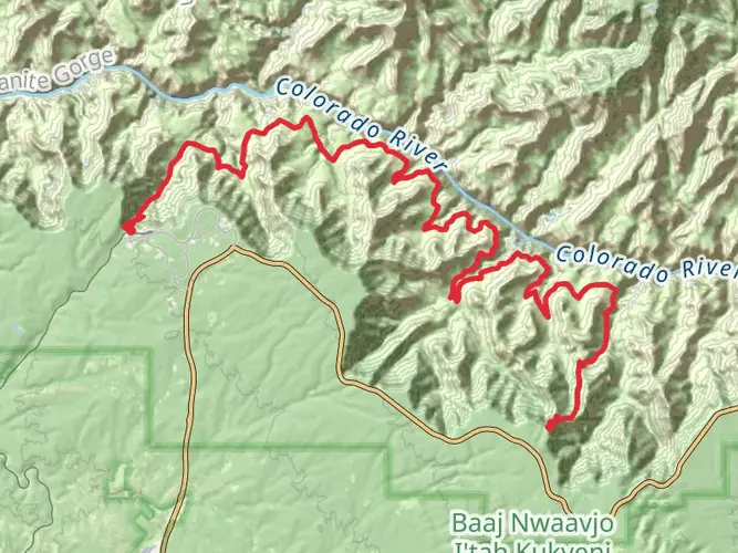
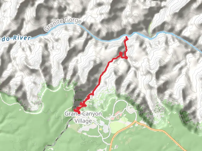
South Kaibab Trail to the Colorado River
Starting from the trailhead, the South Kaibab Trail descends steeply into the canyon, offering panoramic views almost immediately. The trail is 11 km (6.8 miles) one way and takes you to the Colorado River. Along the way, you'll pass notable landmarks such as Ooh Aah Point at about 1 km (0.6 miles), Cedar Ridge at 2.3 km (1.4 miles), and Skeleton Point at 4.8 km (3 miles), where you can catch your first glimpse of the river.
The path is well-maintained but has no water sources, so carrying an adequate supply is crucial. As you continue, you'll encounter the Tonto Platform and the inner canyon's Vishnu Schist rock formations before reaching the river.
Colorado River to Bright Angel Campground
Upon reaching the Colorado River, you'll cross the famous Kaibab Suspension Bridge (also known as the Black Bridge) to the north side. Here, you can rest at the Bright Angel Campground, located near Phantom Ranch. This area is rich in history, with early Native American settlements and the establishment of Phantom Ranch as a tourist destination in the 1920s.
Bright Angel Trail to the South Rim
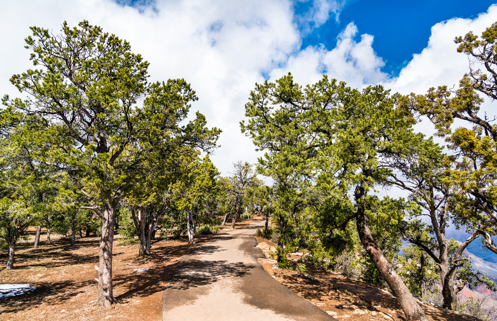
The return journey to the South Rim is via the Bright Angel Trail, which is approximately 15.5 km (9.6 miles) long. This trail offers a gentler ascent with several rest houses and water sources along the way. Indian Garden, located 7.2 km (4.5 miles) from the South Rim, is a great place to rest and enjoy the shade of cottonwood trees.
The trail continues to ascend, providing views of the inner canyon and the Colorado River. As you approach the South Rim, you'll pass through the Redwall Limestone and the Supai Group rock formations, which tell a geological story millions of years old.
Wildlife and Safety
The Grand Canyon is home to diverse wildlife, including mule deer, bighorn sheep, and a variety of bird species. Always observe wildlife from a distance and do not feed animals. Safety is paramount on this hike; be prepared for extreme weather conditions, carry plenty of water, and be aware of the signs of heat exhaustion and altitude sickness.
Navigation
For navigation purposes, hikers are encouraged to use HiiKER, which provides detailed maps and trail information to help you stay on track.
Historical Significance
The Grand Canyon region is steeped in history, with evidence of human presence dating back thousands of years. The trails you'll be hiking were traditionally used by Native American tribes and were later developed for tourism in the early 20th century. The Grand Canyon itself is a geological marvel, showcasing layers of rock that reveal the Earth's history.
Conclusion
The South Kaibab - Colorado River - Bright Angel Loop is an extraordinary hike that offers a full Grand Canyon experience. With its challenging terrain, breathtaking views, and rich history, this trail is a must-do for seasoned hikers seeking an adventure in one of the world's most iconic natural wonders.

What to expect?
Activity types
Frequently asked questions
How long is the South Kaibab - Colorado River - Bright Angel Loop and how hard is it?
The South Kaibab - Colorado River - Bright Angel Loop is about 33.21 km, or 20.6 miles, with roughly 1,530 m of elevation gain. It is rated Extra Difficult and is typically treated as a multi-day Grand Canyon route because it drops from the South Rim to the Colorado River and climbs back out on Bright Angel Trail.
Where do you start the South Kaibab - Colorado River - Bright Angel Loop and can you drive to the trailhead?
The South Kaibab - Colorado River - Bright Angel Loop starts on the South Rim near Yaki Point at the South Kaibab Trailhead. Private vehicles are not allowed at that trailhead, so access is usually by the park shuttle from Grand Canyon Visitor Center; the hike finishes at Bright Angel Trailhead in Grand Canyon Village, which makes it a point-to-point rim return rather than a same-trail out-and-back.
Is there water on the South Kaibab - Colorado River - Bright Angel Loop?
Water is the biggest planning issue on the South Kaibab - Colorado River - Bright Angel Loop. There is no water along the South Kaibab Trail itself, while Bright Angel Trail has seasonal water at Mile-and-a-Half Resthouse and Three-Mile Resthouse and year-round water at Havasupai Gardens, though Grand Canyon pipeline breaks can interrupt any of those supplies.
What landmarks do you pass on the South Kaibab - Colorado River - Bright Angel Loop?
The South Kaibab - Colorado River - Bright Angel Loop passes several of the South Rim corridor trail’s best-known viewpoints. Early on, the route reaches Ooh Aah Point, then Cedar Ridge and Skeleton Point before descending toward the Colorado River, with broad views across the inner canyon and the dark Vishnu Schist near the river corridor.
How long does the South Kaibab - Colorado River - Bright Angel Loop take?
Most hikers should plan the South Kaibab - Colorado River - Bright Angel Loop as a multi-day trip rather than a single long day. The full route is about 33 km with around 1,530 m of climbing, and the hardest part is the long ascent back to the South Rim on Bright Angel Trail after reaching the river.
Is the South Kaibab - Colorado River - Bright Angel Loop suitable for a day hike?
For most hikers, the South Kaibab - Colorado River - Bright Angel Loop is not a casual day hike. The South Kaibab descent alone is steep, exposed, and dry, and park guidance specifically warns that hiking below Skeleton Point as a day hike is not recommended because of the distance, heat, and roughly 5,000 feet of elevation change each way to the river.
Are there any closures that affect the South Kaibab - Colorado River - Bright Angel Loop right now?
As of June 3, 2026, closures do affect the standard South Kaibab - Colorado River - Bright Angel Loop. South Kaibab Trail is open to Phantom Ranch and the Black Bridge is open, but the River Trail connection from the Bright Angel side to the South Kaibab junction remains closed through June 30, 2026, so the usual loop is disrupted unless park conditions change.
Comments and Reviews
User comments, reviews and discussions about the South Kaibab - Colorado River - Bright Angel Loop, Arizona.
4.63
average rating out of 5
8 rating(s)