Download
3D Flyover
Add to list
More
62.6 km
~3 days
2240 m
Multi-Day
“Embark on the epic Rae Lakes Loop, a breathtaking, strenuous Sierra Nevada adventure steeped in natural grandeur and historical paths.”
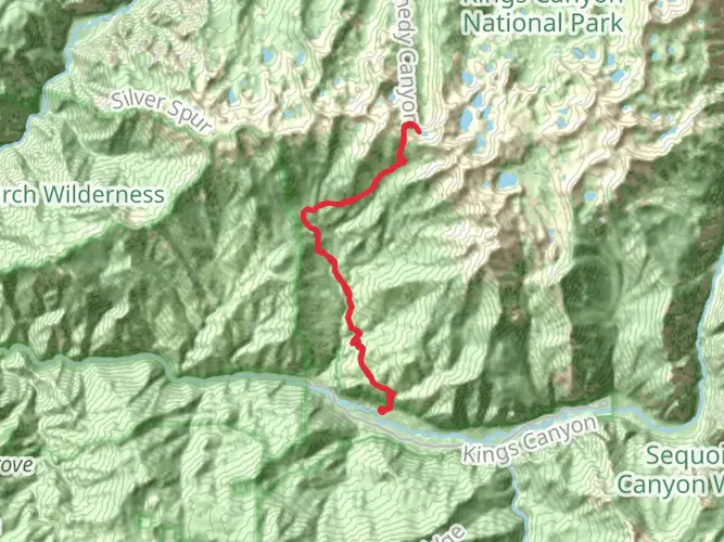
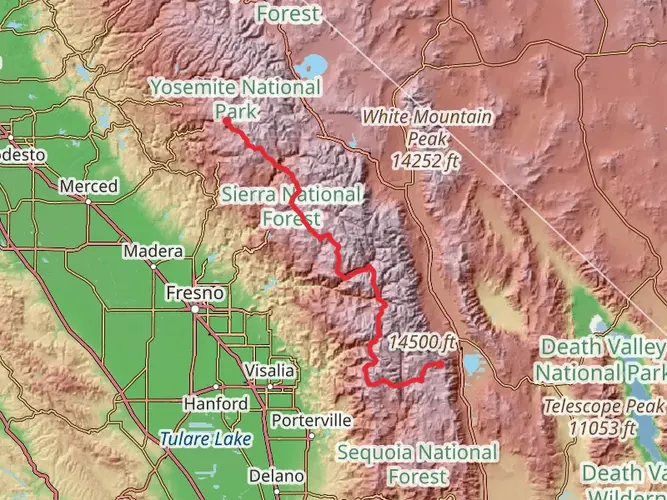
The Rae Lakes Loop is a challenging and rewarding trek nestled in the Sierra Nevada, starting and ending near Roads End in Kings Canyon National Park, not far from Fresno County, California. This approximately 63 kilometers (39 miles) journey boasts a significant elevation gain of around 2200 meters (7200 feet), making it a strenuous hike that requires good physical condition and proper preparation.
Getting to the Trailhead
To reach the trailhead, if you're driving, take Highway 180 east from Fresno to the Roads End area in Kings Canyon National Park. The drive will take you through the stunning Kings Canyon, with its deep valleys and towering cliffs. For those relying on public transportation, options are limited, but during the summer months, the Sequoia Shuttle operates from Visalia to the park, and from there, you can find transportation to Roads End.
Navigating the Trail
Once on the trail, hikers can choose to tackle the loop in either a clockwise or counterclockwise direction, though many opt to go clockwise to spread out the elevation gain more evenly. HiiKER is an excellent tool for navigation, offering detailed maps and waypoints to ensure you stay on the right path.
Landmarks and Scenery
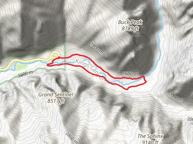
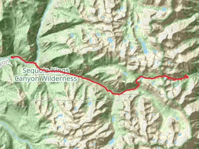
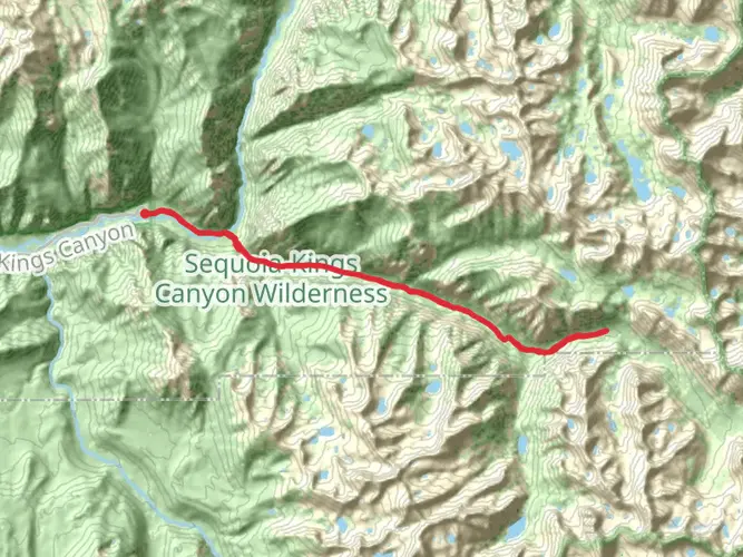
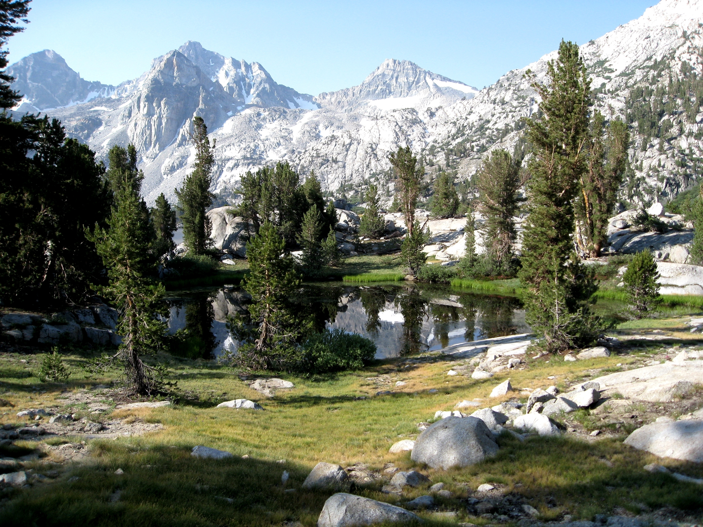
The Rae Lakes Loop traverses diverse landscapes, from deep canyons and lush forests to alpine lakes and high mountain passes. Early in the hike, you'll cross the South Fork Kings River before ascending towards the John Muir Wilderness. The trail offers breathtaking views of the Sierra peaks and the opportunity to pass through the iconic Mist Falls, which is about 8 kilometers (5 miles) from the trailhead.
As you continue, you'll encounter the Sphinx, a notable rock formation, and eventually reach the Woods Creek suspension bridge, a memorable crossing that's both thrilling and a great spot for photos.
Wildlife and Nature
The area is rich in wildlife, including black bears, so proper food storage and bear safety are essential. You'll also likely spot marmots, deer, and various bird species. The trail is adorned with wildflowers, especially in the late spring and early summer.
Historical Significance
The Rae Lakes Loop is part of the larger John Muir Trail and Pacific Crest Trail, which have historical significance as major long-distance hiking routes in the United States. The region has been traversed by Native Americans, early settlers, and conservationists like John Muir himself, who fought to preserve the beauty of the Sierra Nevada.
Challenges and Considerations
The Golden Staircase and Glen Pass are two of the more challenging sections, with steep, rocky terrain. Glen Pass, at an elevation of 3600 meters (11,800 feet), can be particularly daunting, with snow lingering well into the summer months. Hikers should be prepared for altitude sickness and changing weather conditions.
Permits and Regulations
A wilderness permit is required for overnight stays on the Rae Lakes Loop, which can be obtained from the Kings Canyon National Park visitor centers. Due to the trail's popularity, it's wise to reserve a permit well in advance, especially if you're planning to hike during the peak season.
Conclusion
In conclusion, the Rae Lakes Loop is a must-hike for those seeking a challenging adventure in the Sierra Nevada. With its stunning landscapes, diverse wildlife, and rich history, it's a journey that offers both natural beauty and a sense of accomplishment. Remember to plan ahead, respect the wilderness, and enjoy the incredible experience that awaits on this iconic trail.

What to expect?
Activity types
Frequently asked questions
How long does the Rae Lakes Loop usually take to hike from Road's End?
The Rae Lakes Loop is about 62.62 km, or roughly 39 miles, and most backpackers take 3 to 5 days to complete it from Road's End in Cedar Grove. The route climbs about 2,240 m overall and reaches Glen Pass at 11,978 feet, so pace depends heavily on acclimatization, pack weight, and stream conditions.
Where is the trailhead and parking for the Rae Lakes Loop in Kings Canyon National Park?
The Rae Lakes Loop starts from the Road's End area in Cedar Grove at the end of Highway 180 in Kings Canyon National Park. The main access is the Woods Creek/Bubbs Creek/Rae Lakes Loop trailhead, and parking is at Road's End, which is the final developed stop at the end of the canyon road.
Do you need a wilderness permit for the Rae Lakes Loop, and which trailhead is used?
An overnight trip on the Rae Lakes Loop requires a wilderness permit because it is a multi-day backcountry route in Sequoia and Kings Canyon National Parks. The loop is commonly started from either the Woods Creek trailhead for a clockwise trip or the Bubbs Creek trailhead for a counterclockwise trip, both accessed from Road's End.
Is the Rae Lakes Loop hiked clockwise or counterclockwise?
The Rae Lakes Loop can be done in either direction, but many hikers choose clockwise from Woods Creek so the climb is spread out before crossing Glen Pass. Counterclockwise via Bubbs Creek is also common, but it puts the long climb toward Vidette Meadow and Glen Pass earlier in the trip.
Are dogs allowed on the Rae Lakes Loop trail?
Dogs are not allowed on the Rae Lakes Loop because pets are not permitted on park trails in Sequoia and Kings Canyon National Parks. That rule applies throughout the route, including the trails from Road's End through Paradise Valley, Woods Creek, Rae Lakes, and Glen Pass.
Do you need a bear canister for the Rae Lakes Loop?
A bear-resistant canister is required on the Rae Lakes Loop. Bears are especially active along this route, and the park requires portable bear-resistant food storage rather than hanging food in trees, including in the Rae Lakes Loop backcountry zone.
What is the hardest part of the Rae Lakes Loop hike?
The hardest section of the Rae Lakes Loop is usually the approach to and crossing of Glen Pass, the high point of the route at 11,978 feet. The full loop is rated difficult, covers about 62.62 km, and combines sustained climbing with high elevation, exposed alpine terrain, and early-season snow or runoff hazards.
Are there any major hazards or seasonal issues on the Rae Lakes Loop?
Yes. High water at stream crossings can be a serious problem in May and early June, and Glen Pass may remain difficult or impassable until mid to late July in heavier snow years. The South Fork Kings River bridge above Paradise Valley also remains out, so crossings in that area can be hazardous and may force a turnaround depending on conditions.
Comments and Reviews
User comments, reviews and discussions about the Rae Lakes Loop, California.
5.0
average rating out of 5
2 rating(s)