Download
3D Flyover
Add to list
More
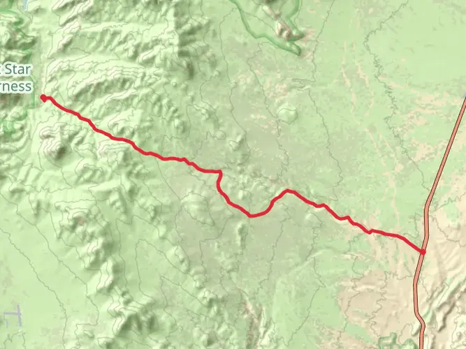
690.9 km
~29 days
19838 m
Multi-Day
“Embark on the Pacific Crest Trail's Central California adventure, a scenic but strenuous journey through diverse and historic wilderness.”
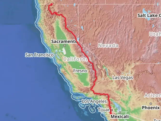
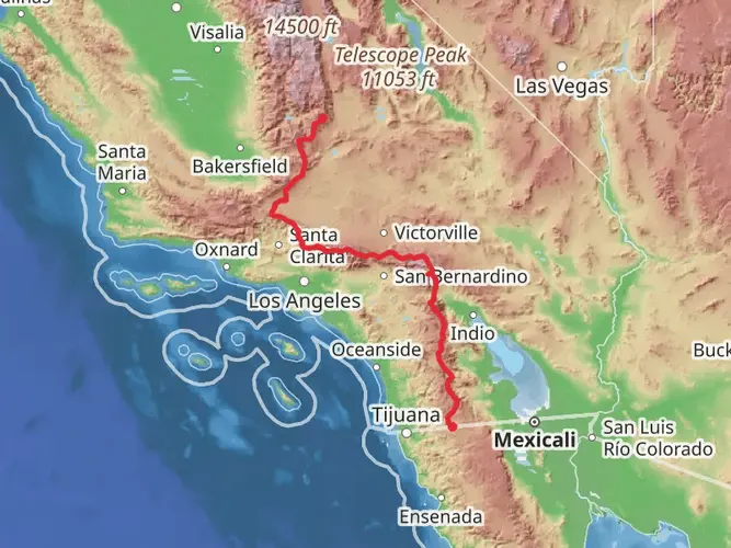
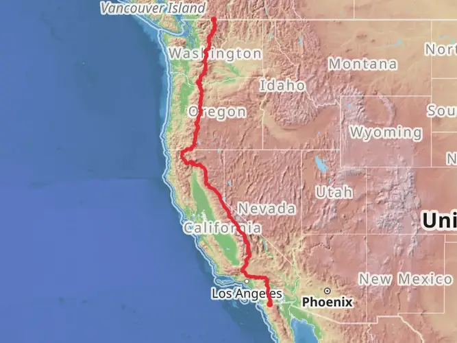
Spanning approximately 430 miles (691 km) with an elevation gain of around 65,000 feet (19,800 meters), the Pacific Crest Trail through Central California is a challenging and rewarding section of this iconic long-distance path. The trailhead is situated near Kern County, California, and the trail itself is a point-to-point hike that is rated as difficult due to its length, elevation gain, and remote nature.
Getting to the Trailhead
To reach the starting point of the Central California section of the Pacific Crest Trail, hikers can drive to the vicinity of Kern County. For those relying on public transportation, options may be limited, but regional buses or shuttles could be available to nearby towns, from where a taxi or ride-share service can be used to reach the trailhead. Hikers should consult local transit authorities for the most current schedules and routes.
Navigating the Trail
Hikers can use the HiiKER app to navigate the trail, ensuring they stay on the correct path and have access to up-to-date maps and information. The app can be particularly useful in areas where the trail may be less well-marked or in challenging weather conditions.
Landmarks and Scenery
As you traverse the Central California section of the Pacific Crest Trail, you'll encounter a diverse array of landscapes, including high mountain passes, deep forests, and arid desert areas. Notable landmarks include the scenic Forester Pass, which at 13,153 feet (4,009 meters) is the highest point on the entire Pacific Crest Trail. Hikers will also pass through the John Muir Wilderness, named after the famous naturalist, which offers stunning views of alpine lakes and rugged peaks.
Wildlife and Nature
The region is home to a rich variety of wildlife, including black bears, mule deer, and mountain lions. Birdwatchers may spot species such as the mountain bluebird and Clark's nutcracker. The flora is equally diverse, with wildflowers blooming in the spring and summer, and the changing colors of aspen and other deciduous trees providing a spectacular display in the fall.
Historical Significance
The Pacific Crest Trail runs through areas that are rich in history. The trail itself was designated as a National Scenic Trail in 1968, but the land it crosses has been inhabited and used by indigenous peoples for thousands of years. Additionally, parts of the trail follow routes that were used by early European settlers and prospectors during the California Gold Rush in the mid-19th century.
Preparation and Planning
Given the trail's difficulty, hikers should be well-prepared with the appropriate gear, including reliable footwear, weather-appropriate clothing, and a means to purify water. It's also essential to plan for resupply points, as the trail passes through remote areas where resources are scarce. Hikers should be prepared for sudden weather changes and be knowledgeable about wilderness first aid.
Safety Considerations
Due to the remote nature of the trail, it's crucial to leave a detailed itinerary with someone before embarking on the hike. Hikers should be aware of the symptoms of altitude sickness, as the trail reaches significant elevations. It's also important to practice bear safety, including the use of bear-proof containers for food and scented items.
By taking the necessary precautions and respecting the natural environment, hikers can enjoy the breathtaking beauty and challenge of the Pacific Crest Trail through Central California.

What to expect?
Activity types
Frequently asked questions
How long is the Pacific Crest Trail - Central California section and how hard is it?
The Pacific Crest Trail - Central California section is 690.92 km long, or about 430 miles, with 19,838 m of total elevation gain. It is rated Extra Difficult, which fits the scale of the route: this is a long, remote, multi-day Sierra section with sustained climbing, high passes, and major logistical demands.
What is the highest point on the Pacific Crest Trail - Central California section?
A standout high point on the Pacific Crest Trail - Central California section is Forester Pass at 13,153 feet, about 4,009 meters, in Sequoia and Kings Canyon. Yosemite’s PCT reaches 11,056 feet at Donohue Pass, so the Central California stretch includes multiple very high Sierra crossings before dropping toward lower trailheads and valleys.
Do I need permits for the Pacific Crest Trail - Central California section?
Permits are typically required for overnight travel on the Pacific Crest Trail - Central California section because the route passes through heavily managed wilderness in places such as Yosemite and Sequoia-Kings Canyon. Trailhead-specific wilderness permits are used in many segments, and permit rules can differ depending on where the trip starts and which jurisdiction issues the entry permit.
Are dogs allowed on the Pacific Crest Trail - Central California section?
Dogs are not allowed on every part of the Pacific Crest Trail - Central California section. The route passes through Yosemite National Park and Sequoia-Kings Canyon National Parks, and pets are prohibited on trails in Sequoia and Kings Canyon; the Pacific Crest Trail Association also notes total dog bans on some national park sections of the PCT. That means a continuous dog-friendly trip is not possible across the full Central California section.
Where can hikers access the Pacific Crest Trail - Central California section by road?
Road access points for the Pacific Crest Trail - Central California section include Sonora Pass on Highway 108, where a seasonal trailhead gives direct access to the PCT, and Yosemite-area trailheads tied to Tuolumne Meadows and Lyell Canyon. In Kings Canyon, Road’s End is a major access point for trails such as Woods Creek and Bubbs Creek that connect to the John Muir Trail/PCT corridor.
Does the Pacific Crest Trail - Central California section overlap with the John Muir Trail?
Yes. A large part of the Pacific Crest Trail - Central California section shares tread with the John Muir Trail through the Sierra Nevada. That overlap is especially important through Yosemite, the Ansel Adams Wilderness, and Sequoia-Kings Canyon, so many well-known landmarks on this section, including Donohue Pass and Forester Pass, are on the shared JMT/PCT corridor.
Are bear canisters required on the Pacific Crest Trail - Central California section?
Bear-resistant food storage is required in important parts of the Pacific Crest Trail - Central California section. Yosemite requires approved bear canisters for wilderness travel, and Sequoia-Kings Canyon requires animal-resistant containers in several backcountry zones along the John Muir Trail and Pacific Crest Trail corridor, including areas around Woods Creek, Bubbs Creek, and Forester Pass.
Comments and Reviews
User comments, reviews and discussions about the Pacific Crest Trail - Central California, California.
4.8
average rating out of 5
5 rating(s)