Download
Preview
Add to list
More
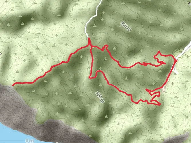
60.5 km
~4 days
2459 m
Multi-Day
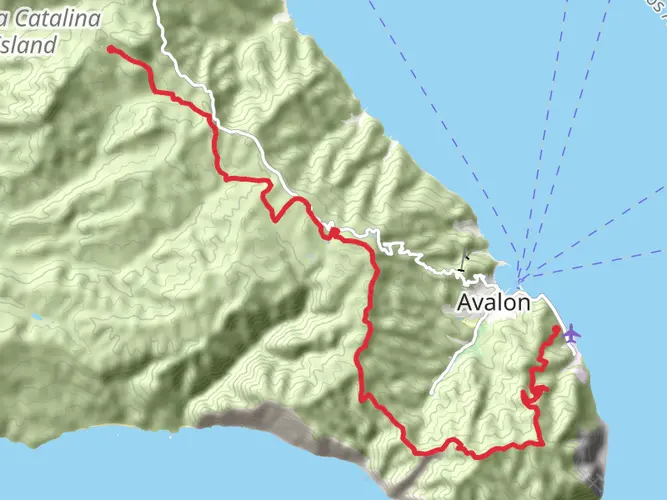
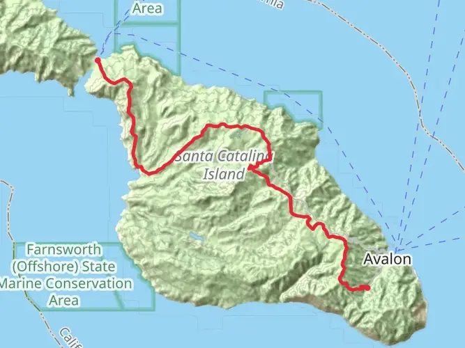
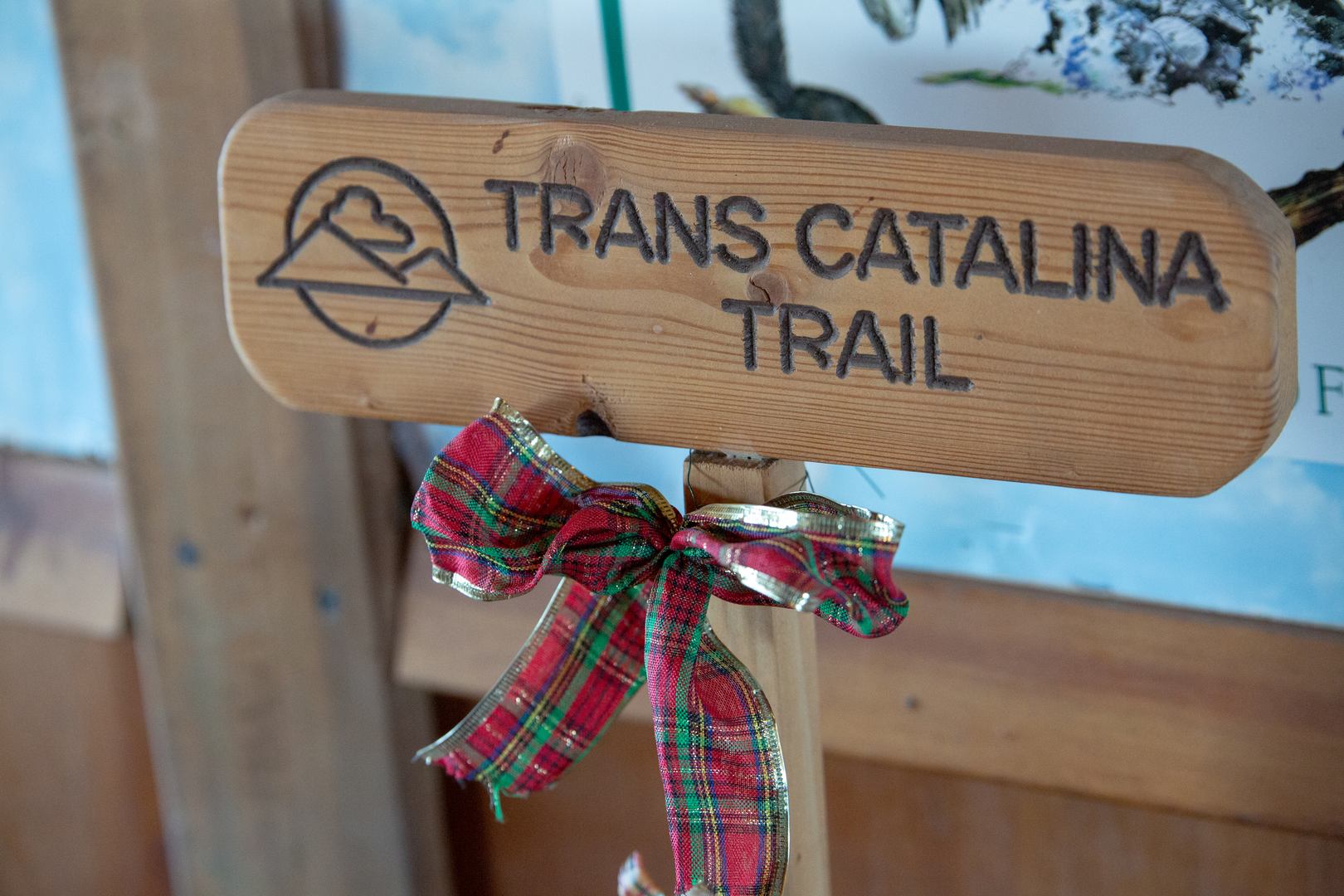
The Trans-Catalina Trail is a 60.5 km trail that starts in Avalon, Los Angeles County, California. Based on our data, the hike is graded as Difficult. For information on how we grade trails, please read measuring the difficulty of a hiking trail on hiiker. Also, check our latest community posts for trail updates. This hike can be completed in approx 3 days. Caution is advised on trail times as this depends on multiple variables. For more info read about how we calculate hike time.

What to expect?
Activity types
Frequently asked questions
How long is the Trans-Catalina Trail and how hard is the hike?
The Trans-Catalina Trail is 60.49 km long with 2,459 m of elevation gain, which puts it firmly in the difficult category. Even though the mileage is manageable for a multi-day route, the island terrain includes repeated steep climbs and descents with long exposed stretches and limited shade.
How many days does the Trans-Catalina Trail usually take to hike?
Most hikers complete the Trans-Catalina Trail in about 4 to 5 days. The standard backpacking itinerary commonly breaks the route into overnight stops at Black Jack, Little Harbor, Two Harbors, and Parsons Landing, which spreads out the 60.49 km distance and the 2,459 m of climbing more realistically.
Do you need a permit for the Trans-Catalina Trail?
Yes. A hiking permit is mandatory for the Trans-Catalina Trail, and the Catalina Island Conservancy issues it free of charge. Campsite reservations are also a separate part of planning because the usual overnight stops along the route require booked camping, and popular dates can fill early. ([catalinaconservancy.org](https://catalinaconservancy.org/recreation/trans-catalina-trail/?utm_source=openai))
Where do you start and finish the Trans-Catalina Trail?
The classic Trans-Catalina Trail route starts in Avalon and finishes near Two Harbors on Catalina Island. That point-to-point layout matters for logistics because Catalina Express notes that ferry service from Two Harbors returns to San Pedro, so many hikers prefer to arrive from San Pedro as well to simplify the trip. ([catalinaconservancy.org](https://catalinaconservancy.org/recreation/trans-catalina-trail/?utm_source=openai))
What are the main campsites on the Trans-Catalina Trail?
The main overnight stops most often used on the Trans-Catalina Trail are Black Jack Campground, Little Harbor Campground, Two Harbors Campground, and Parsons Landing. Hermit Gulch in Avalon is also relevant for hikers starting or ending in town, especially when building a longer itinerary around ferry arrival times. ([catalinaconservancy.org](https://catalinaconservancy.org/recreation/trans-catalina-trail/?utm_source=openai))
Is there water on the Trans-Catalina Trail or do you need to carry it?
Water planning is a big part of the Trans-Catalina Trail. The Catalina Island Conservancy recommends the ability to carry 3 liters, and key water points listed along the route include Haypress Reservoir near mile 5.6, with additional water logistics tied to campsite lockers and resupply around Two Harbors. ([catalinaconservancy.org](https://catalinaconservancy.org/recreation/trans-catalina-trail/?utm_source=openai))
What is the best time of year to hike the Trans-Catalina Trail?
The Trans-Catalina Trail is open year-round, but spring and fall are generally the best seasons for hiking. Those months are usually the most temperate on Catalina, which matters on a difficult route with exposed ridgelines, limited shade, and big elevation changes over 60.49 km. ([catalinaconservancy.org](https://catalinaconservancy.org/recreation/trans-catalina-trail/?utm_source=openai))
What wildlife might you see on the Trans-Catalina Trail?
Wildlife sightings on the Trans-Catalina Trail can include Catalina Island foxes, bison, bald eagles, and a wide variety of birds. The route crosses Catalina’s interior and coastal wildlands, so hikers should expect animal encounters to be possible and keep a safe distance, especially from bison. ([catalinaconservancy.org](https://catalinaconservancy.org/recreation/trans-catalina-trail/?utm_source=openai))
Comments and Reviews
User comments, reviews and discussions about the Trans-Catalina Trail, California.
4.33
average rating out of 5
6 rating(s)