Download
3D Flyover
Add to list
More
395.9 km
~18 days
14304 m
Multi-Day
“Embark on the Theodore Solomons Trail, a scenic yet demanding trek through the Sierra Nevada's heart.”
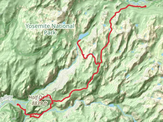
Spanning approximately 246 miles (396 km) with an elevation gain of around 46,920 feet (14,300 meters), the Theodore Solomons Trail is a challenging and rewarding point-to-point hike that traverses the Sierra Nevada mountain range. The trailhead is located near Mariposa County, California, and the trail concludes in the vicinity of Kings Canyon National Park.
Getting to the Trailhead
To reach the starting point of the Theodore Solomons Trail, hikers can drive to the vicinity of Yosemite National Park's southern entrance near Fish Camp, California. For those relying on public transportation, the nearest major transit hub is in Fresno, California, from which you can take a combination of buses and shuttles to reach the trailhead area.
Navigating the Trail
Hikers can use the HiiKER app to navigate the trail, ensuring they stay on the correct path and have access to up-to-date maps and information. The trail is well-marked in most sections, but due to its length and remote nature, it's essential to have a reliable navigation tool.
Landmarks and Scenery
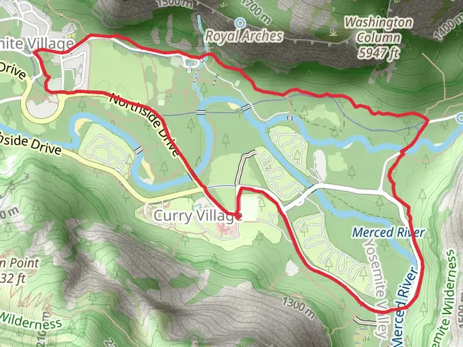
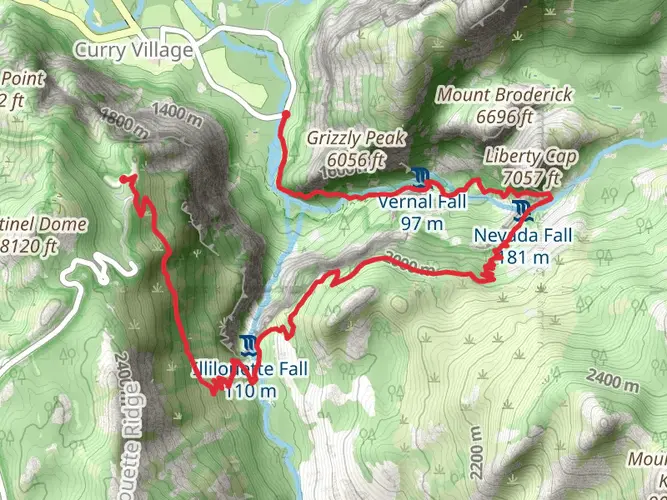
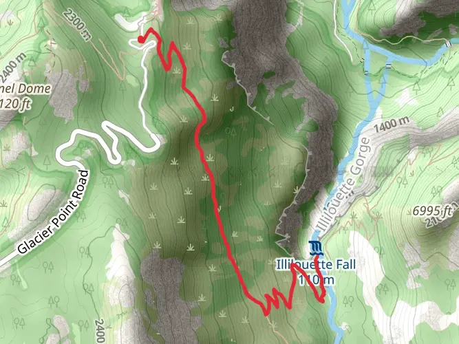
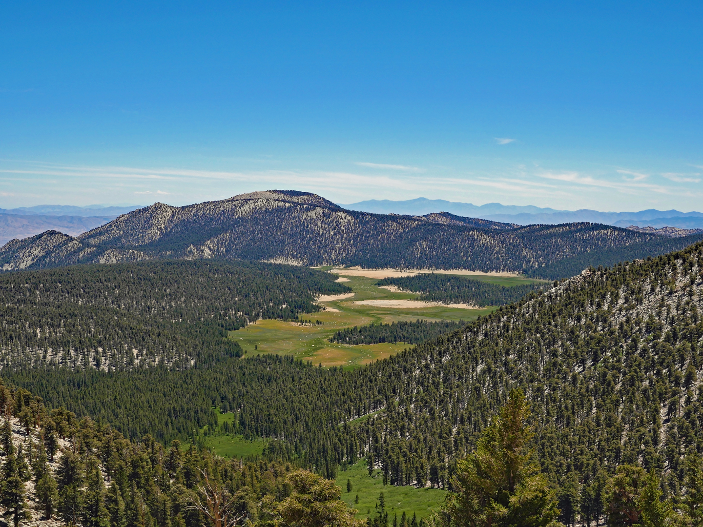
The Theodore Solomons Trail offers a diverse array of landscapes, from alpine meadows and high mountain passes to dense forests and serene lakes. Notable landmarks along the route include the Merced and Tuolumne Rivers, both of which provide stunning scenery and are critical water sources for the region.
Wildlife and Nature
As you traverse the trail, you'll likely encounter a variety of wildlife, including black bears, mule deer, and a plethora of bird species. The trail also winds through several different ecosystems, each with its unique flora and fauna. Hikers should be prepared for possible wildlife encounters by knowing how to store food properly and understanding how to react if they come across animals.
Historical Significance
The trail is named after Theodore Solomons, an explorer and early advocate of the Sierra Nevada who first proposed the idea of a trail running along the range. The trail passes through areas rich in Native American history and early settler activity, offering hikers a glimpse into the past and the opportunity to reflect on the region's historical significance.
Preparation and Planning
Given the trail's difficulty and remote nature, hikers should be well-prepared with the appropriate gear, including a tent, sleeping bag, and bear canister for food storage. Water sources are available but may be scarce in certain areas, so carrying a water filter and planning for water stops is crucial. Due to the significant elevation gain and loss throughout the hike, physical preparation is also key to a successful journey.
Weather and Best Time to Hike
The best time to hike the Theodore Solomons Trail is from late June to early October when the snow has melted, and the weather is more stable. However, hikers should be prepared for sudden weather changes and colder temperatures at higher elevations, even during the summer months.
Permits and Regulations
Hikers should check the latest permit requirements for the Theodore Solomons Trail, as permits are required for overnight stays in the wilderness areas it traverses. Additionally, hikers should familiarize themselves with Leave No Trace principles to minimize their impact on the environment.
By preparing adequately and respecting the natural and historical significance of the trail, hikers can embark on a memorable journey through some of California's most breathtaking landscapes on the Theodore Solomons Trail.

What to expect?
Activity types
Frequently asked questions
How long is the Theodore Solomons Trail in California?
The Theodore Solomons Trail is about 395.85 kilometers long, or roughly 246 miles. It is a multi-day point-to-point route through the Sierra Nevada, so most hikers treat it as a long backpacking trip rather than a short section hike.
How difficult is the Theodore Solomons Trail and how much climbing does it have?
The Theodore Solomons Trail is rated difficult and packs in about 14,304 meters of elevation gain, which is roughly 46,920 feet. That combination of distance and climbing makes it a serious high-country route suited to experienced backpackers with strong endurance and solid navigation skills.
Where does the Theodore Solomons Trail start and finish?
The route begins near Yosemite National Park’s southern entrance by Fish Camp in Mariposa County and runs south toward the Kings Canyon National Park area. It is generally described as a point-to-point Sierra Nevada traverse rather than a loop, so end-to-end logistics need to be planned in advance.
Do you need a permit for the Theodore Solomons Trail if starting near Yosemite?
If the Theodore Solomons Trail trip begins with an overnight start from a Yosemite trailhead, a Yosemite wilderness permit is required year-round for overnight wilderness travel. Yosemite issues permits by entry trailhead, and reservations are especially important from late April through October because trailhead quotas apply.
Can you park overnight for the Theodore Solomons Trail near Yosemite trailheads?
Overnight parking is allowed at or near many Yosemite trailheads for the duration of a wilderness trip, although some roads and lots have seasonal restrictions. In particular, overnight parking on Tioga Road and Glacier Point Road is prohibited beginning October 15 until those roads reopen in spring, so the exact Theodore Solomons Trail start point matters.
What is the best time of year to hike the Theodore Solomons Trail?
The main season for the Theodore Solomons Trail is typically summer into early fall, when high Sierra passes are more likely to be snow-free. Yosemite notes that some trailhead roads, especially Tioga Road and Glacier Point Road, are usually closed from sometime in November until late May or June, which can limit access outside the core season.
Are dogs allowed on the Theodore Solomons Trail through Yosemite backcountry?
Dogs are not allowed on non-paved trails, in wilderness areas, or in most backcountry terrain in Yosemite National Park, so that restriction affects Theodore Solomons Trail sections that use Yosemite wilderness. Because this route crosses protected mountain terrain, dog access is not a simple yes-or-no and should be checked section by section before any trip.
Comments and Reviews
User comments, reviews and discussions about the Theodore Solomons Trail, California.
4.71
average rating out of 5
7 rating(s)