Download
3D Flyover
Add to list
More
1074.5 km
~41 days
16663 m
Multi-Day
“Embark on the Oregon Timber Trail, a 668-mile trek through Oregon's diverse ecosystems, from arid deserts to lush forests.”
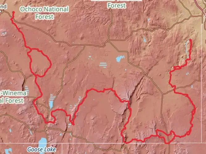
Spanning approximately 1075 kilometers (668 miles) and boasting an elevation gain of around 16600 meters (54,462 feet), the Oregon Timber Trail offers an immersive journey through the diverse landscapes of Oregon, starting near Modoc County, California. This point-to-point trail is a medium-difficulty adventure that weaves through a variety of ecosystems, from arid deserts to lush forests.
Getting to the Trailhead
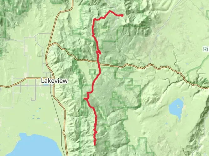
The southern terminus of the Oregon Timber Trail is accessible by car, located near the California-Oregon border. For those relying on public transportation, the nearest significant city with bus and train services is Klamath Falls, Oregon. From there, you can rent a car or arrange a shuttle to the trailhead.
Navigating the Trail
Hikers can utilize the HiiKER app to navigate the trail, ensuring they stay on the correct path and have access to up-to-date information about the route. The app provides detailed maps and waypoints that are crucial for a trail of this length and complexity.
Landmarks and Natural Features
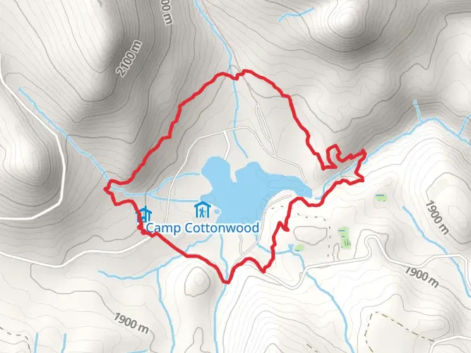
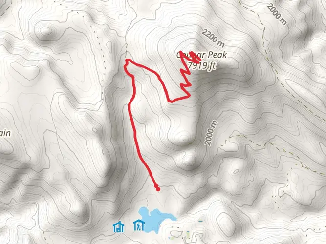
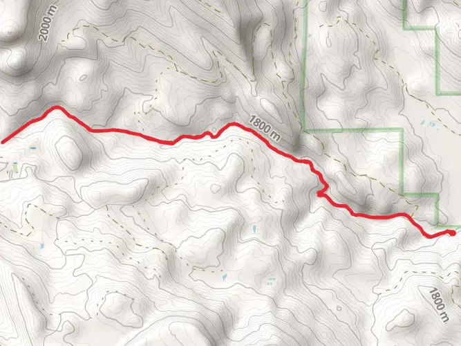
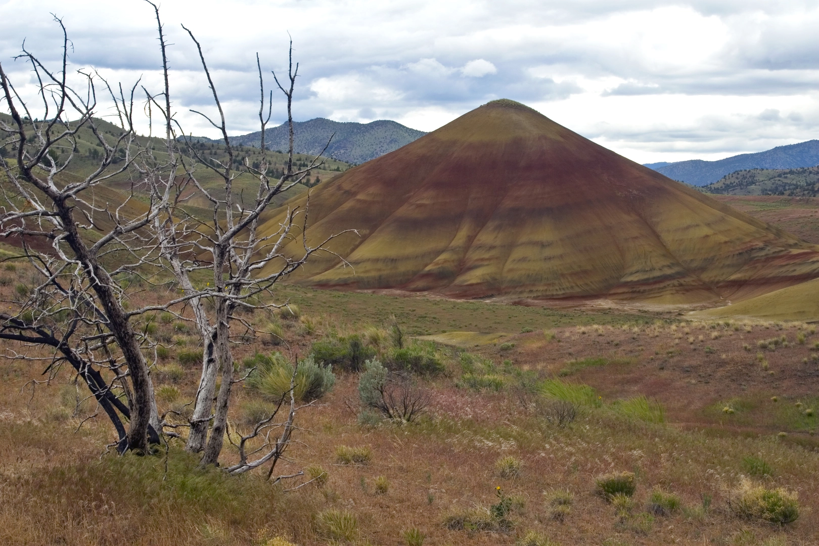
As you embark on the trail, you'll encounter the Fremont National Forest, which is home to ancient stands of ponderosa pine. The trail meanders through the Cascade Range, offering views of iconic peaks such as Mount Hood. Approximately halfway, the trail reaches the high desert region of Central Oregon, where the landscape transitions to sagebrush and juniper.
Wildlife and Flora
The Oregon Timber Trail is a haven for wildlife enthusiasts. Keep an eye out for deer, elk, and a variety of bird species, including the great gray owl. The trail also traverses areas rich in wildflowers, especially during the spring and early summer months.
Historical Significance
The trail passes through regions that were historically significant for the timber industry, which played a crucial role in Oregon's development. Hikers will come across old logging roads and may see remnants of the bygone era of logging.
Preparation and Planning
Given the trail's length and varied terrain, hikers should plan for a multi-week trek and be prepared for self-sufficiency. Water sources can be scarce in certain sections, so carrying a reliable water filter and planning for water stops is essential. Weather conditions can change rapidly, especially in the higher elevations, so pack accordingly.
Elevation and Distance
The trail's elevation gain is significant, with some sections being more challenging than others. Hikers should be prepared for long ascents and descents, which can be taxing on the body. It's advisable to train for the trail's demands and to plan for rest days in your itinerary.
End of the Trail
The northern terminus of the Oregon Timber Trail is located in the Hood River County, where the landscape is dominated by the Columbia River Gorge. This endpoint is also accessible by car, and public transportation options are available in the nearby city of Hood River for your return journey.

Frequently asked questions
How long is the Oregon Timber Trail and how many days does the Oregon Timber Trail take?
The Oregon Timber Trail is 1,074.53 km, or about 668 miles, point to point. At that length, it is a true multi-day route rather than a weekend hike, and completion time varies widely with pace, resupply plans, and conditions. Most end-to-end trips are planned in weeks rather than days.
Where does the Oregon Timber Trail start near the California border?
The southern end of the Oregon Timber Trail begins near the California-Oregon border in the Fremont country of south-central Oregon. The official Fremont tier is described as starting near the border, and the route uses the Crane Mountain National Recreation Trail and Fremont National Recreation Trail corridor in the Fremont-Winema National Forest.
What kind of terrain is on the Oregon Timber Trail from south to north?
The Oregon Timber Trail crosses a huge range of Oregon landscapes over its 1,074.53 km length. The southern Fremont section runs through remote Warner Mountain and outback country, then the route continues north through central Oregon forests and volcanic terrain before reaching the Mount Hood area and the far northeastern mountains near the finish.
How much elevation gain is on the Oregon Timber Trail?
The Oregon Timber Trail has about 16,663 meters of total elevation gain, which is roughly 54,669 feet. That amount of climbing, combined with the trail's 1,074.53 km length, makes it a difficult long-distance route that demands strong fitness and careful daily planning.
Is the Oregon Timber Trail difficult?
Yes. The Oregon Timber Trail is rated difficult, and that fits the numbers: 1,074.53 km of distance and 16,663 meters of climbing. The challenge comes from sustained elevation gain, long remote stretches, and the fact that the route crosses multiple mountain and forest regions rather than staying in one compact park or trail system.
What are the main landmarks and forests on the Oregon Timber Trail?
The route links several major Oregon mountain and forest regions. The southern section travels through the Fremont-Winema National Forest, and farther north the trail passes through central Oregon forest country, reaches the Mount Hood area, and eventually finishes in northeastern Oregon after crossing a broad sweep of the state.
When is the best time of year to do the Oregon Timber Trail?
The usual window is the snow-free season, generally mid-summer into early fall, because higher sections can hold snow well beyond spring. Late season wildfire smoke or closures can also affect travel, especially on a route this long that crosses multiple national forests, so timing often comes down to balancing snowmelt against fire season.
Comments and Reviews
User comments, reviews and discussions about the Oregon Timber Trail, California.
4.44
average rating out of 5
9 rating(s)