Download
3D Flyover
Add to list
More
15.2 km
~4 hrs 59 min
1171 m
Multi-Day
“Embark on a strenuous trek through diverse terrains to the rewarding oasis of Sykes Hot Springs.”
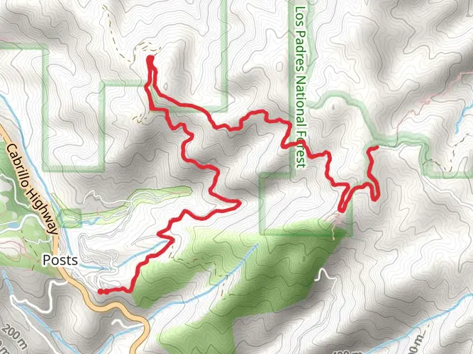
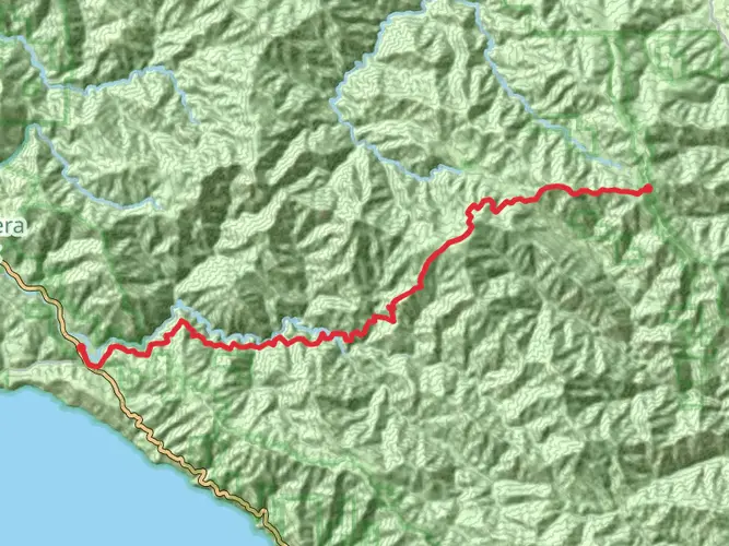
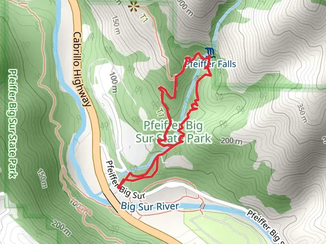
Sykes Hot Springs is a challenging yet rewarding hike located near Monterey County, California. The trail stretches approximately 15 kilometers (about 9.3 miles) and features an elevation gain of around 1100 meters (roughly 3600 feet), making it a strenuous journey suited for experienced hikers. This point-to-point trail is renowned for its beautiful hot springs, which serve as a perfect reward after a long hike.
Getting to the Trailhead
To reach the trailhead, you can drive to the Big Sur Station on Highway 1, which is the nearest significant landmark. For those relying on public transportation, options are limited due to the remote nature of the area, but during peak seasons, there may be bus services available from Monterey that get you close to Big Sur Station. From there, you may need to arrange a taxi or hitchhike to the trailhead.
The Hike Itself
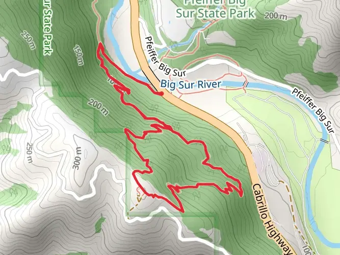
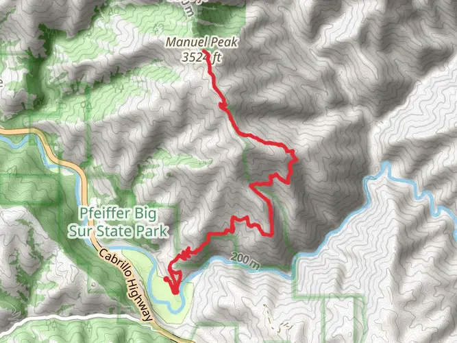
The hike to Sykes Hot Springs begins with a gradual ascent through a dense redwood forest, offering a cool canopy of shade. The trail follows the Big Sur River and crosses it several times, so waterproof boots or sandals for fording are recommended. After about 3 kilometers (nearly 2 miles), you'll reach the Ventana Camp, a good spot to rest and check your gear before the steeper sections ahead.
As you continue, the trail becomes more challenging with steep inclines and switchbacks. The environment transitions from redwood groves to chaparral and oak woodlands, offering diverse flora and fauna. Keep an eye out for wildlife such as deer, snakes, and if you're lucky, you might spot a California condor soaring above.
Landmarks and Natural Features
Around the halfway point, you'll encounter the Terrace Creek Camp. This is another potential rest stop where you can replenish your water supply. From here, the trail climbs more aggressively, with the toughest section known as "The Roller Coaster" due to its rapid ascents and descents.
After conquering the undulating terrain, you'll be rewarded with the sight of Sykes Hot Springs. The hot springs are a series of natural pools along the river, offering a soothing soak with temperatures that can reach up to 100 degrees Fahrenheit (38 degrees Celsius). It's the perfect place to relax your muscles and enjoy the natural beauty around you.
Historical Significance
The region holds historical significance as it was once home to the Esselen and Ohlone Native American tribes. The hot springs themselves have been a destination for centuries, serving as a natural retreat and healing spot.
Preparation and Planning
Given the trail's difficulty rating of Extra Difficult, it's essential to be well-prepared. Ensure you have a map and compass or use the HiiKER app for navigation. Pack plenty of water, high-energy food, and layers of clothing to adapt to changing temperatures. A first aid kit, headlamp, and emergency shelter are also advisable. Always check the weather forecast and trail conditions before setting out, as the trail can become treacherous after heavy rains.
Remember to practice Leave No Trace principles, pack out all your trash, and be mindful of the delicate ecosystem. Due to the popularity of the hot springs, consider visiting during the week to avoid crowds and secure a good camping spot if you plan to stay overnight.
By preparing adequately and respecting the natural environment, your hike to Sykes Hot Springs will be a memorable adventure through one of California's most stunning landscapes.

What to expect?
Activity types
Frequently asked questions
How long is the Sykes Hot Springs hike and how hard is it from Big Sur?
The Sykes Hot Springs hike is about 15.23 km, or 9.5 miles, with roughly 1,171 meters of elevation gain. That amount of climbing puts it firmly in the extra-difficult category, and the Pine Ridge Trail from Big Sur is widely considered a strenuous route even for experienced hikers.
Where do you park for the Sykes Hot Springs hike in Monterey County?
The usual access point for the Sykes Hot Springs hike is the Pine Ridge Trailhead at Big Sur Station Visitor Center off Highway 1. The Forest Service lists a dedicated parking area with 55 spaces, potable water at the site, and a parking fee of $10 per vehicle per calendar day.
Are dogs allowed on the Sykes Hot Springs hike on the Pine Ridge Trail?
Dogs are allowed on the Pine Ridge Trail to Sykes Hot Springs. Current Forest Service guidance says dogs must be under leash or voice control, should be leashed around horses and pack animals, and dog waste should be buried at least 100 feet from water or the trail.
How many river crossings are on the Sykes Hot Springs hike, and is it safe in winter?
The route to Sykes Hot Springs requires multiple crossings of the Big Sur River. The Forest Service warns that in winter, or after heavy rain, those crossings can become dangerous or even impossible, so access to Sykes may not be feasible during high water conditions.
Is the Sykes Hot Springs hike open year-round, or does it close seasonally?
The Pine Ridge Trailhead at Big Sur is listed as open year-round, but that does not guarantee safe access to Sykes Hot Springs in every season. Winter storms and high river levels can make the route impassable, and conditions on this trail can change quickly after rain or downed trees.
Can you do the Sykes Hot Springs hike as a day hike, or is it better as an overnight trip?
Sykes Hot Springs can be done as a hard day hike, but the route is also a classic overnight because it is long, steep, and involves river crossings. The trail is classified as multi-day, and Sykes Camp is one of several backcountry camps along Pine Ridge Trail, alongside places like Terrace Creek, Barlow Flat, and Redwood Camp.
Is there public transportation to the Sykes Hot Springs hike from Monterey?
Public transit to the Sykes Hot Springs hike is limited but possible in some periods via Monterey-Salinas Transit service toward Big Sur. The practical target is Big Sur Station, which sits by the Pine Ridge Trailhead, but service levels and weather-related disruptions can change, especially along Highway 1 in winter and spring.
Comments and Reviews
User comments, reviews and discussions about the Sykes Hot Springs, California.
4.6
average rating out of 5
10 rating(s)