Download
3D Flyover
Add to list
More
263.8 km
~11 days
6841 m
Multi-Day
“Embark on the Tahoe Rim Trail for a scenic, history-rich hiking adventure through diverse and breathtaking landscapes.”
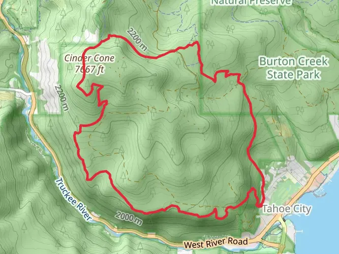
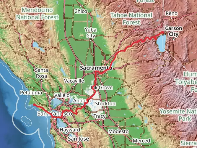
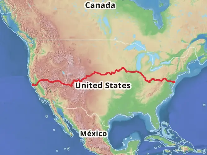
The Tahoe Rim Trail encircles the stunning Lake Tahoe, offering hikers a diverse array of landscapes, from high mountain peaks to lush meadows, and deep forests to expansive vistas. This approximately 264-kilometer (164-mile) loop trail, with an elevation gain of around 6,800 meters (22,300 feet), is a challenging yet rewarding experience that attracts outdoor enthusiasts from all over the world.
Getting to the Trailhead
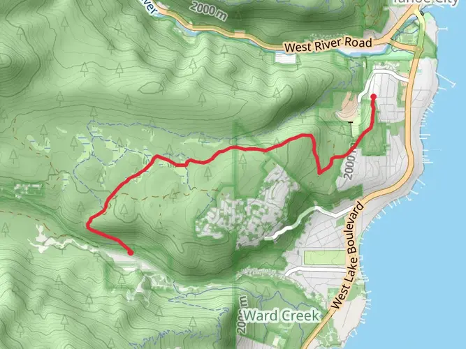
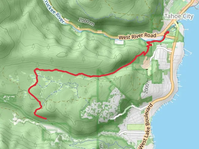
The trailhead is conveniently located near Placer County, California. For those driving, it's accessible via Highway 267, which leads to the Tahoe Basin. There are various points where you can start the hike since it's a loop, but a common starting point is near Tahoe City. Public transportation options are available seasonally, with buses from surrounding cities that can drop you off at points near the trail.
Navigating the Trail
Hikers can rely on the HiiKER app for detailed maps and navigation assistance throughout the journey. The app provides up-to-date trail information, helping you to stay on track and be aware of any trail changes or closures.
Landmarks and Scenery
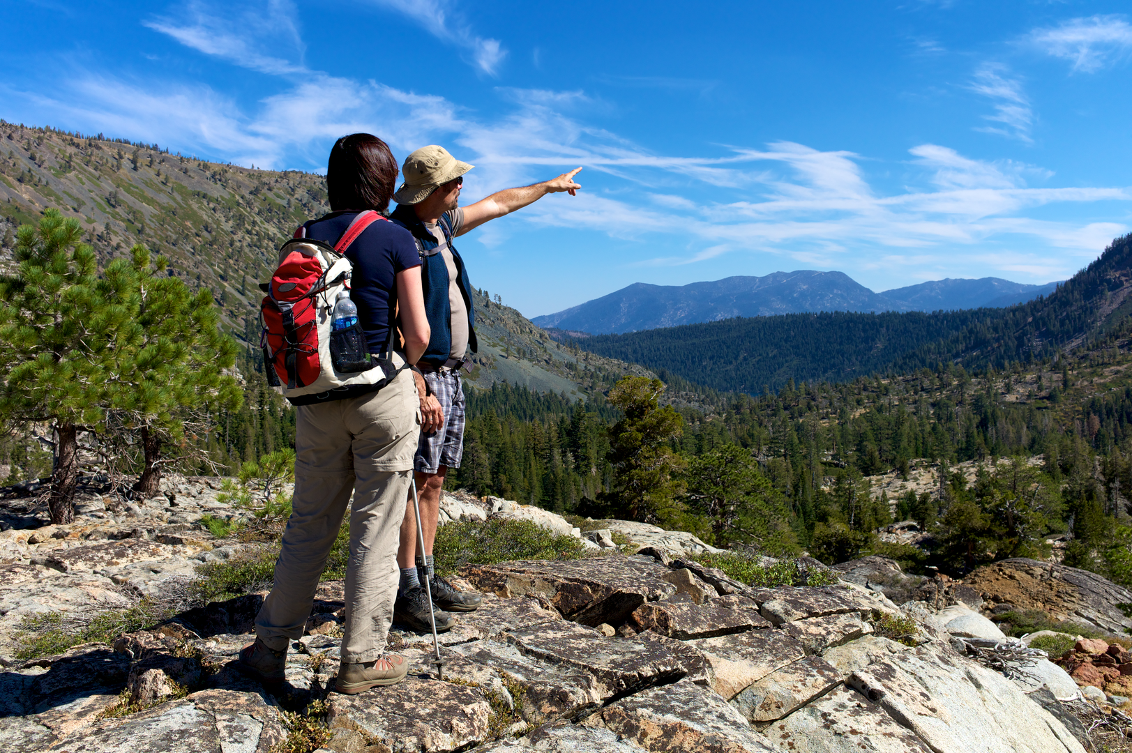
As you embark on the Tahoe Rim Trail, you'll be greeted by the impressive sight of the Sierra Nevada range. The trail offers panoramic views of Lake Tahoe, the largest alpine lake in North America, and the Carson Valley. Notable landmarks include the Mount Rose Wilderness area, where you can summit Mount Rose at 3,286 meters (10,785 feet) for a breathtaking view of the surrounding landscape.
Flora and Fauna
The trail traverses through various habitats, home to a rich biodiversity. You'll walk through forests of Jeffrey pine and white fir, cross wildflower-filled meadows, and may even spot wildlife such as black bears, mule deer, and mountain lions. Birdwatchers will delight in the variety of bird species, including the mountain chickadee and the Clark's nutcracker.
Historical Significance
The region around Lake Tahoe is steeped in history, with the Washoe Tribe being the original inhabitants of the area. Throughout your hike, you'll encounter sites that reflect the cultural heritage and the impact of the Gold Rush era, including old cabins and remnants of mining operations.
Trail Challenges
The trail is rated as medium difficulty, but it's important to prepare for the challenges it presents. Weather conditions can change rapidly at high altitudes, and snow can be present on the trail well into the summer months. Proper gear and clothing are essential, as well as a good supply of water and food.
Planning Your Hike
Most hikers take 10 to 15 days to complete the trail, but it can be broken down into smaller sections for day hikes or overnight trips. There are designated campsites along the route, and it's important to adhere to Leave No Trace principles to preserve the trail's natural beauty.
Remember, the Tahoe Rim Trail is not just a physical challenge, but an opportunity to immerse yourself in the natural splendor and historical richness of the Lake Tahoe region. Whether you're a seasoned hiker or a casual explorer, the trail offers an unforgettable adventure.

What to expect?
Activity types
Frequently asked questions
How long is the Tahoe Rim Trail and how many days does it usually take to hike?
The Tahoe Rim Trail is 263.85 km, or about 164 miles, with roughly 6,841 meters of climbing. Most thru-hikers break the full loop into about 10 to 14 days, depending on pace, resupply plans, and how much time is spent on higher-elevation sections around Lake Tahoe.
Where can you start the Tahoe Rim Trail near Tahoe City, and is there parking?
A common starting point for the Tahoe Rim Trail is Tahoe City on the north shore of Lake Tahoe. Official trail access and parking are available in the Tahoe City area, including the 64 Acres trailhead zone, but parking can be tight in peak season and some trailheads fill early on summer weekends.
Is the Tahoe Rim Trail dog friendly?
Dogs are allowed on all sections of the Tahoe Rim Trail. In busier areas they are expected to be on leash, and elsewhere they should remain under reliable voice control, which matters on a long route that passes through popular trailheads, wilderness sections, and high-use viewpoints around the Tahoe Basin.
Do you need a permit to backpack the Tahoe Rim Trail?
Most of the Tahoe Rim Trail does not require an overnight permit, but Desolation Wilderness does. Day use in Desolation Wilderness also requires a free self-issued permit, and overnight users need the appropriate wilderness permit. Bear-resistant food storage is required throughout the entire Tahoe Rim Trail system.
Can you camp anywhere on the Tahoe Rim Trail?
Camping on the Tahoe Rim Trail is regulated rather than completely open. In general, camping is allowed 100 to 300 feet from the trail, at least 200 feet from water, and 100 feet from other trails, but camping at trailheads is prohibited and special rules apply in places such as Desolation Wilderness and Lake Tahoe Nevada State Park.
What is the best time of year to hike the Tahoe Rim Trail?
The main hiking season for the Tahoe Rim Trail is typically summer into early fall, when the high country is most likely to be snow-free. Because the route circles Lake Tahoe at elevation, winter and spring can bring snow, ice, slush, and muddy stretches, especially on higher sections near areas such as Mount Rose and Desolation Wilderness.
Can you get to the Tahoe Rim Trail without a car?
Yes, some Tahoe Rim Trail access points can be reached by public transit, although planning is important because service around the basin is limited. Major trailheads with transit connections include Tahoe City at 64 Acres and Kingsbury South, making car-free section hikes more practical than a full loop without shuttle logistics.
Comments and Reviews
User comments, reviews and discussions about the Tahoe Rim Trail, California.
4.25
average rating out of 5
8 rating(s)