Download
3D Flyover
Add to list
More
157.6 km
~7 days
4070 m
Multi-Day
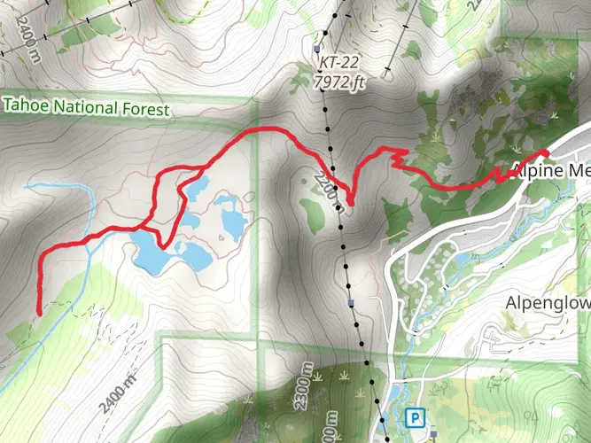
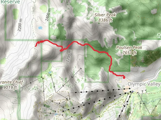
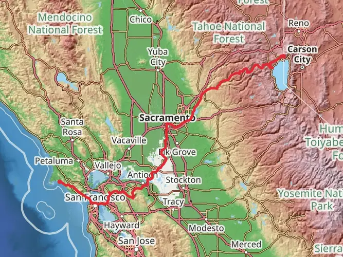
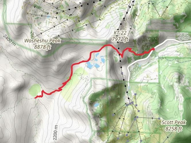
The Western States Endurance Run Trail is a 157.6 km trail that starts in Olympic Valley, Placer County, California. Based on our data, the hike is graded as Medium. For information on how we grade trails, please read measuring the difficulty of a hiking trail on hiiker. Also, check our latest community posts for trail updates. This hike can be completed in approx 7 days. Caution is advised on trail times as this depends on multiple variables. For more info read about how we calculate hike time.

What to expect?
Activity types
Frequently asked questions
How long is the Western States Endurance Run Trail in Placer County, California?
The Western States Endurance Run Trail is 157.6 km long, making it a true multi-day route rather than a short out-and-back. It crosses a large section of Placer County from the high country near Olympic Valley toward Auburn, with major changes in terrain and temperature along the way.
How much elevation gain is on the Western States Endurance Run Trail?
The Western States Endurance Run Trail has 4,070 meters of elevation gain. Even though it is rated medium overall, that amount of climbing spread across 157.6 km makes it a serious endurance route with long ascents, descents, and sustained effort over multiple days.
Where does the Western States Endurance Run Trail start and finish?
The route is associated with the historic Western States Trail corridor running from Olympic Valley to Auburn. The trail passes through the Granite Chief Wilderness and finishes in Auburn, and the broader Western States route is known for linking the Sierra high country with the American River canyons and the Auburn area.
Are dogs allowed on the Western States Endurance Run Trail?
Dog access depends on which section of the Western States Endurance Run Trail is being hiked. In Auburn State Recreation Area, dogs are allowed, except at Lake Clementine, and they must be under control on a leash no longer than 6 feet. In the Granite Chief Wilderness, dogs are prohibited on the Tevis Cup Trail and on the Western States Trail in Picayune Valley from May 15 to July 15 because of seasonal deer fawning closures.
Where can hikers park for the Western States Endurance Run Trail near Olympic Valley or Auburn?
One practical access point near the eastern end is Squaw Valley Park at 101 Squaw Valley Road in Olympic Valley, where the park map shows Western States Trail access and 110 parking stalls, including 4 ADA spaces. On the Auburn side, Auburn State Recreation Area identifies major trailheads including the Auburn Horse Staging Area on Pleasant Avenue, the Quarry Trail near Highway 49, and the Foresthill Divide Loop Trail.
What landmarks and river crossings are on the Western States Endurance Run Trail?
The Western States Endurance Run Trail is known for passing Emigrant Pass, entering the Granite Chief Wilderness, and dropping into the canyons of California Gold Country. The route also includes a notable crossing of the Middle Fork of the American River before continuing west toward Auburn on the reddish-brown foothill trails.
Is the Western States Endurance Run Trail hard to hike?
The Western States Endurance Run Trail is rated medium, but its scale makes it demanding in practice. At 157.6 km with 4,070 meters of climbing, it is best understood as a long multi-day endurance hike where heat in the lower canyons, remote stretches, and repeated elevation change matter as much as the technical difficulty.
Comments and Reviews
User comments, reviews and discussions about the Western States Endurance Run Trail, California.
4.67
average rating out of 5
6 rating(s)