Download
Preview
Add to list
More
51.7 km
~3 days
2252 m
Multi-Day
“Embark on the Siskiyou Boundary Trail, a historic and strenuous trek through California's wild heart.”
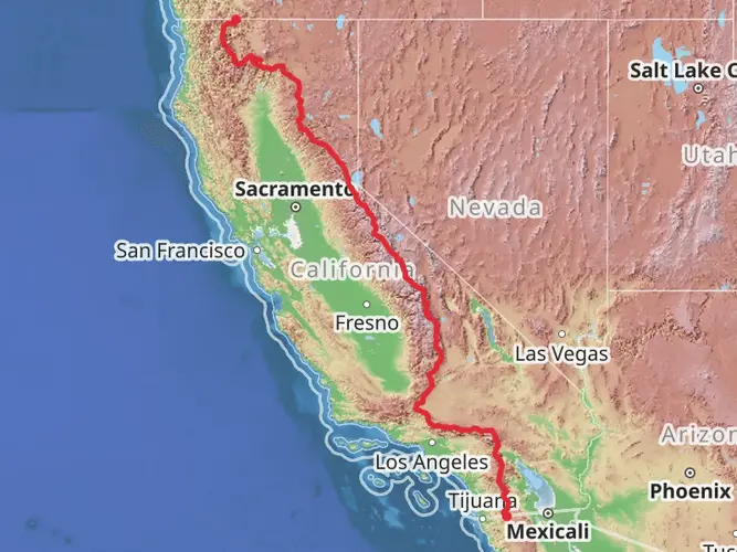
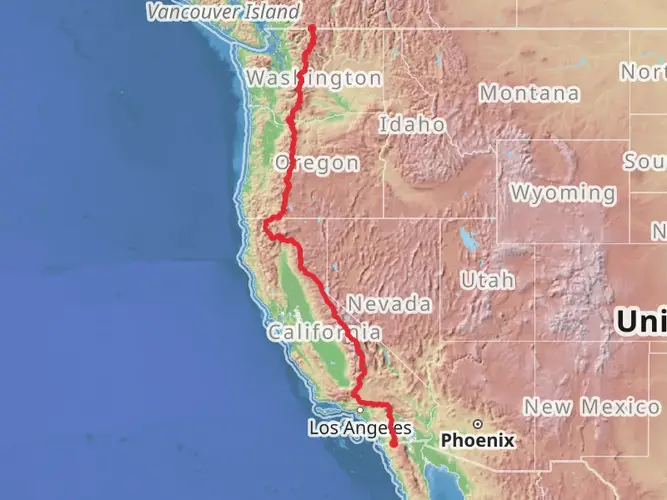
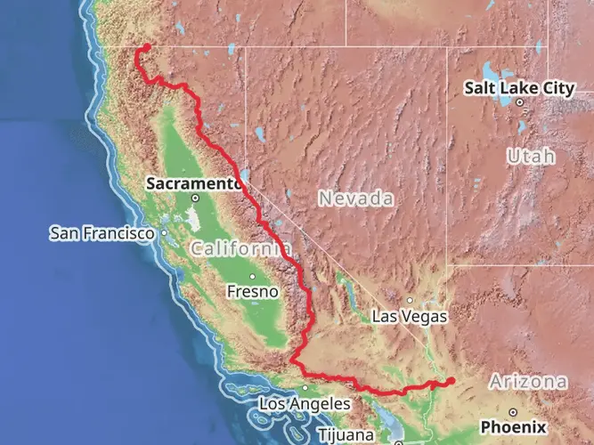
The Siskiyou Boundary Trail is a challenging and rewarding point-to-point hike that spans approximately 52 kilometers (about 32 miles) with an elevation gain of around 2200 meters (approximately 7220 feet). This trail is nestled in the scenic region of Siskiyou County, California, and is known for its rugged terrain and breathtaking landscapes.
Getting to the Trailhead
To reach the trailhead, hikers can drive to the vicinity of Siskiyou County, where the trail begins. For those relying on public transportation, options may be limited due to the remote nature of the area, so it's advisable to check local transit resources for the latest schedules and routes. Once at the starting point, hikers will find themselves on the cusp of an adventure through one of California's most diverse and historically rich regions.
Navigating the Trail
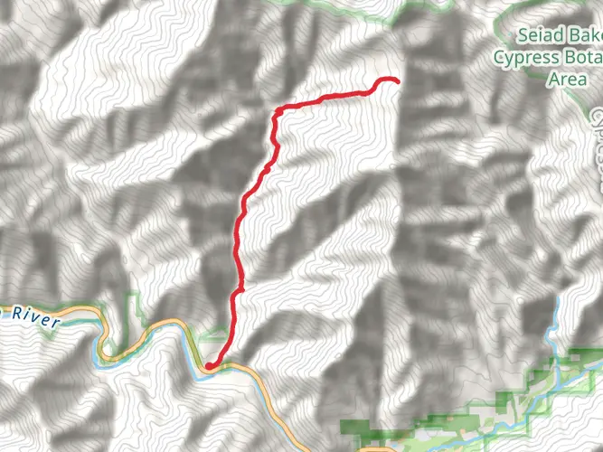
As you embark on the Siskiyou Boundary Trail, it's essential to have a reliable navigation tool. HiiKER is an excellent resource for trail maps and navigation, ensuring that you stay on the correct path throughout your journey. The trail is well-marked in most sections, but due to its length and difficulty, having a digital map on hand is a wise precaution.
Landmarks and Natural Features
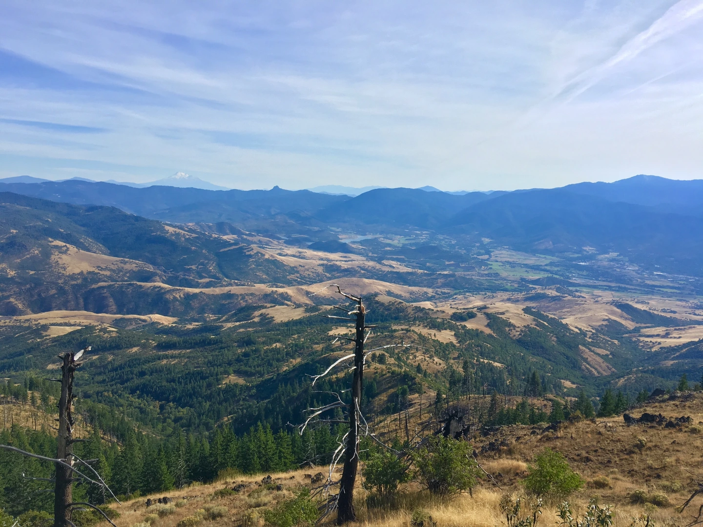
The trail meanders through a variety of landscapes, including dense forests, alpine meadows, and rocky ridges. Early on, hikers will ascend through coniferous forests, with the potential to spot local wildlife such as black bears, deer, and a plethora of bird species. As you gain elevation, the vegetation changes, and you may find yourself surrounded by wildflowers in the spring and summer months.
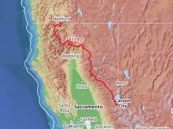
One of the significant landmarks along the trail is the breathtaking view of Mount Shasta, a potentially active volcano that dominates the skyline. The mountain's presence is a constant companion as you traverse the Siskiyou Wilderness, offering a stunning backdrop for your hike.
Historical Significance
The region is steeped in history, with the trail itself cutting through areas that were once bustling with activity during the Gold Rush era. Hikers will be walking paths that miners and settlers once used in their quest for fortune and a new life. The Siskiyou area is also significant for its indigenous history, as it was home to several Native American tribes who lived in harmony with the land for thousands of years.
Trail Challenges
The Siskiyou Boundary Trail is rated as difficult, and rightfully so. The elevation gain is substantial, and the terrain can be unforgiving. Hikers should be prepared for steep climbs and potentially treacherous descents. It's recommended that only experienced hikers attempt this trail, and it's essential to be in good physical condition.
Preparation and Safety
Before setting out, ensure you have all the necessary gear, including sturdy hiking boots, weather-appropriate clothing, and plenty of water and food. Given the trail's length and remote nature, it's also wise to carry a first-aid kit, a means of purifying water, and emergency shelter. Always let someone know your itinerary and expected return time.
Seasonal Considerations
The best time to hike the Siskiyou Boundary Trail is from late spring to early fall when the snow has melted, and the trail is most accessible. However, weather in the mountains can be unpredictable, so always check the forecast before departing and be prepared for sudden changes in conditions.
By taking the necessary precautions and respecting the natural environment, hikers can enjoy the rugged beauty and historical significance of the Siskiyou Boundary Trail, a true gem in the crown of California's wilderness areas.

What to expect?
Activity types
Frequently asked questions
How long does the Siskiyou Boundary Trail take to hike?
The Siskiyou Boundary Trail is 51.65 km, or about 32.1 miles, with 2,252 meters of climbing, so it is usually treated as a multi-day backpacking route rather than a day hike. Strong hikers may finish it in 2 long days, but 3 days is a more realistic pace for covering the distance while managing the sustained elevation gain and rugged terrain.
How difficult is the Siskiyou Boundary Trail in Siskiyou County?
The Siskiyou Boundary Trail is rated Extra Difficult. That matches the numbers: 51.65 km of hiking with 2,252 meters of ascent is a serious effort, and the route is best suited to experienced hikers who are comfortable with long mileage, steep climbing, and backcountry travel over multiple days.
What is the total elevation gain on the Siskiyou Boundary Trail?
The Siskiyou Boundary Trail gains 2,252 meters, which is about 7,388 feet, over its 51.65 km length. That amount of climbing is spread across a point-to-point route, so the trail feels strenuous even for strong backpackers and calls for careful pacing, especially on loaded overnight trips.
When is the best time of year to hike the Siskiyou Boundary Trail?
The best window for the Siskiyou Boundary Trail is usually summer into early fall, when higher sections of the Siskiyou Crest are more likely to be free of lingering snow. In Siskiyou County, winter conditions commonly arrive from late November into mid-April, and the Red Buttes Wilderness area is known for dry, exposed stretches where hot weather and limited water can also be a factor.
Is there parking at the Siskiyou Boundary Trail trailhead?
Trailhead parking is available at access points into the Red Buttes Wilderness, where the Boundary Trail runs along the Siskiyou Crest. Access is remote and typically depends on forest roads rather than developed large-capacity lots, so parking is best treated as limited trailhead parking suitable for a point-to-point shuttle plan rather than a simple out-and-back day-hike setup.
Can you do the Siskiyou Boundary Trail as a day hike?
Most hikers do not treat the Siskiyou Boundary Trail as a day hike. At 51.65 km with 2,252 meters of ascent, it is long enough and strenuous enough that it fits a multi-day itinerary far better, especially because it is a point-to-point route and not a loop.
Is there public transportation to the Siskiyou Boundary Trail?
Public transportation in Siskiyou County is limited, and the trail itself sits in a remote backcountry area rather than near a regular transit stop. Siskiyou County’s STAGE system serves parts of the county, but reaching the actual trailheads for the Siskiyou Boundary Trail generally requires a private vehicle or a prearranged shuttle because the final access is on forest roads.
Comments and Reviews
User comments, reviews and discussions about the Siskiyou Boundary Trail, California.
4.56
average rating out of 5
9 rating(s)