Download
Preview
Add to list
More
98.8 km
~5 days
1302 m
Multi-Day
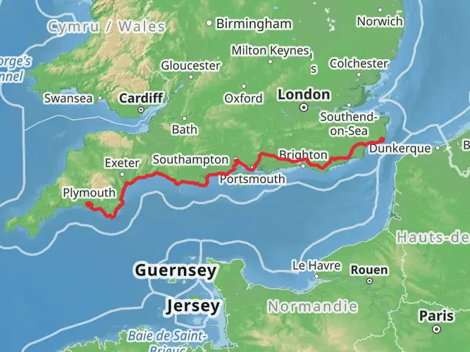
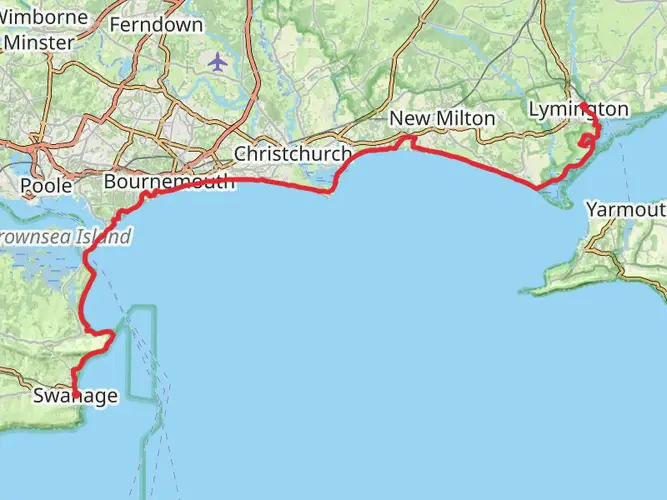
The Hengistbury Head, Christchurch to Stourhead via Stour Valley Way is a 98.8 km trail that starts in , Bournemouth, Christchurch and Poole, England. Based on our data, the hike is graded as Easy. For information on how we grade trails, please read measuring the difficulty of a hiking trail on hiiker. Also, check our latest community posts for trail updates. This hike can be completed in approx 4 days. Caution is advised on trail times as this depends on multiple variables. For more info read about how we calculate hike time.

What to expect?
Activity types
Frequently asked questions
How long does the Hengistbury Head, Christchurch to Stourhead via Stour Valley Way hike take?
Hengistbury Head, Christchurch to Stourhead via Stour Valley Way is 98.83 km long, so most hikers treat it as a multi-day walk rather than a single outing. With 1,302 m of total ascent and generally easy grading, it is commonly split into about 4 to 6 days depending on pace, overnight stops, and weather.
Is the Hengistbury Head, Christchurch to Stourhead via Stour Valley Way hike difficult?
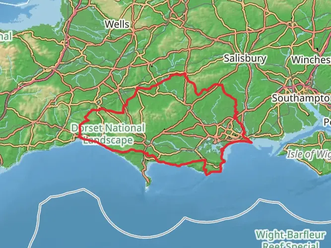
Hengistbury Head, Christchurch to Stourhead via Stour Valley Way is rated easy, which fits the character of the Stour Valley Way as a predominantly flat long-distance route following the River Stour. The main challenge is its 98.83 km length rather than technical terrain, although there are some hillier sections with views around places such as Hambledon Hill, Hod Hill, Dudsbury Hillfort, and Hengistbury Head.
Where does the Hengistbury Head, Christchurch to Stourhead via Stour Valley Way start and finish?
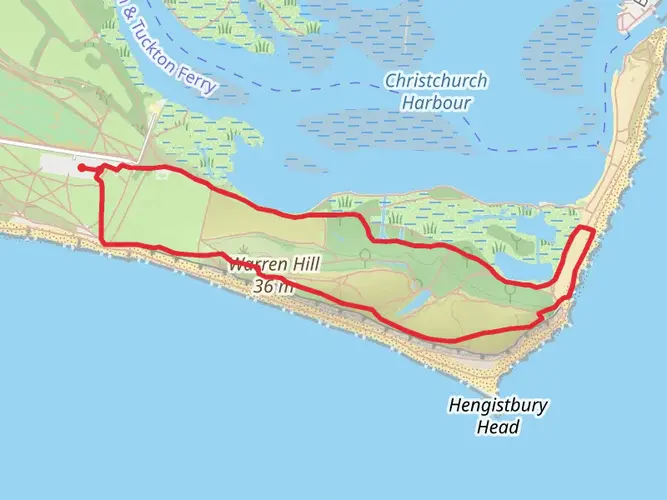
The route links Hengistbury Head on the Dorset coast near Christchurch with Stourhead in Wiltshire, following the River Stour inland. Official descriptions of the Stour Valley Way place one end at Hengistbury Head, where the river reaches the sea, and the other at Stourhead near the river’s source.
Can the Hengistbury Head, Christchurch to Stourhead via Stour Valley Way be done using public transport?
Yes. The coastal end is accessible from Christchurch, and the Stour Valley Way is widely described as straightforward to reach by train for the Christchurch start. At the inland end, Stourhead has parking and seasonal shuttle-bus links from nearby rail stations on some days, but transport at that end is less direct, so many walkers plan this as a one-way trip with a transfer at the finish.
Is there parking at the Hengistbury Head end of the Hengistbury Head, Christchurch to Stourhead via Stour Valley Way?
Yes. Hengistbury Head has a main visitor area and car park near the headland, making the Christchurch end practical for a long-distance start. The headland is managed as a local nature reserve, and the visitor center area is the usual access point before joining the Stour Valley Way inland.
What landmarks are on the Hengistbury Head, Christchurch to Stourhead via Stour Valley Way hike?
Hengistbury Head, Christchurch to Stourhead via Stour Valley Way follows the River Stour from the coast through Dorset and into Wiltshire. Notable landmarks named on official route descriptions include Hengistbury Head, Christchurch Harbour, Hambledon Hill, Hod Hill, Dudsbury Hillfort, and Stourhead at the inland end.
Comments and Reviews
User comments, reviews and discussions about the Hengistbury Head, Christchurch to Stourhead via Stour Valley Way, England.
4.86
average rating out of 5
7 rating(s)