Download
Preview
Add to list
More
160.0 km
~9 days
5049 m
Multi-Day
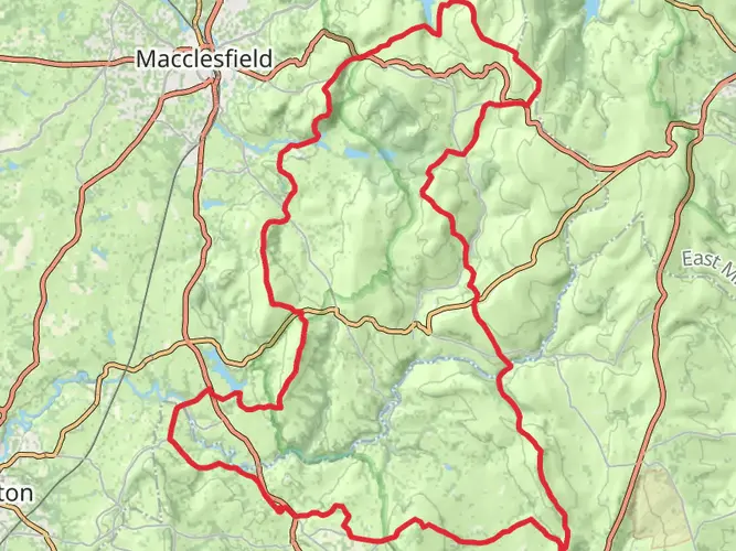
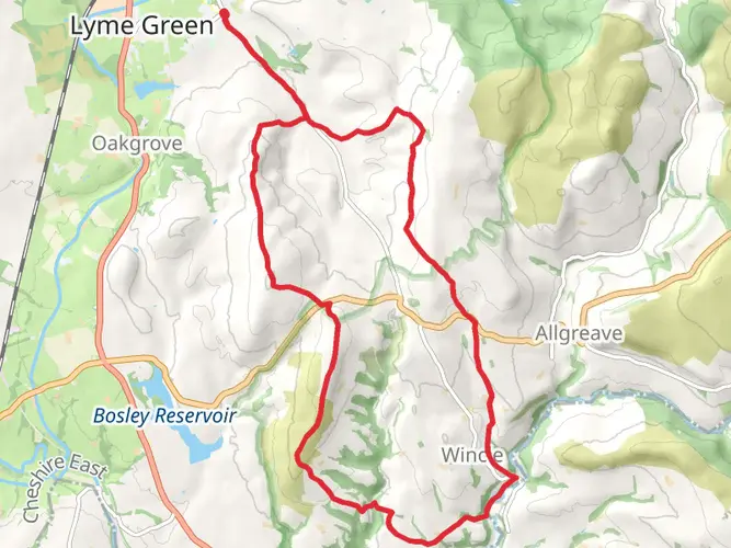
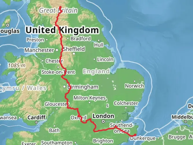
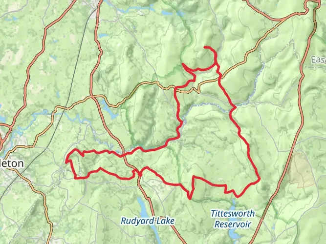
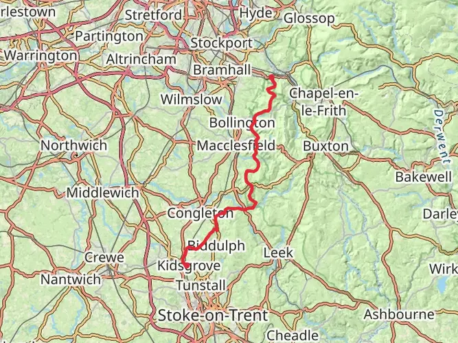
The Manchester Walk from south of Macclesfield to Horwich is a 160.0 km trail that starts in , Cheshire East, England. Based on our data, the hike is graded as Medium. For information on how we grade trails, please read measuring the difficulty of a hiking trail on hiiker. Also, check our latest community posts for trail updates. This hike can be completed in approx 7 days. Caution is advised on trail times as this depends on multiple variables. For more info read about how we calculate hike time.

What to expect?
Activity types
Frequently asked questions
How long is the Manchester Walk from south of Macclesfield to Horwich and how many days does it take?
The Manchester Walk from south of Macclesfield to Horwich is 159.98 km long with 5,049 m of total ascent. That distance is usually tackled as a multi-day hike, and a typical schedule is about 9 days, depending on pace, weather, and how the stages are split.
Is the Manchester Walk from south of Macclesfield to Horwich a difficult hike?
The Manchester Walk from south of Macclesfield to Horwich is rated medium, but it is still a serious long-distance outing because it combines nearly 160 km of walking with 5,049 m of climbing. The challenge comes less from technical ground and more from the cumulative distance, repeated ascents, and the need to manage several full days on foot.
Where does the Manchester Walk from south of Macclesfield to Horwich start and finish?
The route starts south of Macclesfield in Cheshire East and finishes in Horwich, on the edge of the West Pennine Moors near Bolton. That makes it a linear end-to-end walk rather than a loop, so transport planning at both ends is an important part of the trip.
Can the Manchester Walk from south of Macclesfield to Horwich be done using public transport?
Yes. Macclesfield has a mainline railway station with regular rail connections, making the southern end straightforward to reach by train. At the northern end, Horwich is served by Horwich Parkway railway station, which provides rail access for finishing the walk and returning toward Manchester and the wider North West.
Is parking available for the Manchester Walk from south of Macclesfield to Horwich?
Parking is available in Macclesfield, including at Macclesfield railway station, which is a practical option near the southern end of the route. At the Horwich end, parking is also available around Horwich Parkway, but because this is a linear 159.98 km walk, many hikers use rail rather than leaving a car at one end.
What kind of hike is the Manchester Walk from south of Macclesfield to Horwich?
The Manchester Walk from south of Macclesfield to Horwich is a multi-day linear hike in North West England. It links the countryside south of Macclesfield with Horwich over a 159.98 km route, so it suits hikers looking for an end-to-end journey rather than a short circular day walk.
Comments and Reviews
User comments, reviews and discussions about the Manchester Walk from south of Macclesfield to Horwich, England.
5.0
average rating out of 5
1 rating(s)