Download
Preview
Add to list
More
54.5 km
~3 days
460 m
Multi-Day
“Embark on the Bishop Bennet Way for a historical and bucolic trek through Cheshire's heartlands.”
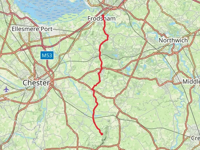
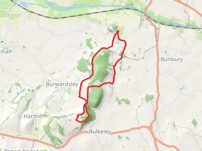
The Bishop Bennet Way is a scenic trail that meanders through the picturesque countryside of Cheshire, England. Spanning approximately 54 kilometers (about 33.5 miles) with an elevation gain of around 400 meters (roughly 1312 feet), this point-to-point route offers a medium difficulty level, making it accessible to hikers with a reasonable level of fitness.
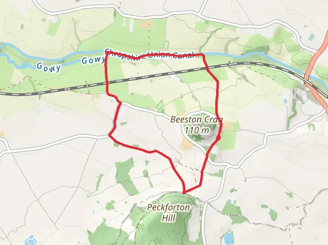
Starting near Cheshire West and Chester, the trailhead can be found close to Beeston Castle, a historic landmark that provides a dramatic beginning to the hike. For those arriving by public transport, buses run regularly to the nearby village of Beeston, where it's a short walk to the castle. If driving, parking is available at the castle itself or in the village.
As you embark on the Bishop Bennet Way, you'll traverse a variety of landscapes, including pastoral farmland, quiet woodlands, and serene river valleys. The trail is well-marked, but carrying a reliable navigation tool like HiiKER is recommended to stay on track and to be aware of upcoming waypoints.
Historical Significance and Landmarks
The route is named after William Bennet, the Bishop of Chester in the early 19th century, who was known for his horseback travels across the diocese. Along the way, hikers will encounter numerous historical sites, such as the aforementioned Beeston Castle, which dates back to the 13th century and offers panoramic views of the surrounding countryside.
Further along, the Sandstone Trail intersects with Bishop Bennet Way, providing an opportunity to explore more of the region's heritage. The trail also passes through the village of Burwardsley, home to the Cheshire Workshops, where you can learn about the local craft of candle making.
Flora and Fauna
The Cheshire landscape is rich with wildlife, and as you hike, keep an eye out for various bird species, including skylarks and buzzards. The hedgerows and woodlands are home to small mammals like hedgehogs and foxes, while the open fields may offer sightings of deer at dawn or dusk.
In spring and summer, the trail is lined with wildflowers, adding splashes of color to the green backdrop. The diverse habitats ensure a vibrant display of flora throughout the year, with bluebells carpeting the woodland floors in spring and heather blooming on the heathland in late summer.
Navigating the Trail
The trail is generally well-signed, with the distinctive Bishop Bennet Way markers guiding you along the route. However, due to the trail's length and rural nature, it's wise to have a backup navigation method. HiiKER can provide detailed maps and GPS coordinates to ensure you remain on the correct path.
Preparation and Planning
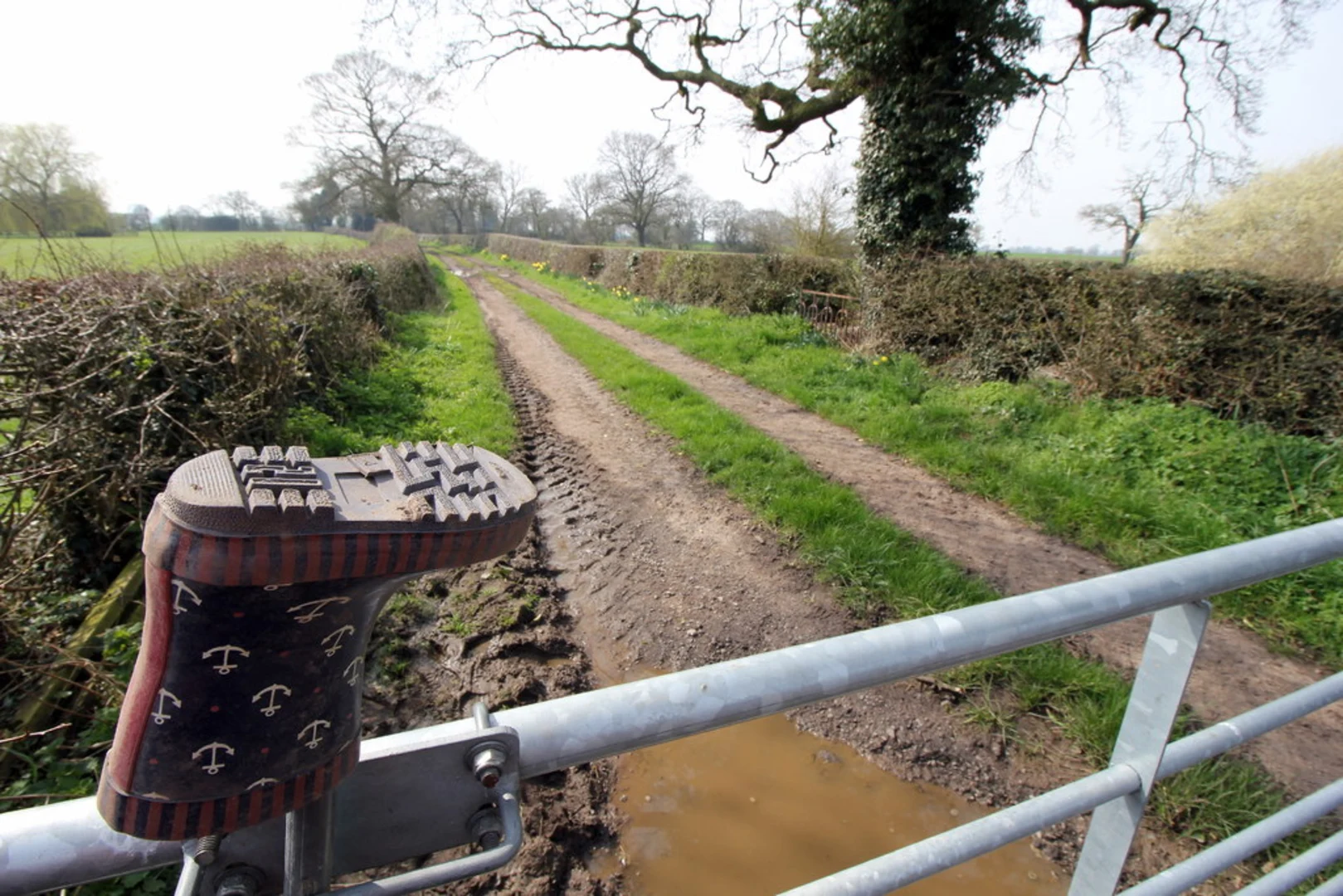
Before setting out, ensure you have adequate water and food, as there are limited facilities along certain sections of the trail. Weather in the English countryside can be unpredictable, so pack layers and waterproof gear. Sturdy hiking boots are recommended, as the terrain can be uneven and muddy in places.
For those looking to complete the trail over multiple days, there are a number of accommodation options along the route, including bed and breakfasts, inns, and camping sites. It's advisable to book these in advance, especially during peak hiking seasons.
Remember to respect the countryside code, leaving no trace and keeping to the marked paths to protect the natural environment and farmland that the Bishop Bennet Way traverses. With its blend of natural beauty, wildlife, and historical intrigue, this trail offers a rewarding experience for hikers looking to explore the heart of Cheshire.

What to expect?
Activity types
Frequently asked questions
How long is the Bishop Bennet Way and how many days does it usually take to walk?
The Bishop Bennet Way is 54.46 km, or about 33.8 miles, with roughly 460 m of elevation gain. Most walkers split it into 2 to 3 days because it is a point-to-point route with generally easy terrain rather than a steep mountain trail.
Where does the Bishop Bennet Way start and finish in Cheshire?
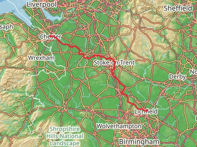
The Cheshire route of the Bishop Bennet Way starts below Beeston Castle and runs west toward the Welsh border, passing places including Tattenhall, Aldford, Farndon, Malpas, and Whitchurch before finishing near the hilltop village of Wirswall on the Shropshire border. That makes it a linear trail rather than a loop.
Is the Bishop Bennet Way an easy walk or is it better suited to experienced hikers?
The Bishop Bennet Way is generally considered an easy long-distance trail. Over 54.46 km it gains about 460 m, so the challenge is more about covering the distance over one or more days than dealing with sustained steep climbing.
Can the Bishop Bennet Way be done as a walk, or is it only for horse riders and cyclists?
The Bishop Bennet Way was created as a multi-user route and is used by horse riders and cyclists, but it can also be walked. Walkers should expect a mix of countryside tracks, lanes, and public rights of way across south-west Cheshire rather than a footpath designed only for hiking.
What towns and landmarks does the Bishop Bennet Way pass on the way from Beeston Castle?
From the Beeston Castle area, the Bishop Bennet Way passes through or near Tattenhall, Aldford, Farndon, Malpas, and Whitchurch before reaching Wirswall. Beeston Castle is the standout historic landmark at the start, and the route also intersects the Sandstone Trail in Cheshire.
Is the Bishop Bennet Way waymarked and easy to follow?
The Bishop Bennet Way is a waymarked recreational route in Cheshire, but it still crosses a broad mix of farmland, tracks, minor roads, and rights of way. Navigation is usually straightforward for a prepared long-distance walker, though a map or offline route guidance is still sensible on a 54 km point-to-point trail.
Comments and Reviews
User comments, reviews and discussions about the Bishop Bennet Way, England.
4.25
average rating out of 5
8 rating(s)