Download
Preview
Add to list
More
172.9 km
~10 days
4198 m
Multi-Day
“Embark on a historical and natural odyssey through England's countryside along the Samaritans Way South West.”
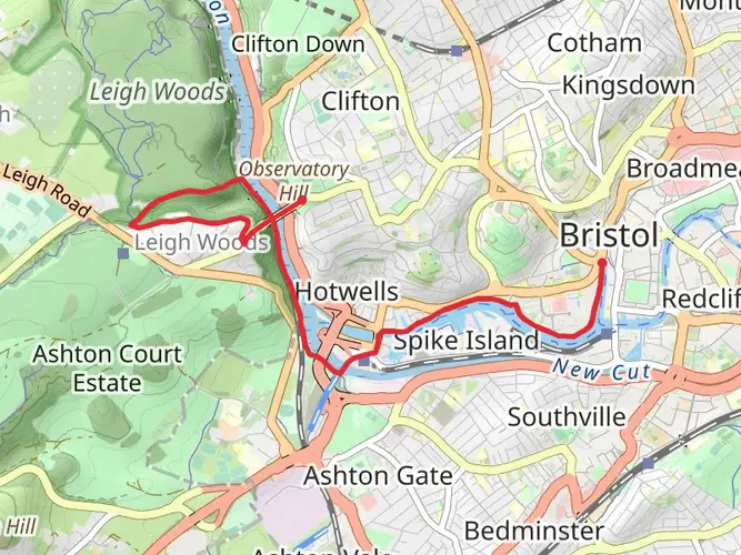
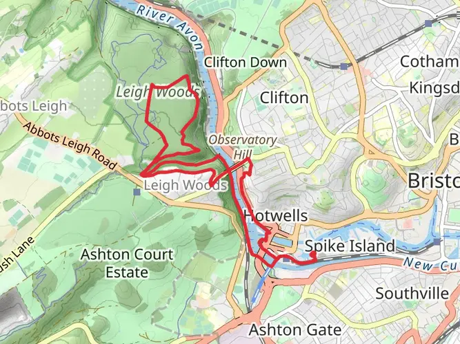
Spanning approximately 173 kilometers (107 miles) with an elevation gain of around 4100 meters (13,450 feet), the Samaritans Way South West is a point-to-point trail that offers a medium difficulty rating for hikers. The trailhead is conveniently located near the vibrant City of Bristol, England, which is easily accessible by both public transport and car.
Getting to the Trailhead
To reach the starting point of the Samaritans Way South West, hikers can take a train or bus to Bristol and then a local bus or taxi to the trailhead. For those driving, parking is available in the area, and the exact location can be pinpointed using the HiiKER app for precise navigation.
Trail Overview
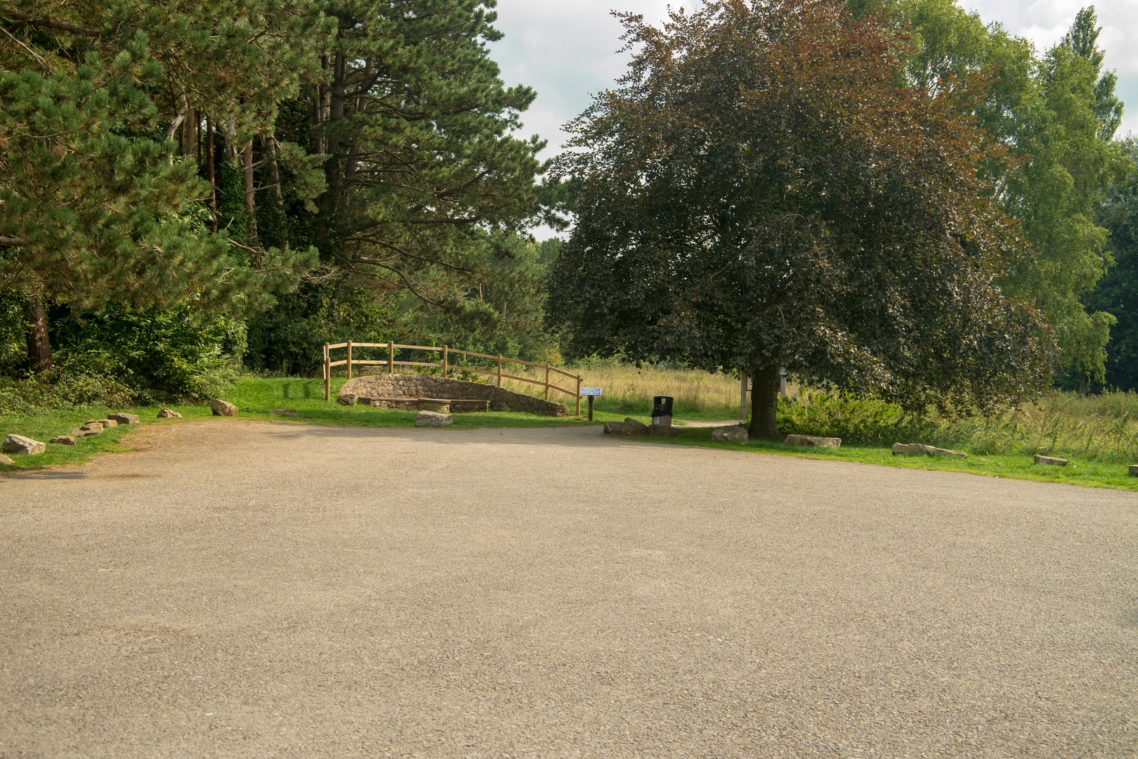
The journey begins in the outskirts of Bristol, where the trail meanders through the rolling Mendip Hills, offering sweeping views of the Somerset countryside. The path leads through a variety of landscapes, including dense woodlands, open farmland, and along riverbanks, each providing its own unique scenery and challenges.
Historical Significance
As hikers traverse this trail, they will encounter numerous sites of historical significance. The region is steeped in history, with ancient monuments, historic villages, and centuries-old battlefields. One of the notable landmarks is the Cheddar Gorge, a limestone gorge in the Mendip Hills, near the village of Cheddar. It is known for its stunning cliffs, stalactite-filled caves, and as the site where Britain's oldest complete human skeleton, the Cheddar Man, was found.
Natural Beauty and Wildlife
The Samaritans Way South West is a haven for nature enthusiasts. The trail offers the chance to witness a diverse array of wildlife, including deer, badgers, and a variety of bird species. The changing seasons bring different flora to life, with bluebells carpeting the woodland floors in spring and the rich hues of changing leaves in autumn.
Navigation and Preparation
Hikers should prepare for a variety of terrains, including some steep ascents and descents. The trail is well-marked, but carrying a detailed map or using the HiiKER app is recommended for navigation. It's important to pack sufficient water, food, and weather-appropriate clothing, as conditions can change rapidly.
Accommodation and Resupply Points
Along the route, there are several towns and villages where hikers can find accommodation, ranging from campgrounds to bed and breakfasts. Resupply points for food and water are also available, but it's wise to plan these stops in advance to ensure they coincide with your hiking itinerary.
Conclusion
The Samaritans Way South West is a trail that offers a rich tapestry of English countryside, historical sites, and diverse natural habitats. It is a journey that promises to be as rewarding as it is challenging, providing an immersive experience into the heart of the South West's landscape and heritage.

What to expect?
Activity types
Frequently asked questions
How long does the Samaritans Way South West take to walk from Bristol to Lynton?
The Samaritans Way South West is about 172.89 km, or roughly 107 miles, so most hikers split it over 7 to 10 days. A common pace is around 17 to 25 km per day, especially with the route’s 4,198 m of total ascent and its mix of hills, farmland, and longer moorland stretches.
Where does the Samaritans Way South West start and finish?
The Samaritans Way South West is a point-to-point route that starts in Bristol and runs west through Somerset into North Devon, finishing at Lynton near Lynmouth. The full route is widely described as Bristol to Lynton, passing major landmarks including the Mendip Hills, Cheddar Gorge, the Quantocks, Exmoor, Doone Valley, and the East Lyn River.
What are the main landmarks on the Samaritans Way South West?
Key landmarks on the Samaritans Way South West include Clifton Suspension Bridge in Bristol, the Mendip Hills, Cheddar Gorge, Wells, Glastonbury, the Quantock Hills, Exmoor, Doone Valley, Badgworthy Water, Brendon, Myrtleberry Cleaves, and the East Lyn River valley into Lynton. That variety is a big reason the trail feels more like a cross-country journey than a single-terrain walk.
Is the Samaritans Way South West waymarked all the way?
The Samaritans Way South West is not waymarked for its entire length. The route is described as fully waymarked from Bristol to Goathurst, but beyond that, navigation matters more and hikers should expect to rely on mapping for sections across Exmoor and into North Devon.
Is the Samaritans Way South West a difficult long-distance walk?
The Samaritans Way South West is generally rated medium difficulty, but it is still a serious long-distance walk. Over 172.89 km it gains about 4,198 m of elevation, so the challenge comes less from technical ground and more from the cumulative climbing, multi-day distance, and exposed stretches on higher ground such as the Mendips, Quantocks, and Exmoor.
Can the Samaritans Way South West be reached by public transport?
Yes. Bristol, the eastern end of the Samaritans Way South West, is well served by rail and bus connections, making the start straightforward to reach without a car. At the western end, Lynton and the North Devon coast are not rail-served, so onward travel usually involves bus connections via Barnstaple or other regional hubs.
Comments and Reviews
User comments, reviews and discussions about the Samaritans Way South West, England.
4.75
average rating out of 5
4 rating(s)