Download
Preview
Add to list
More
28.2 km
~2 days
205 m
Multi-Day
“Embark on the Camel Trail, a captivating 28-kilometer journey through Cornwall's rich history and vibrant landscapes.”
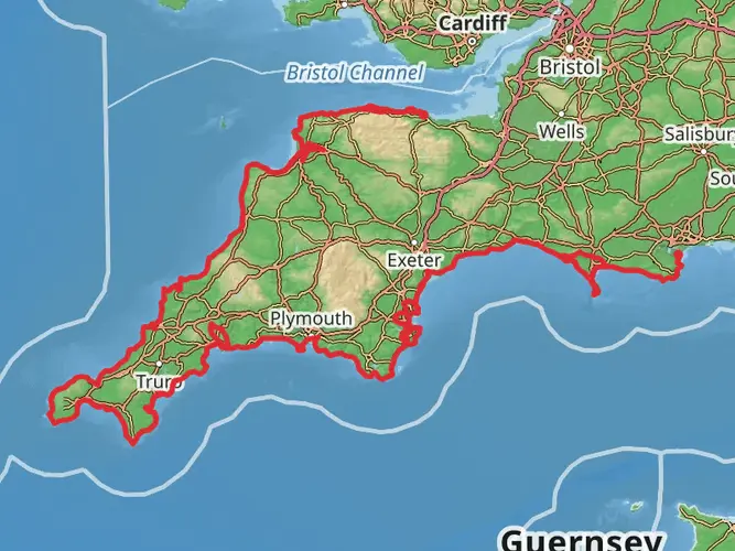
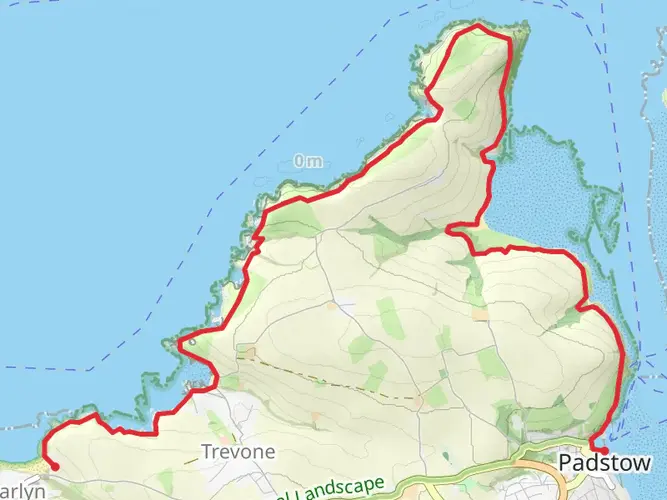
The Camel Trail, stretching approximately 28 kilometers (about 17.4 miles) with an elevation gain of around 200 meters (656 feet), is a scenic and historically rich route that follows a disused railway line in the heart of Cornwall, England. This point-to-point trail is considered to have a medium difficulty rating, making it accessible for most hikers with a reasonable level of fitness.
Getting to the Trailhead
To reach the trailhead, which is situated near Padstow, a picturesque fishing port on the north coast of Cornwall, hikers can either drive or use public transportation. If driving, there is a car park in Padstow where you can leave your vehicle for the day. For those opting for public transport, buses run regularly to Padstow from various towns in Cornwall, including Newquay and Bodmin.
Navigating the Trail
Hikers can utilize the HiiKER app to navigate the trail, ensuring they stay on the correct path and can pinpoint their location at any time. The app also provides valuable information about the trail and its surroundings.
Trail Highlights and Landmarks
As you embark on the Camel Trail, you'll be greeted by the serene Camel Estuary, which boasts an abundance of birdlife, especially during the migratory seasons. Keep an eye out for wading birds and, if you're lucky, you might spot an osprey fishing in the waters.
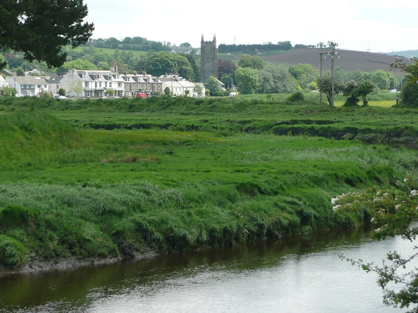
The trail then meanders through the wooded countryside, following the River Camel. The gentle incline is barely noticeable as you pass through the picturesque Cornish landscape. After approximately 5.5 miles (8.9 kilometers), you'll reach Wadebridge, a charming market town where you can take a break and explore local shops and cafes.
Continuing on, the trail leads you towards Bodmin, about 5.8 miles (9.3 kilometers) further along. Here, you'll find the Bodmin and Wenford Railway, a heritage steam railway, which is a nod to the trail's historical significance as a former transport route for the region's china clay and mineral industries.
The final stretch of the trail takes you through the Camel Valley, known for its vineyards and lush greenery. As you approach the end of the trail, the gentle ascent brings you to the edge of Bodmin Moor, offering expansive views of the surrounding countryside.
Nature and Wildlife
The Camel Trail is a haven for nature enthusiasts. The surrounding woodlands and hedgerows are home to a variety of wildlife, including otters, bats, and a diverse range of bird species. The changing seasons bring different flora and fauna to the forefront, so there's always something new to discover.
Historical Significance
The region's history is deeply intertwined with the trail. The disused railway line is a relic of Cornwall's industrial past, and as you hike, you'll be following the same routes that once transported goods to and from the coast. The trail offers a unique perspective on the evolution of transport and industry in the area.
Preparation and Planning
Before setting out on the Camel Trail, ensure you have appropriate footwear and clothing for the weather conditions. The trail is well-maintained and suitable for walking and cycling, but some sections can be muddy after rain. It's advisable to carry water and snacks, although there are opportunities to stop for refreshments in the towns along the route.
Remember, the Camel Trail is a shared-use path, so be mindful of cyclists and other users. Enjoy the journey at your own pace, and take the time to appreciate the natural beauty and historical significance of this unique trail in Cornwall.

Frequently asked questions
How long does it take to walk the Camel Trail from Padstow to Bodmin?
Walking the full Camel Trail usually takes most of a day. The route is 28.25 km with only about 205 m of elevation gain, so the terrain is gentle, but a typical hiking pace still puts the full Padstow to Bodmin journey in the roughly 6 to 8 hour range depending on stops in Wadebridge and along the River Camel.
Is the Camel Trail in Cornwall easy enough for beginners and families?
The Camel Trail is widely considered an easy route because it follows a disused railway line with a very gradual gradient. At 28.25 km, the full trail is long, but the low 205 m elevation gain and mostly smooth, traffic-free path make shorter sections around Padstow, Wadebridge, or Bodmin suitable for beginners and many family groups.
Where can you park for the Camel Trail near Padstow, Wadebridge, or Bodmin?
Parking is available at the main access points for the Camel Trail, including Padstow, Wadebridge, Bodmin, and Wenfordbridge. Cornwall Council also notes facilities and parking along the route, and public toilets are available in Padstow town center, beside the trail in Wadebridge, and at Wendfordbridge, which helps when planning a longer point-to-point day.
Can dogs go on the Camel Trail in Cornwall?
Dogs are generally allowed on the Camel Trail, which is a shared-use route popular with walkers and cyclists. Because the trail is busy, especially between Padstow and Wadebridge, dogs need close control near bikes and other users, and the easy gradients make it a practical option for a long but not especially strenuous dog walk.
What towns and landmarks does the Camel Trail pass through?
The Camel Trail links Padstow, Wadebridge, and Bodmin, following the old railway corridor through the Camel Estuary and then inland beside the River Camel. The estuary section near Padstow is known for broad water views and birdlife, while the inland stretches pass wooded river scenery and traces of Cornwall's railway and industrial history.
Can you get to the Camel Trail by public transport?
Yes. Padstow and Wadebridge are served by bus, and the Go Cornwall Bus 11 route connects Padstow, Wadebridge, and Bodmin Parkway station, making it one of the most practical public transport links for the Camel Trail. That makes it possible to plan a one-way walk without needing to return to the original trailhead by car.
Are there toilets and places to stop along the Camel Trail?
There are toilets at Padstow town center, beside the trail in Wadebridge, and at Wendfordbridge, which are useful reference points on a 28.25 km day. The route also passes through the main trail towns of Padstow, Wadebridge, and Bodmin, so the easiest places for breaks are around those built-up sections rather than on the quieter river stretches.
Comments and Reviews
User comments, reviews and discussions about the Camel Trail, England.
4.67
average rating out of 5
9 rating(s)