Download
Preview
Add to list
More
866.9 km
~43 days
11951 m
Multi-Day
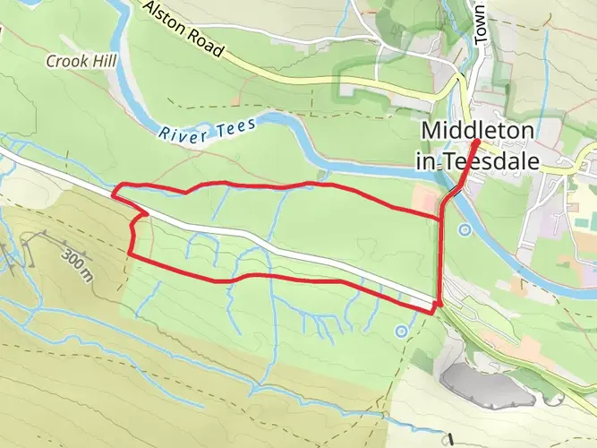
The Middleton in Teesdale to Harwich Walk is a 866.9 km trail that starts in , County Durham, England. Based on our data, the hike is graded as Medium. For information on how we grade trails, please read measuring the difficulty of a hiking trail on hiiker. Also, check our latest community posts for trail updates. This hike can be completed in approx 33 days. Caution is advised on trail times as this depends on multiple variables. For more info read about how we calculate hike time.

What to expect?
Activity types
Frequently asked questions
How long is the Middleton in Teesdale to Harwich Walk and how many days does it usually take?
The Middleton in Teesdale to Harwich Walk is 866.94 km long with 11,951 m of total ascent, so it is firmly a multi-day end-to-end route rather than a weekend trail. A typical through-hike pace puts it at roughly six weeks on foot, with many itineraries landing around 40 to 45 walking days depending on daily mileage and rest days.
What is the difficulty of the Middleton in Teesdale to Harwich Walk?
The Middleton in Teesdale to Harwich Walk is rated medium, but that still means a serious long-distance undertaking because the route covers 866.94 km and climbs 11,951 m in total. The challenge comes more from sustained daily mileage over many stages than from mountaineering terrain, especially as the walk links a chain of established long-distance paths across England.
Which long-distance trails make up the Middleton in Teesdale to Harwich Walk?
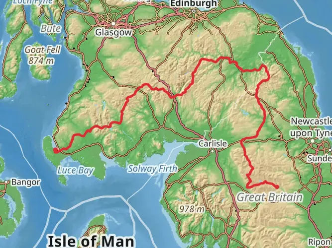
This walk follows the E2 route across England from Middleton-in-Teesdale to Harwich by joining named trails in sequence. The line commonly uses the Teesdale Way, Tees Link, Cleveland Way, Yorkshire Wolds Way, Viking Way, Hereward Way, Fen Rivers Way, Fleam Dyke and Roman Road Walk, Icknield Way Trail, Stour Valley Path, and Essex Way before reaching Harwich.
Where does the Middleton in Teesdale to Harwich Walk start and finish?
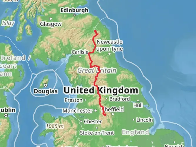
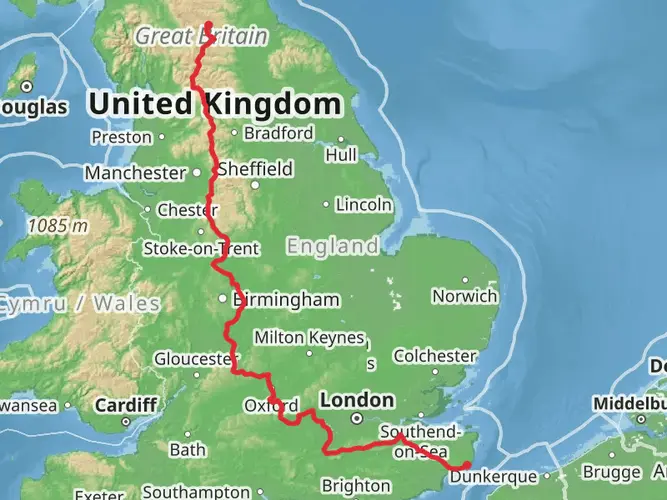
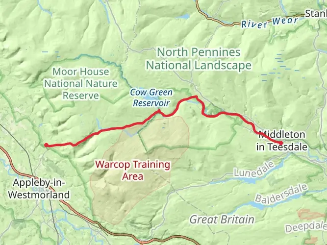
The route starts at Middleton-in-Teesdale in County Durham and finishes at Harwich on the Essex coast. In England, this section of the E2 begins at Middleton-in-Teesdale and runs southeast across northern and eastern England to Harwich International Port, linking inland river valleys, wolds, fenland, and the Stour estuary.
Is the Middleton in Teesdale to Harwich Walk waymarked the whole way?
The Middleton in Teesdale to Harwich Walk is not generally signed as one single trail from end to end. It is assembled from a series of existing named long-distance routes, so waymarking is usually by the individual trail being followed at that stage, such as the Cleveland Way, Yorkshire Wolds Way, Viking Way, or Essex Way, rather than by one continuous Middleton in Teesdale to Harwich marker.
What kind of scenery does the Middleton in Teesdale to Harwich Walk pass through?
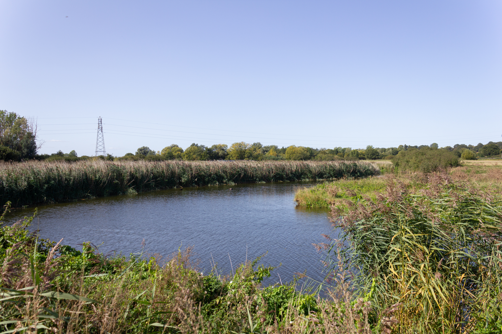
The Middleton in Teesdale to Harwich Walk crosses a notably varied slice of England. It begins in Teesdale in the North Pennines, then follows sections that include the North York Moors coast, the Yorkshire Wolds, the Lincolnshire and East Midlands lowlands, the Cambridgeshire fens, the chalk and heath landscapes around the Icknield Way, and finally the Stour estuary and Essex coast at Harwich.
Comments and Reviews
User comments, reviews and discussions about the Middleton in Teesdale to Harwich Walk, England.
5.0
average rating out of 5
2 rating(s)