Download
3D Flyover
Add to list
More
16.5 km
~3 hrs 46 min
286 m
Loop
“A varied Teesdale ramble threads waterfalls, wild scars and open fell views with reflective charm.”
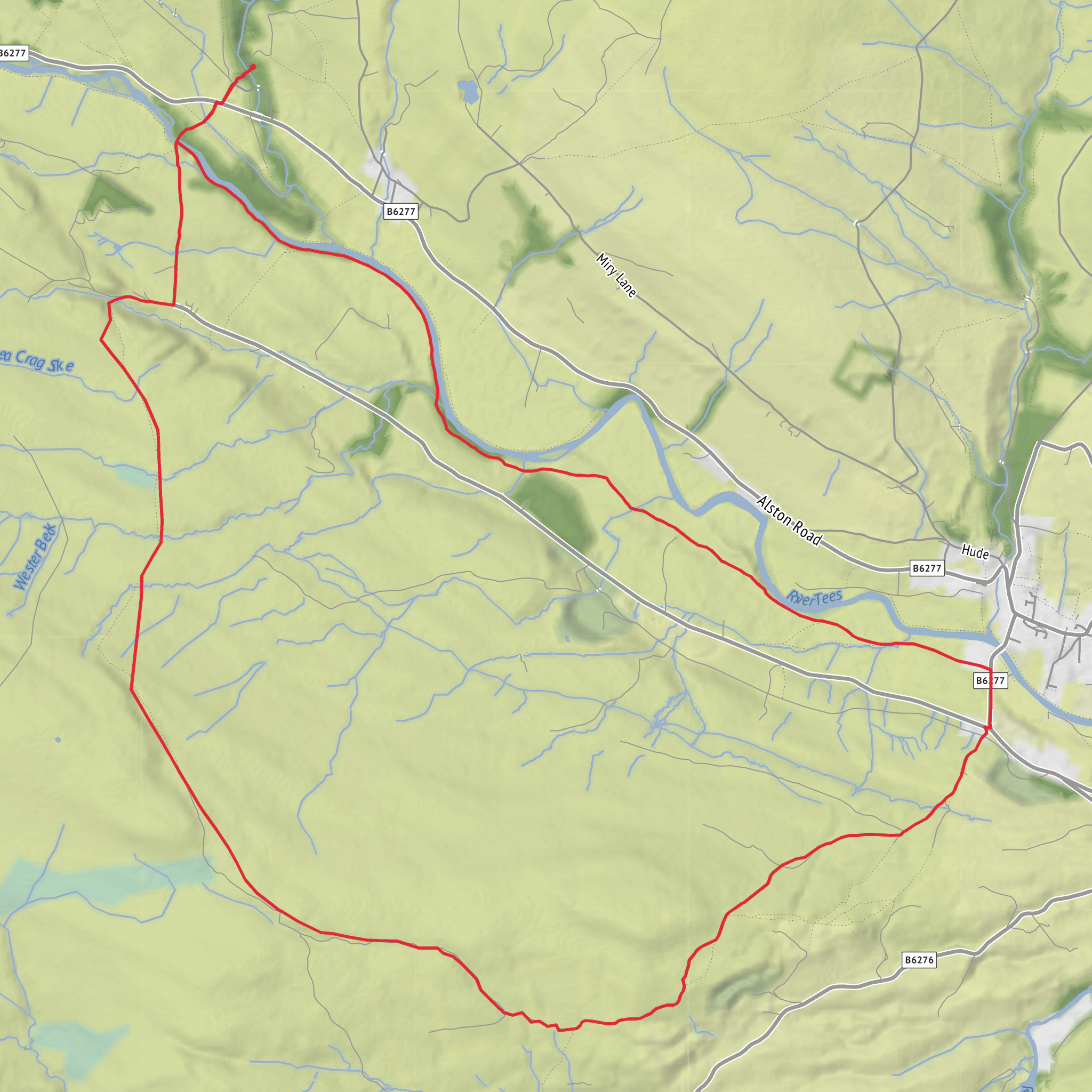
This easy-going loop explores one of Upper Teesdale’s most varied landscapes, combining riverside walking, open fell-edge scenery, short rocky escarpments and some of the best-known waterfalls in the North Pennines. Over roughly 16 km / 10 miles with about 300 m / 985 ft of ascent, it is best thought of as a longer easy walk rather than a completely flat one: the gradients are generally steady, but there are a few rises away from the River Tees, some rougher ground near the scars, and sections that can feel exposed in wind or poor weather. The usual starting point is Bowlees Visitor Centre, Bowlees, Newbiggin-in-Teesdale, Barnard Castle DL12 0XE, which sits just off the B6277 and is the most practical trailhead for this circuit. (visorando.com)
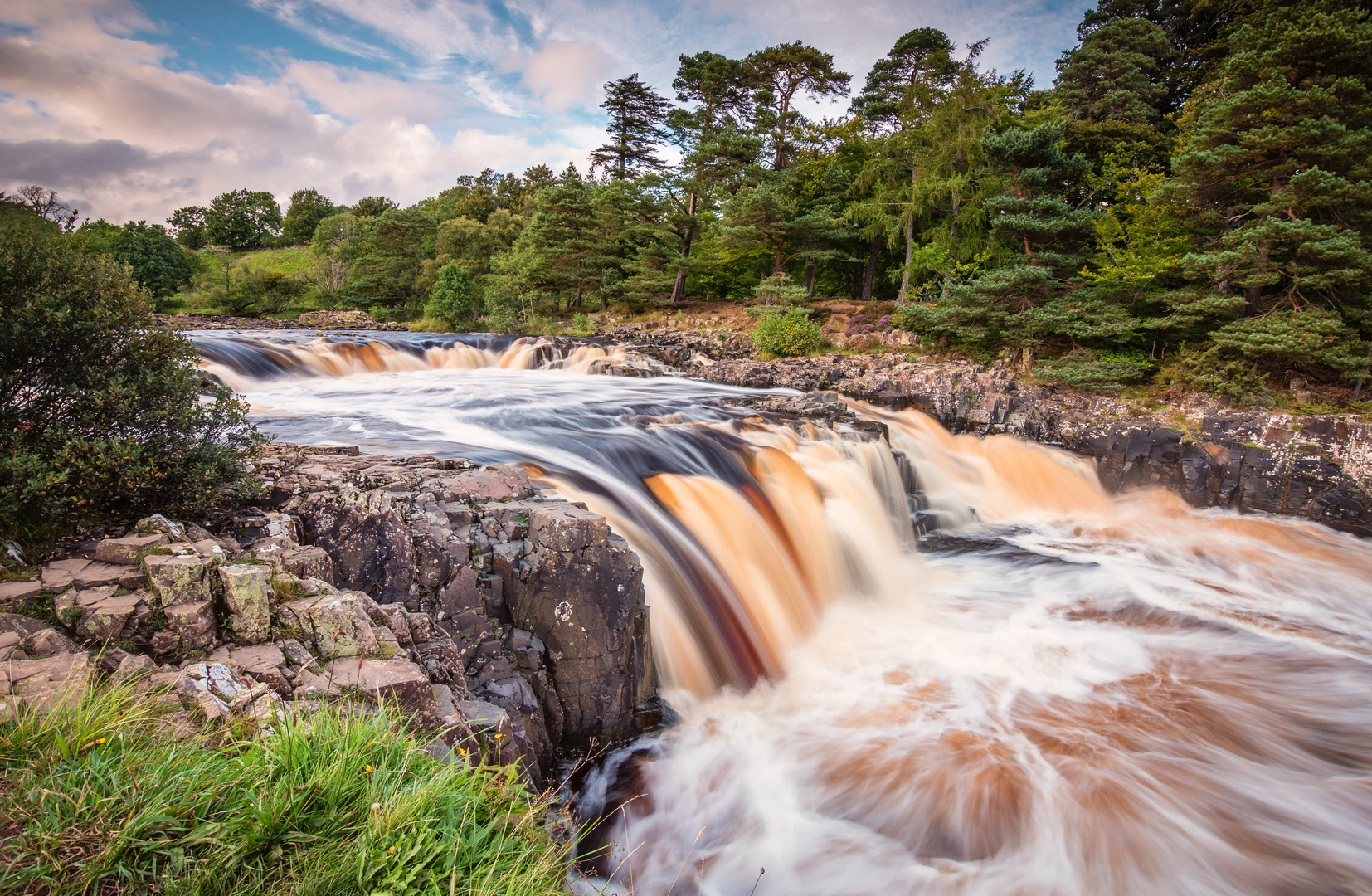
From Bowlees, the route quickly reaches the River Tees and begins with one of the walk’s highlights: Low Force, where the river spreads into a broad, stepped cascade over dark Whin Sill rock. The paths here are usually clear and well used, but they can be slick after rain, especially on stone steps, roots and damp riverside sections. This first part is ideal for settling into the walk, with the sound of fast water, woodland edges and open views beginning to build as you move upstream. If the route uses Wynch Bridge, expect a narrow historic suspension bridge with a bit of bounce underfoot; it is memorable rather than difficult, but it may not suit anyone uncomfortable with heights or movement on bridges. (outdoorexploringfamily.com)
Terrain and what to expect
After the river section, the loop climbs gradually toward Holwick Scars and the ground becomes more open. This is where the walk changes character. The riverside path gives way to pasture, moor-edge tracks and less enclosed terrain, with wider views across Teesdale and toward the surrounding fells. Under dry conditions the walking is straightforward, but after wet weather there may be muddy field paths, soft patches and uneven ground. Although the route is rated easy overall, this middle section is where good footwear matters most.
Brown Dod is not a major summit in the mountain sense, but it adds a pleasant sense of height and space to the circuit. The ascent is modest, and the reward is a broader perspective over the valley, the scars and the Tees corridor. Holwick Scars themselves are a striking geological feature: dark, dramatic crags formed by the Whin Sill, the same resistant igneous rock that shapes many of the North Pennines’ best-known cliffs and waterfalls. The North Pennines is internationally recognized as a UNESCO Global Geopark, and this route is a very good introduction to why the area matters geologically. (unesco.org)
Navigation is usually uncomplicated on the better-trodden sections near Bowlees and the river, but the more open stretches can feel less obvious in mist, low cloud or fading light. For planning and on-route checking, use HiiKER and do not rely on waymarks alone if visibility is poor.
Landmarks, wildlife and local character
The River Tees is the thread that ties the whole walk together. Depending on the exact line taken, you may also gain views toward High Force, one of England’s most famous waterfalls, while the loop’s core scenic features remain Low Force, the Tees gorge, Holwick Scars and the open fell-side around Brown Dod. The contrast between wooded riverbank, rushing water, grazed fields and exposed moorland is what makes this route especially rewarding. (outdoorexploringfamily.com)
Upper Teesdale is also well known for its wildlife and plant life. The wider North Pennines supports important upland habitats including blanket bog, hay meadows and breeding grounds for wading birds. On and around this walk, hikers may see curlew, lapwing, oystercatcher and meadow pipit in the right season, while the river corridor can attract dippers and wagtails. Sheep are common, and some field sections may also contain cattle, so dogs should be managed carefully and gates left as found. The area around Bowlees and Upper Teesdale is also nationally important for nature conservation, with nearby reserves and protected landscapes reflecting the special mix of geology, upland climate and rare flora. (unesco.org)
Historically, this landscape has been shaped not only by natural forces but by centuries of human use. Teesdale and the North Pennines have a strong lead-mining heritage, and even where obvious mine remains are not the main focus of the walk, the
Surfaces
Unknown
Grass
Dirt
Asphalt
Gravel
Wood
Comments and Reviews
User comments, reviews and discussions about the River Tees, Brown Dod, Holwick Scars and Low Force Loop, England.
average rating out of 5
0 rating(s)
