Download
3D Flyover
Add to list
More
119.0 km
~5 days
1927 m
Multi-Day
“Embark on the Cumbria Way for a historical hike through the Lake District's diverse landscapes and rich heritage.”
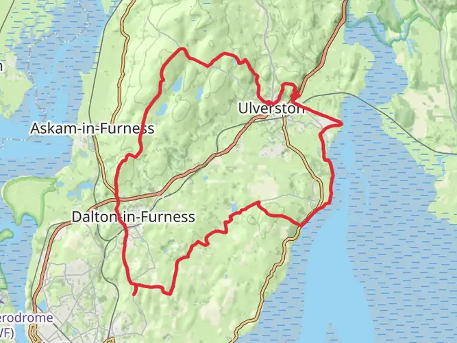
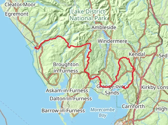
Spanning approximately 119 kilometers (74 miles) with an elevation gain of around 1900 meters (6234 feet), the Cumbria Way is a scenic and varied point-to-point trail that takes hikers through the heart of the Lake District National Park. Starting near the market town of Ulverston, the trail heads north, concluding in the historic city of Carlisle.
Getting to the Trailhead
To reach the southern trailhead in Ulverston, hikers can take a train to Ulverston railway station from major cities like Manchester or Lancaster. If driving, there is parking available in the town. The northern end in Carlisle is well-served by public transport, including trains and buses, making it convenient for hikers to return after completing the trail.
The Journey Through the Lake District
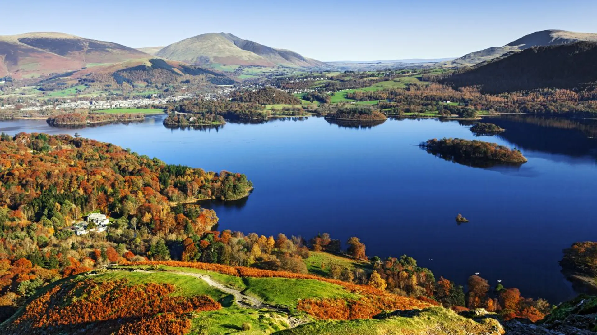
The Cumbria Way meanders through some of the most picturesque landscapes in England, including serene valleys, rugged fells, and tranquil lakes. The trail is well-marked, but carrying a detailed map or using a navigation tool like HiiKER is recommended to ensure you stay on the correct path.
Key Sections and Landmarks
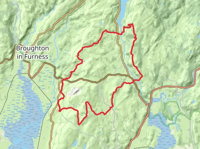
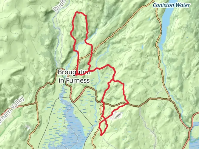
After leaving Ulverston, hikers will pass through the pastoral scenery of the Low Furness countryside before reaching the first significant natural landmark, Coniston Water. This lake is known for its association with the Victorian art critic John Ruskin and the children's author Arthur Ransome.
As the trail continues, it ascends gently into the Coniston Fells, offering stunning views of the surrounding peaks and valleys. The highest point on the trail is at High Pike, where hikers can enjoy panoramic vistas of the Lake District.
Descending into the Langdale Valley, the path takes you past the iconic Langdale Pikes, a favorite among climbers and photographers alike. The trail then leads to the charming village of Grasmere, once home to the poet William Wordsworth.
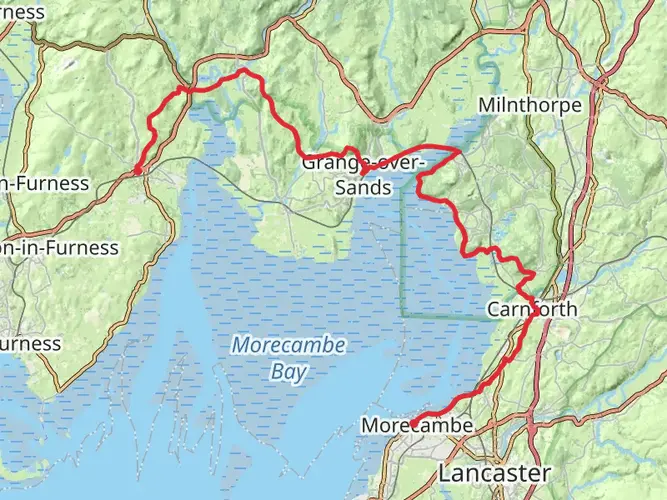
Further north, the Cumbria Way skirts around the peaceful Derwent Water and through the market town of Keswick. Hikers will then traverse the Caldbeck Fells, an area rich in mining history, before reaching the final stretch that leads to Carlisle, with its impressive cathedral and castle.
Flora and Fauna
The Lake District is home to a diverse range of wildlife. Red squirrels, peregrine falcons, and the rare Fell ponies can be spotted. The area is also known for its unique habitats, including ancient woodlands and wildflower meadows, which bloom spectacularly in spring and summer.
Historical Significance
The region is steeped in history, from Neolithic stone circles to remnants of Roman forts along Hadrian's Wall. The trail itself passes through areas that have been shaped by centuries of farming, mining, and the literary heritage of the Romantic poets.
Preparation and Planning
The Cumbria Way is considered to have a medium difficulty rating. Hikers should be prepared for changeable weather and carry appropriate gear. Accommodations range from campgrounds to bed and breakfasts, so planning overnight stays in advance is advisable, especially during peak seasons.
The best times to hike the Cumbria Way are from late spring to early autumn, when the weather is milder and the days are longer. Always check local conditions and forecasts before setting out, and be prepared for sections of the trail that can become muddy after rain.
By taking the time to prepare and plan, hikers can fully enjoy the natural beauty and historical richness of the Cumbria Way.

What to expect?
Activity types
Frequently asked questions
How long is the Cumbria Way and how many days does the Cumbria Way usually take?
The Cumbria Way is 118.98 km, or about 74 miles, with 1,927 m of total ascent. Most walkers split it into around five to six days, with common overnight stops including Coniston, Great Langdale, Keswick, and Caldbeck before finishing in Carlisle.
Where does the Cumbria Way start and finish?
The Cumbria Way is a south-to-north route from Ulverston to Carlisle. Along the way it passes through some of the best-known Lake District landscapes, including Coniston Water, Great Langdale, Borrowdale, Derwent Water, and the village of Caldbeck before reaching the city finish in Carlisle.
Is the Cumbria Way difficult?
The Cumbria Way is generally rated medium difficulty. Although it avoids many of the highest Lake District summits, it still covers nearly 119 km with 1,927 m of climbing, so the challenge comes from the cumulative distance, multi-day effort, and rougher upland sections through valleys and passes.
What are the main places and landmarks on the Cumbria Way route?
The Cumbria Way links Ulverston and Carlisle through a classic Lake District line that includes Coniston, Great Langdale, Borrowdale, Keswick, Skiddaw Forest, and Caldbeck. Named highlights on or close to the route include Coniston Water, Derwent Water, Stake Pass, and the northern fells around High Pike.
Can the Cumbria Way be reached by public transport?
Yes. The southern end is in Ulverston, which has a railway station, and the northern end finishes in Carlisle, one of the main rail hubs in northwest England. That makes the Cumbria Way practical as a linear walk, with rail travel available at both ends rather than needing a car shuttle.
Is the Cumbria Way dog friendly?
Dogs are generally allowed on public footpaths and bridleways used by the Cumbria Way, but they need close control, and a short lead is often the sensible choice around livestock and busy shared sections in the Lake District. Conditions can change on farmland and access land, so control matters throughout the route, especially in valleys and near grazing areas.
Where can you park for the Cumbria Way in Ulverston?
Parking for the Cumbria Way is typically done in Ulverston at the southern end, where town parking is available near the start. In the Lake District, roadside access needs care because blocking gates, driveways, or narrow roads can cause problems, and overnight parking on access land or rights of way is not permitted.
Comments and Reviews
User comments, reviews and discussions about the Cumbria Way, England.
4.8
average rating out of 5
99 rating(s)