Download
Preview
Add to list
More
165.8 km
~9 days
4423 m
Multi-Day
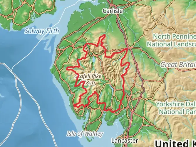
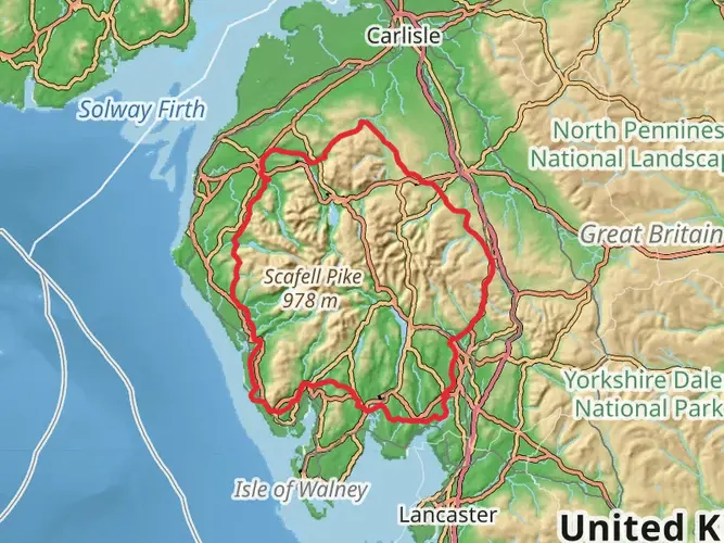
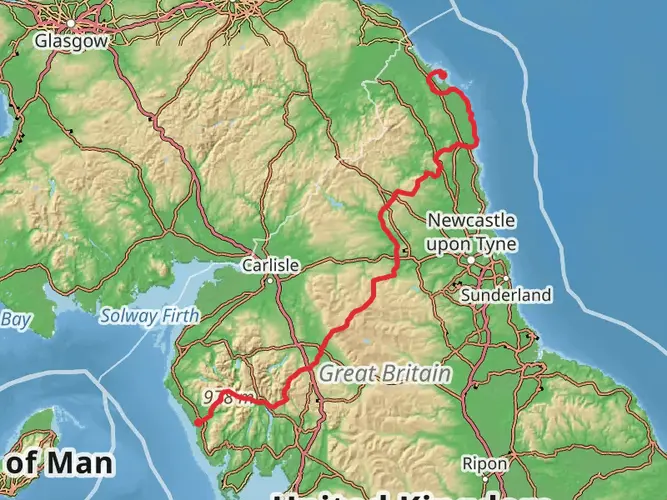
The Hadrian's High Way is a 165.8 km trail that starts in Copeland, Cumbria, England. Based on our data, the hike is graded as Medium. For information on how we grade trails, please read measuring the difficulty of a hiking trail on hiiker. Also, check our latest community posts for trail updates. This hike can be completed in approx 7 days. Caution is advised on trail times as this depends on multiple variables. For more info read about how we calculate hike time.

What to expect?
Activity types
Frequently asked questions
How long is Hadrian's High Way and how many days does it usually take to hike?
Hadrian's High Way is 165.8 km long with 4,423 m of total ascent, so it is firmly a multi-day walk rather than a weekend trail. Most hikers break a route of this length into about 8 to 12 days, depending on daily mileage, weather, and how much time is spent on the higher Pennine sections and the Hadrian's Wall stretch.
How difficult is Hadrian's High Way in Cumbria and what kind of terrain does it cover?
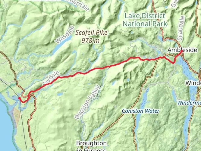
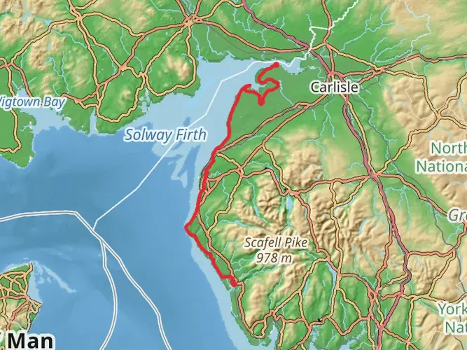
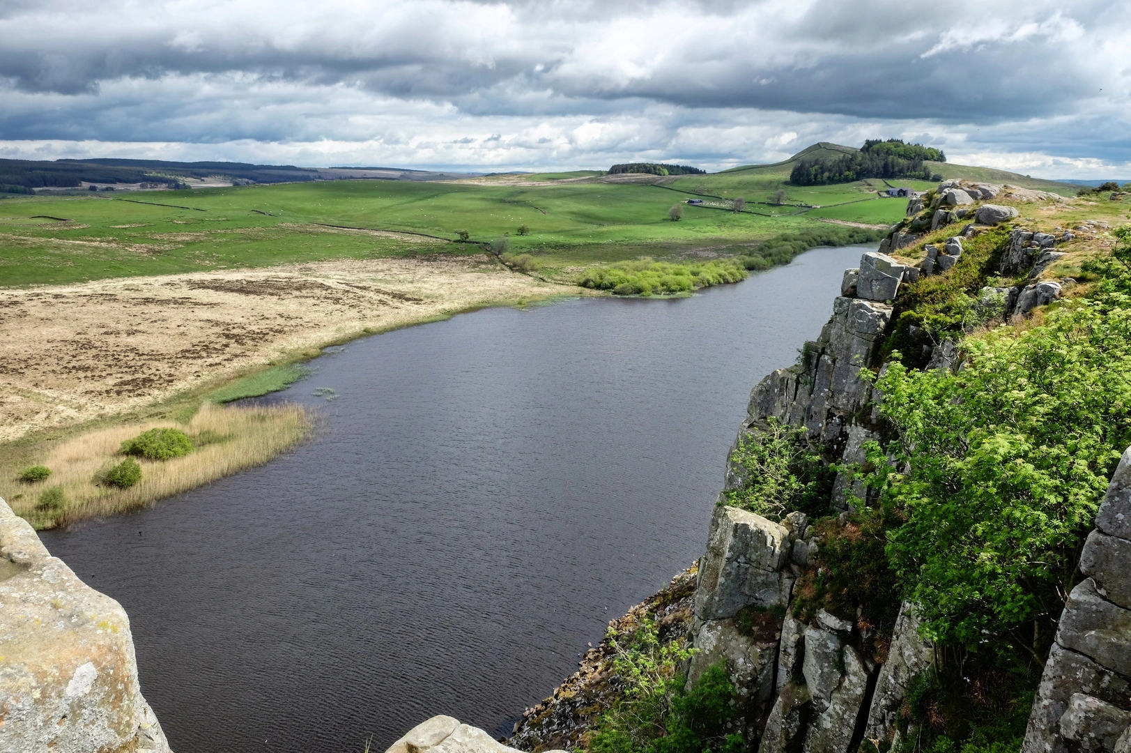
Hadrian's High Way is rated medium, but the numbers show it is still a substantial undertaking: 165.8 km with 4,423 m of climbing. The route links fell and moorland country with lower valley sections, and it finishes on the Hadrian's Wall corridor near Greenhead, so hikers should expect a mix of long-distance paths, rough upland ground, and sustained ascent rather than a flat end-to-end walk.
Where does Hadrian's High Way start and finish?
Hadrian's High Way begins at Skelwith Bridge in Cumbria and finishes at Greenhead in Northumberland. Greenhead sits on the Hadrian's Wall corridor, and the final section connects into the well-known wall country around the central Roman sites rather than ending in a major city center.
Can you use public transportation for Hadrian's High Way at the finish near Greenhead?
Yes. The eastern end of Hadrian's High Way is practical for public transportation because Greenhead is close to the Hadrian's Wall visitor corridor, where the AD122 bus links major wall sites and nearby settlements. Haltwhistle is also the nearest rail hub for many walkers finishing that end of the route, making the trail workable without a car shuttle at both ends.
Is Hadrian's High Way dog friendly?
Hadrian's High Way can be walked with a dog in many sections, but it is not a simple yes-or-no route because access rules can change by land type and heritage site. On the Hadrian's Wall and Housesteads section, dogs are welcome on short leads, so anyone taking a dog should expect lead use around livestock, protected archaeology, and busy visitor areas.
What is the best time of year to hike Hadrian's High Way?
Late spring through early fall is usually the best window for Hadrian's High Way. A 165.8 km route with 4,423 m of ascent is more manageable when daylight is longer and the higher ground is less likely to be affected by winter wind, saturated paths, or poor visibility on exposed Pennine terrain.
Comments and Reviews
User comments, reviews and discussions about the Hadrian's High Way, England.
average rating out of 5
0 rating(s)