Download
Preview
Add to list
More
46.3 km
~3 days
304 m
Multi-Day
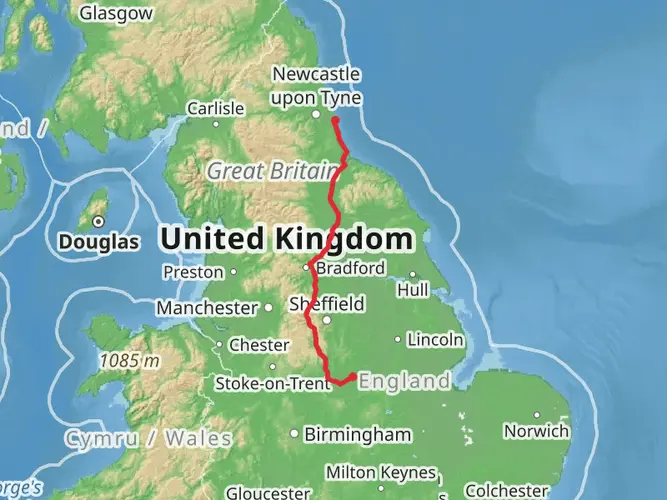
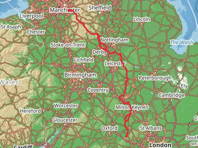
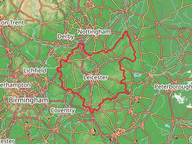
The Erewash Valley Trail is a 46.3 km trail that starts in Erewash, Derbyshire, England. Based on our data, the hike is graded as Easy. For information on how we grade trails, please read measuring the difficulty of a hiking trail on hiiker. Also, check our latest community posts for trail updates. This hike can be completed in approx 2 days. Caution is advised on trail times as this depends on multiple variables. For more info read about how we calculate hike time.

What to expect?
Frequently asked questions
How long is the Erewash Valley Trail and how many days does it take to walk?
The Erewash Valley Trail is 46.35 km long with about 304 m of total elevation gain, so it is a long but relatively gentle multi-day route. Strong walkers could cover it in a long day, but most people split it into 2 days to keep the pace easy and leave time for canal-side sections, towns, and heritage stops such as Bennerley Viaduct and Langley Mill.
Is the Erewash Valley Trail difficult or suitable for beginners?
The Erewash Valley Trail is rated easy, and the numbers support that: 46.35 km of distance but only 304 m of climbing overall. Much of the route follows low-level valley ground, canal towpaths, and traffic-free paths between places such as Long Eaton, Sandiacre, Ilkeston, and Langley Mill, so it is generally manageable for beginners with enough stamina for the mileage.
Where does the Erewash Valley Trail start and finish?
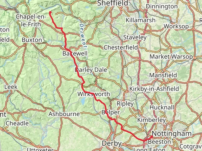
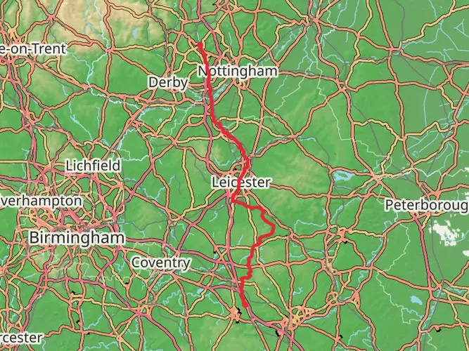
The Erewash Valley Trail is commonly described as a circular route in the Erewash Valley, with Langley Mill used as a start and finish point on many route descriptions. The southern part of the trail also reaches Sawley and Trent Lock, and the route passes through Long Eaton, Sandiacre, and Ilkeston before returning north toward Langley Mill.
Can the Erewash Valley Trail be reached by train or public transport?
Yes. The Erewash Valley Trail passes through built-up parts of the Derbyshire and Nottinghamshire border area, and Ilkeston is used as a rail-access point for car-free walks on the route. Langley Mill and Long Eaton are also key towns on the corridor, making it one of the more practical long walks in Derbyshire for hikers using public transport rather than driving.
What are the main highlights on the Erewash Valley Trail?
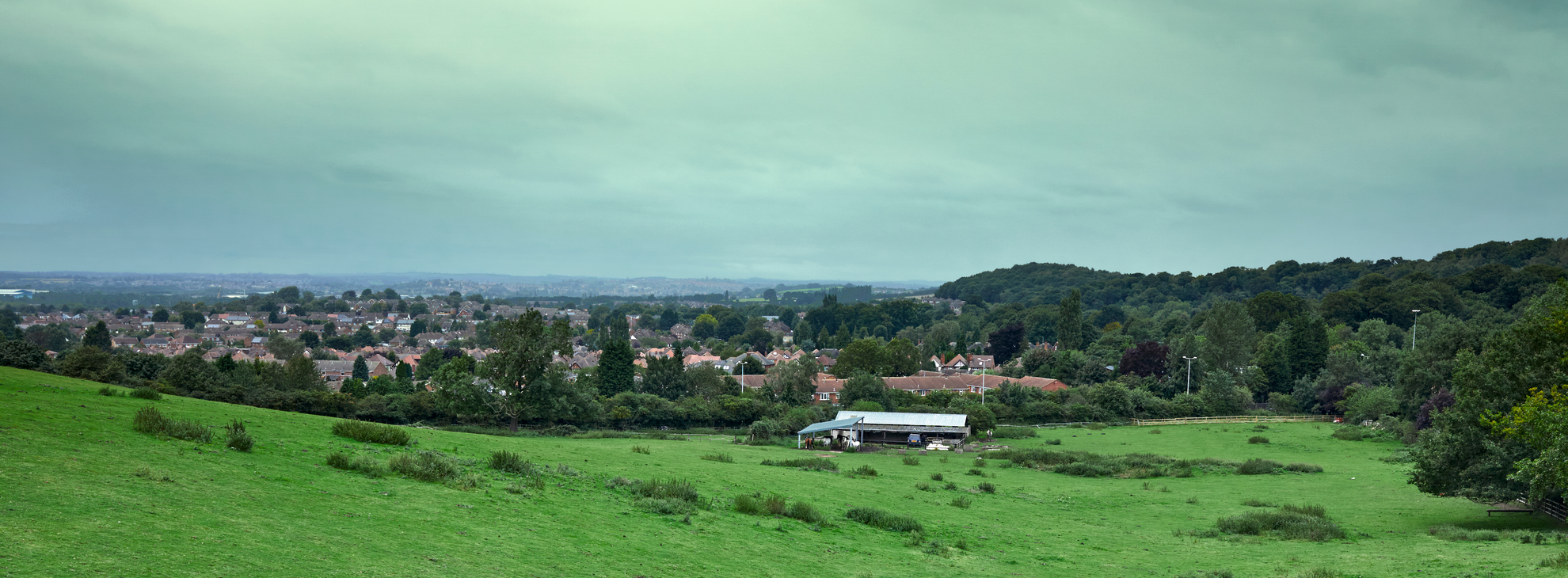
The Erewash Valley Trail combines waterside walking with industrial heritage. Notable landmarks along or near the route include the Erewash Canal, Trent Lock near Sawley, Bennerley Viaduct near Ilkeston, and the canal junction area at Langley Mill where the Erewash Canal meets the Cromford Canal. The trail also links towns including Long Eaton, Sandiacre, and Ilkeston.
Is the Erewash Valley Trail flat?
The Erewash Valley Trail is mostly flat to gently undulating rather than hilly. Over 46.35 km, the total ascent is only 304 m, which is low for a route of this length. That makes it a good option for hikers who want a longer distance walk without sustained climbs or steep mountain terrain.
When is the best time of year to walk the Erewash Valley Trail?
Spring through early fall is usually the best time to walk the Erewash Valley Trail, when towpaths and riverside sections are generally drier and daylight is longer for a 46.35 km route. Parts of the Erewash Valley include floodplain meadows and wetland habitat, so prolonged rain in winter can leave some low-lying stretches muddier or slower going.
Comments and Reviews
User comments, reviews and discussions about the Erewash Valley Trail, England.
average rating out of 5
0 rating(s)