Download
Preview
Add to list
More
20.8 km
~2 days
295 m
Multi-Day
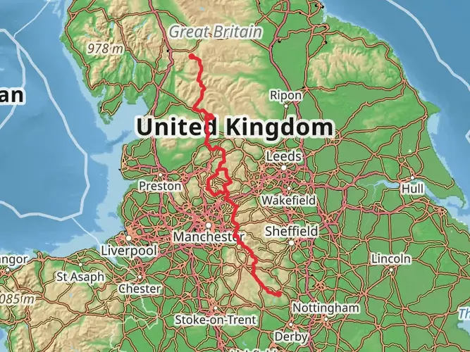
The Longdendale Trail is a 20.8 km trail that starts in , Derbyshire, England. Based on our data, the hike is graded as Easy. For information on how we grade trails, please read measuring the difficulty of a hiking trail on hiiker. Also, check our latest community posts for trail updates. This hike can be completed in approx 4 hrs 39 mins. Caution is advised on trail times as this depends on multiple variables. For more info read about how we calculate hike time.

What to expect?
Frequently asked questions
How long does the Longdendale Trail take to walk end to end?
The Longdendale Trail is 20.76 km long with about 295 m of elevation gain, so most walkers complete the full route in roughly 4.5 to 6.5 hours depending on pace and stops. Its easy grading and former railway alignment make it more straightforward than many Peak District moorland walks, but the full distance still makes it a solid day out.
Where can you park for the Longdendale Trail in Derbyshire?
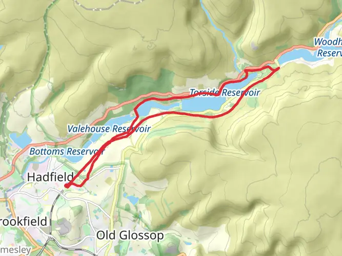
One of the main access points for the Longdendale Trail is Torside Car Park, reached from the B6105 via Glossop or from the A628. Torside sits beside the trail and is a practical place to start shorter out-and-back walks, especially toward the accessible viewing platform and ponds on the Torside section.
Is the Longdendale Trail easy and suitable for beginners or kids?
The Longdendale Trail is generally considered an easy route, with 20.76 km of distance spread over only 295 m of climbing. Because it follows a former railway line, gradients are gentler than on many Peak District hikes, so shorter sections can work well for beginners and families even if the full trail is too long for younger children.
Can you bring dogs on the Longdendale Trail?
Dogs are allowed on Peak District trails, including the Longdendale Trail, but they should be kept on a short lead to protect wildlife, livestock, and other trail users. That matters on Longdendale because it is a shared-use route and parts of the wider valley connect with open countryside where stock may be present.
Can you get to the Longdendale Trail by train or public transport?
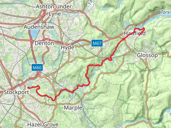
Yes. The Peak District National Park notes that Padfield station can be used to set off on the Longdendale Trail, and the trail also forms part of the Trans Pennine Trail between Hadfield and Woodhead Station. Hadfield railway station in Derbyshire is another nearby rail access point, with step-free access to all platforms.
What will you see on the Longdendale Trail?
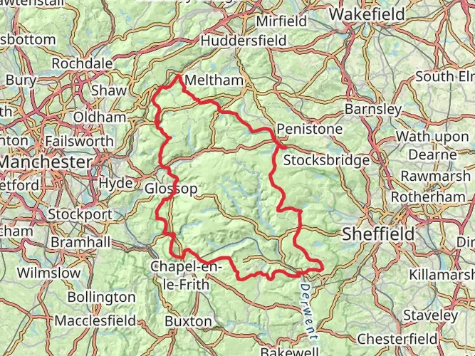
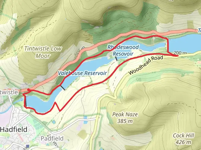
The Longdendale Trail follows the old Manchester to Sheffield railway line through the Longdendale valley, with views of reservoirs, dams, and Dark Peak hills. The route passes the Torside area, and the valley is known for waters including Woodhead, Torside, Rhodeswood, and Valehouse Reservoirs, giving the trail a distinctive waterside feel.
Is the Longdendale Trail good for accessible walking or wheel-friendly sections?
Part of the Longdendale Trail at Torside has been enhanced for accessibility as a Miles Without Stiles route. That section is about 1.7 km one way and includes a viewing platform and ponds, making it one of the easier ways to experience the valley without committing to the full 20.76 km trail.
Comments and Reviews
User comments, reviews and discussions about the Longdendale Trail, England.
5.0
average rating out of 5
3 rating(s)