Download
3D Flyover
Add to list
More
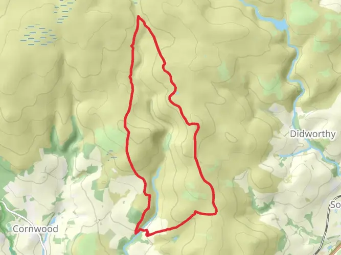
176.5 km
~8 days
4547 m
Multi-Day
“Embark on the Dartmoor Way, a historical and scenic trek through Devon's wild heart.”
The Dartmoor Way is a captivating loop trail that encircles Dartmoor National Park in Devon, England, offering hikers approximately 177 kilometers (110 miles) of diverse landscapes and a cumulative elevation gain of around 4500 meters (14,764 feet). This medium-difficulty trek is a journey through the heart of Devon's wild and rugged moorland, punctuated by picturesque villages, ancient history, and an abundance of wildlife.
Getting to the Trailhead The trail can be accessed from various points due to its loop nature, but a common starting location is near the town of Buckfastleigh, which is well-connected by public transport. Visitors can take a train to Totnes and then a bus to Buckfastleigh, or if arriving by car, there are parking facilities in the town. From here, the trail is easily reachable and well-marked.
Navigating the Trail Hikers can rely on the HiiKER app for detailed maps and navigation assistance throughout the Dartmoor Way. The trail is marked with distinctive Dartmoor Way markers, but having a digital tool can provide additional peace of mind and information on the go.
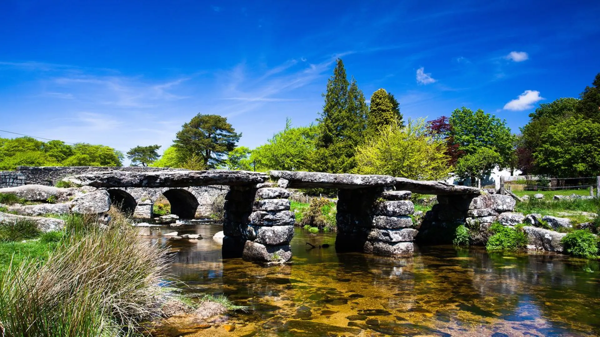
Landmarks and Historical Significance As you traverse the Dartmoor Way, you'll encounter numerous landmarks that reveal the area's rich history. One such site is the Buckfast Abbey, a living Benedictine monastery near the trailhead. Further along, the trail passes through the ancient stannary town of Ashburton, once vital for the tin trade, and the prehistoric Merrivale complex, which features a fascinating collection of Bronze Age megaliths.
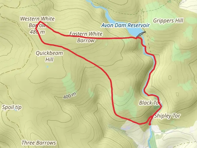
Natural Beauty and Wildlife The trail offers a chance to immerse oneself in Dartmoor's unique habitats, from the windswept moors to the wooded valleys. The area is home to a variety of wildlife, including Dartmoor ponies, otters, and an array of bird species. The changing seasons bring different aspects of Dartmoor to life, with spring and summer showcasing vibrant gorse and heather.
Challenges and Terrain Hikers should be prepared for a mix of terrain, including rocky paths, open moorland, and country lanes. The weather on Dartmoor can be unpredictable, so waterproof gear and layers are essential. While the elevation gain is spread out across the trail, there are some steep sections that will challenge your stamina.
Accommodation and Resupply Points The Dartmoor Way passes through several towns and villages where hikers can find accommodation ranging from campsites to B&Bs. Resupply points for food and water are also available in these settlements, making it convenient to plan multi-day hikes.
Conclusion The Dartmoor Way is a trail that offers more than just a physical challenge; it's a journey through time, nature, and the soul of Devon. With proper preparation and respect for the environment, hikers can enjoy a truly memorable experience on this iconic trail.

What to expect?
Activity types
Frequently asked questions
How long does it take to walk the Dartmoor Way in Devon?
The Dartmoor Way is a 176.54 km long-distance loop with 4,547 m of climbing, so most hikers split it over about 8 to 12 days depending on pace and overnight stops. Strong walkers can move faster, but the route is still a medium-difficulty multi-day circuit around Dartmoor National Park rather than a short break walk.
Where is the best place to start the Dartmoor Way and park for it?
Because the Dartmoor Way is a circular route, it can be started from several towns on the loop, but Buckfastleigh is one of the most practical starting points. It sits on the southern side of the circuit, has town parking, and is a common access point for the route, with Buckfast Abbey close by as a well-known landmark near the start.
Can you get to the Dartmoor Way by public transport from Totnes?
Yes. Buckfastleigh is a common access point for the Dartmoor Way, and Totnes is the usual rail hub for reaching it. The standard public-transport approach is to take a train to Totnes and continue by bus to Buckfastleigh, which makes the southern side of the loop one of the easiest places to join the trail.
Is the Dartmoor Way waymarked or hard to follow?
The Dartmoor Way is a waymarked circular route around Dartmoor National Park, and the walking route is promoted as a signed long-distance trail of about 173 to 176 km. Even so, it is a substantial multi-day route with road, lane, and countryside sections, so navigation is easier with a detailed map or the HiiKER route loaded offline.
Is the Dartmoor Way dog friendly for a multi-day hike?
The Dartmoor Way can be walked with a dog, but control matters because Dartmoor has free-roaming livestock and ponies on and around the route. On Dartmoor access land, dogs must be on a short fixed lead of no more than 2 meters between March 1 and July 31, and leads are also important near sheep, cattle, and ground-nesting bird habitat.
What towns and villages does the Dartmoor Way pass through?
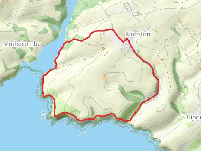
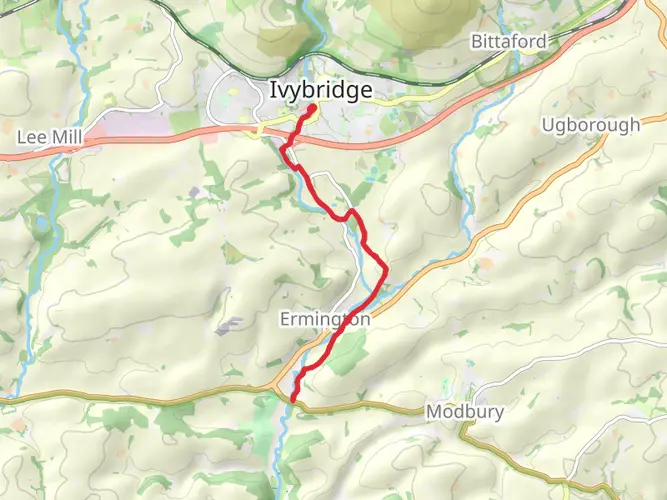
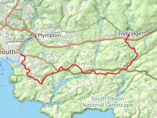
The Dartmoor Way links a string of Dartmoor-edge settlements rather than staying on the high moor throughout. Places named on the route include Buckfastleigh, Ashburton, Bovey Tracey, Moretonhampstead, Chagford, Okehampton, Tavistock, Yelverton, and Ivybridge, which helps with staging, food stops, and overnight planning.
How difficult is the Dartmoor Way and is it suitable for intermediate hikers?
The Dartmoor Way is generally considered medium difficulty, but it is still a serious undertaking at 176.54 km with 4,547 m of ascent. It suits intermediate hikers who are comfortable with repeated long days, mixed terrain, and changing Dartmoor weather, especially when the route is broken into manageable stages.
Comments and Reviews
User comments, reviews and discussions about the Dartmoor Way, England.
4.36
average rating out of 5
11 rating(s)