Download
3D Flyover
Add to list
More
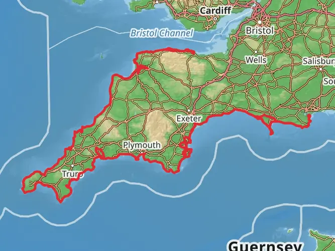
129.8 km
~5 days
2468 m
Multi-Day
“Embark on the Tarka Trail to discover Devon's heart, blending nature's splendor with rich cultural tapestry.”
The Tarka Trail, inspired by Henry Williamson's novel "Tarka the Otter," is a captivating journey through the North Devon biosphere in England, covering approximately 130 kilometers (about 81 miles) with an elevation gain of around 2400 meters (roughly 7874 feet). This loop trail offers a medium difficulty rating, making it accessible to hikers with a moderate level of fitness.
Getting to the Trailhead
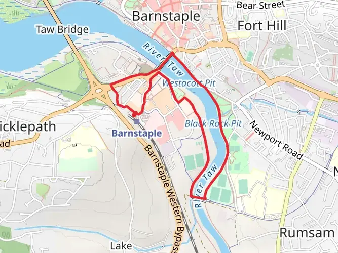
To begin your adventure on the Tarka Trail, you can arrive at the trailhead near Devon by various means. If driving, the starting point is accessible via the A361 road, which connects to the M5 motorway. For those preferring public transport, the nearest train station is Barnstaple, from which you can catch a bus or taxi to the trailhead.
Navigating the Trail
The Tarka Trail is well-marked, but it's always wise to carry a reliable navigation tool like HiiKER to ensure you stay on the right path. The trail is a mix of paved and unpaved sections, with the route taking you through a variety of landscapes, including wooded valleys, moorland, and coastal scenery.
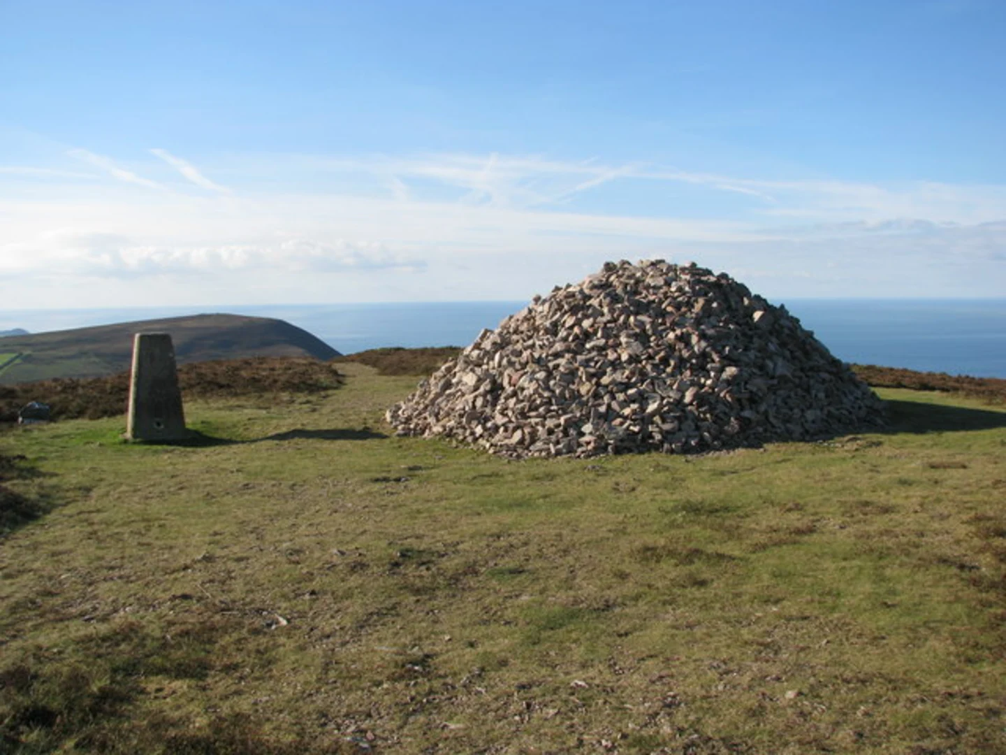
Landmarks and Scenery
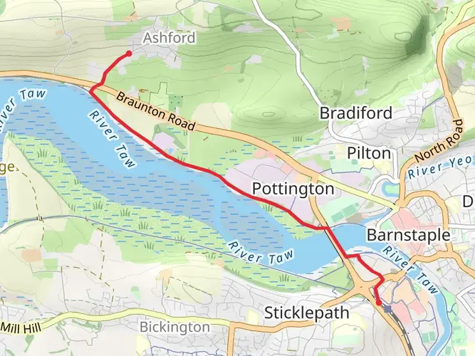
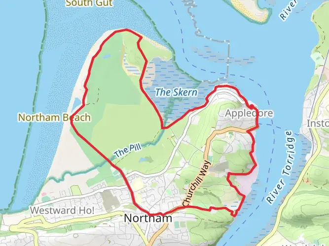
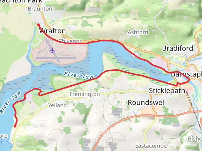
As you embark on the trail, you'll be greeted by the lush countryside and rolling hills of Devon. The path meanders alongside the River Taw, offering serene river views and opportunities to spot local wildlife such as otters and kingfishers. The trail also passes through the charming towns of Braunton, Bideford, and Great Torrington, where you can explore local history and culture.
Historical Significance
The region is steeped in history, with the trail itself following disused railway lines that were once vital to North Devon's transportation. Along the route, you'll encounter historical landmarks such as the Puffing Billy Track, named after the old steam trains that chugged along this line.
Nature and Wildlife
The Tarka Trail traverses through two Areas of Outstanding Natural Beauty – the North Devon Coast and the Tarka Country. This provides a habitat for a diverse array of flora and fauna. Keep an eye out for the rich birdlife, including buzzards and peregrine falcons, as well as the occasional glimpse of deer in the woodlands.
Preparation and Planning
Before setting out, ensure you have appropriate gear for varying weather conditions, as the trail can offer sunshine and rain in equal measure. Sturdy walking shoes are a must, and it's advisable to pack enough water and snacks for the journey, although there are spots along the way to replenish supplies.
Remember, the Tarka Trail is not just a hike; it's an exploration of the heart of Devon, with its natural beauty, wildlife, and a tapestry of history woven into the landscape. Whether you're looking for a multi-day trek or a series of day hikes, the Tarka Trail promises an enriching experience for every walker.

Frequently asked questions
How long does it take to hike the Tarka Trail in Devon?
The Tarka Trail is 129.79 km long with 2,468 m of climbing, so most hikers treat it as a multi-day route rather than a single long day. A typical pace is around 5 to 8 days, depending on daily mileage, weather, and whether the route is split around overnight stops in places such as Barnstaple, Bideford, and Great Torrington.
Where does the Tarka Trail go between Braunton, Barnstaple, Bideford, and Meeth?
The best-known traffic-free section of the Tarka Trail runs for about 52 km, or 32 miles, from Braunton through Barnstaple, Instow, Bideford, and Great Torrington to Meeth. That stretch follows former railway lines through the Taw and Torridge estuary landscape and is one of the defining sections of the wider Tarka Trail route in North Devon.
Can you walk the Tarka Trail from Barnstaple by public transport?
Yes. Barnstaple is the main public transport hub for the Tarka Trail, with a railway station on the Exeter to Barnstaple line and a bus station in town. That makes Barnstaple one of the easiest access points for walkers joining the trail, whether heading toward Braunton and the River Taw or toward Bideford and Great Torrington.
Where can you park to start the Tarka Trail in Barnstaple?
Barnstaple has several practical parking options for joining the Tarka Trail. North Devon Council lists a Tarka Car Park in Barnstaple, and central town options such as Barnstaple Central Car Park and Green Lanes are also close to the town center, rail station, and bus connections, which helps when planning a linear walk or staged itinerary.
Is the Tarka Trail suitable for beginner hikers or families?
The Tarka Trail is generally manageable for beginners with reasonable fitness, but the full route is still a medium-difficulty, multi-day hike at 129.79 km with 2,468 m of ascent. Shorter sections around the former railway line between Braunton and Meeth are easier to break into family-friendly day walks because they are traffic-free and pass through towns including Barnstaple, Bideford, and Great Torrington.
What is the terrain like on the Tarka Trail in North Devon?
Terrain on the Tarka Trail varies a lot across the full route. The well-known Braunton to Meeth section is largely level, traffic-free, and follows old railway lines, while the longer walking route includes a mix of estuary paths, riverside sections, country lanes, wooded valleys, and hillier inland ground that accounts for the trail's 2,468 m of total ascent.
What are the main landmarks and scenery on the Tarka Trail?
The Tarka Trail passes through some of North Devon's most recognizable landscapes, including the River Taw, the Taw and Torridge estuary, and the River Torridge corridor. Key trail towns include Braunton, Barnstaple, Bideford, Great Torrington, and Meeth, and the route is closely associated with the North Devon Biosphere and the landscape that inspired Tarka the Otter.
Comments and Reviews
User comments, reviews and discussions about the Tarka Trail, England.
4.67
average rating out of 5
6 rating(s)