Download
Preview
Add to list
More
70.6 km
~4 days
323 m
Multi-Day
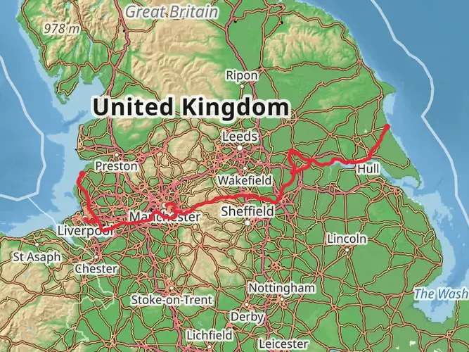
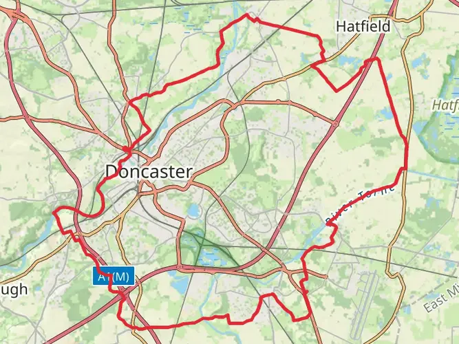
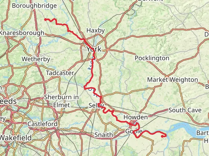
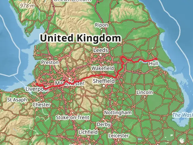
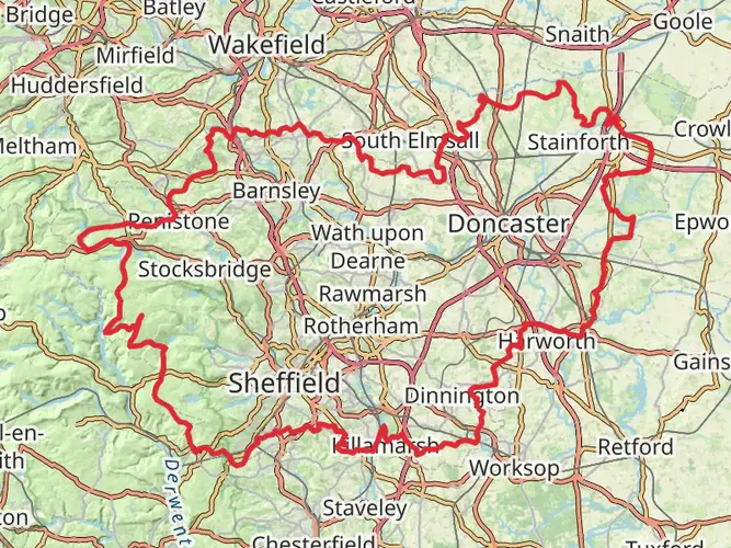
The Peatlands Way is a 70.6 km trail that starts in , Doncaster, England. Based on our data, the hike is graded as Easy. For information on how we grade trails, please read measuring the difficulty of a hiking trail on hiiker. Also, check our latest community posts for trail updates. This hike can be completed in approx 3 days. Caution is advised on trail times as this depends on multiple variables. For more info read about how we calculate hike time.

What to expect?
Activity types
Frequently asked questions
How long does it take to hike the Peatlands Way in Doncaster?
The Peatlands Way is 70.61 km long, so most hikers treat it as a multi-day route rather than a single-day walk. With only 323 m of total climbing and an easy rating, it is often split into about 3 to 4 days, depending on pace and how much time is spent on the moorland sections around Thorne, Crowle, and Hatfield.
Is the Peatlands Way a circular walk or a point-to-point trail?
The Peatlands Way is a circular long-distance route of about 50 miles, or 70.61 km, linking communities around the Humberhead Peatlands. The route traverses the raised peatlands of Thorne, Crowle, and Hatfield moors before looping back, which makes logistics simpler than a point-to-point trail.
Where can you park for the Peatlands Way near Hatfield and Thorne Moors?
Two commonly used parking areas for the Peatlands Way are Boston Park off the A614 and Ten Acre Lake south of Hatfield Woodhouse. Public parking is also available near Crowle Peatland Railway on Dole Road, which can be useful for walkers tackling the Crowle Moor side of the route. ([thepeatlandsway.com](https://www.thepeatlandsway.com/moors.html?utm_source=openai))
What landmarks and places does the Peatlands Way pass through?
The Peatlands Way links the Humberhead Peatlands and passes through or near places including Thorne, Moorends, Crowle, Ealand, Belton, Epworth, Haxey, Westwoodside, Wroot, Hatfield Woodhouse, Stainforth, Kirk Bramwith, Braithwaite, Fishlake, and the River Don corridor. Named features on the route include Ten Acre Lake, St Mary's Church in Hatfield Woodhouse, the Stainforth and Keadby Canal, and sections shared with the Thorne Round Walk. ([thepeatlandsway.com](https://www.thepeatlandsway.com/route.html?utm_source=openai))
Is the Peatlands Way difficult, and does it have much elevation gain?
The Peatlands Way is rated easy and has only 323 m of total elevation gain across 70.61 km. That low climbing total reflects the flat peatland and lowland terrain around Doncaster, so the main challenge is distance and exposure on open moorland rather than steep ascents.
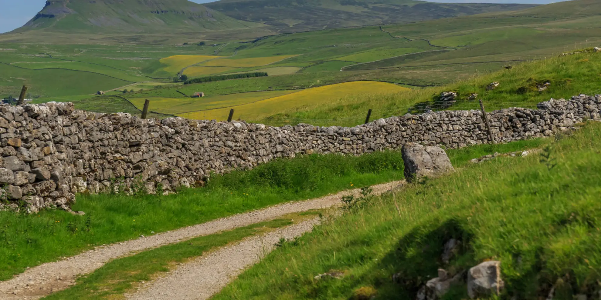
What is the terrain like on the Peatlands Way around the moors?
The route crosses lowland peat country, old tramways, access tracks, canal-side paths, riverside stretches, and village lanes around the Humberhead Peatlands. On the moors, some sections follow former peat-working lines and open access land, so navigation matters if the waymarked route is missed. ([thepeatlandsway.com](https://www.thepeatlandsway.com/moors.html?utm_source=openai))
Is the Peatlands Way good for a beginner multi-day hike?
The Peatlands Way is one of the more approachable long-distance walks in South Yorkshire because it combines an easy difficulty rating with modest total ascent of 323 m over 70.61 km. It suits beginners who are comfortable covering steady daily mileage on flat terrain and managing a multi-day route through exposed peatland landscapes.
Comments and Reviews
User comments, reviews and discussions about the Peatlands Way, England.
4.0
average rating out of 5
1 rating(s)