Download
Preview
Add to list
More
73.8 km
~4 days
376 m
Multi-Day
“"Explore Somerset's beauty and history on the River Parrett Trail, a scenic, medium-difficulty hike for the experienced."”
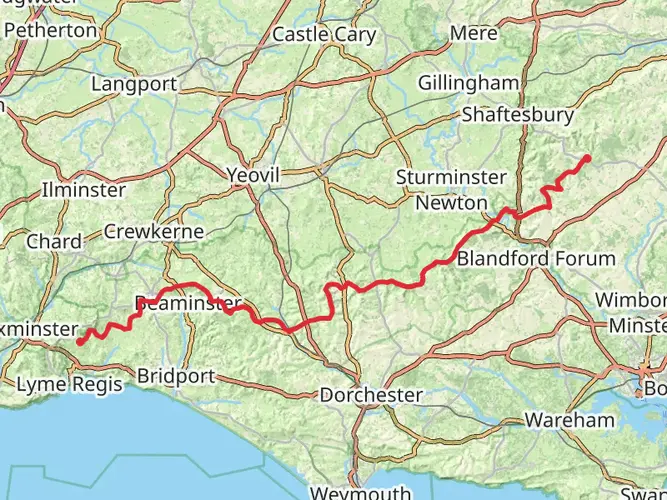
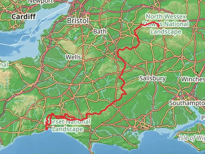
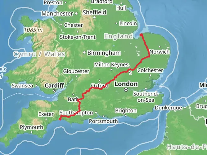
The River Parrett Trail meanders through the picturesque landscapes of Somerset, England, offering hikers a unique blend of natural beauty, wildlife, and historical intrigue. Spanning approximately 74 kilometers (about 46 miles) with an elevation gain of around 300 meters (roughly 980 feet), this point-to-point trail is a medium-difficulty adventure suitable for those with some hiking experience.
Getting to the Trailhead
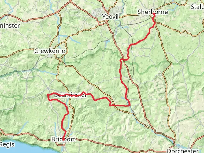
The trailhead is located near the charming village of Chedington in Dorset, which is accessible by car or public transport. If driving, you can set your navigation to Chedington, Dorset, to find the starting point. For those relying on public transportation, the closest train stations are Crewkerne and Yeovil, from which you can take a taxi or a local bus service to reach Chedington.
Navigating the Trail
As you embark on the River Parrett Trail, it's advisable to use a reliable navigation tool like HiiKER to keep track of your progress and ensure you're following the correct path. The trail is well-marked, but having a digital map can be invaluable, especially at points where the trail intersects with local footpaths.
Landmarks and Scenery
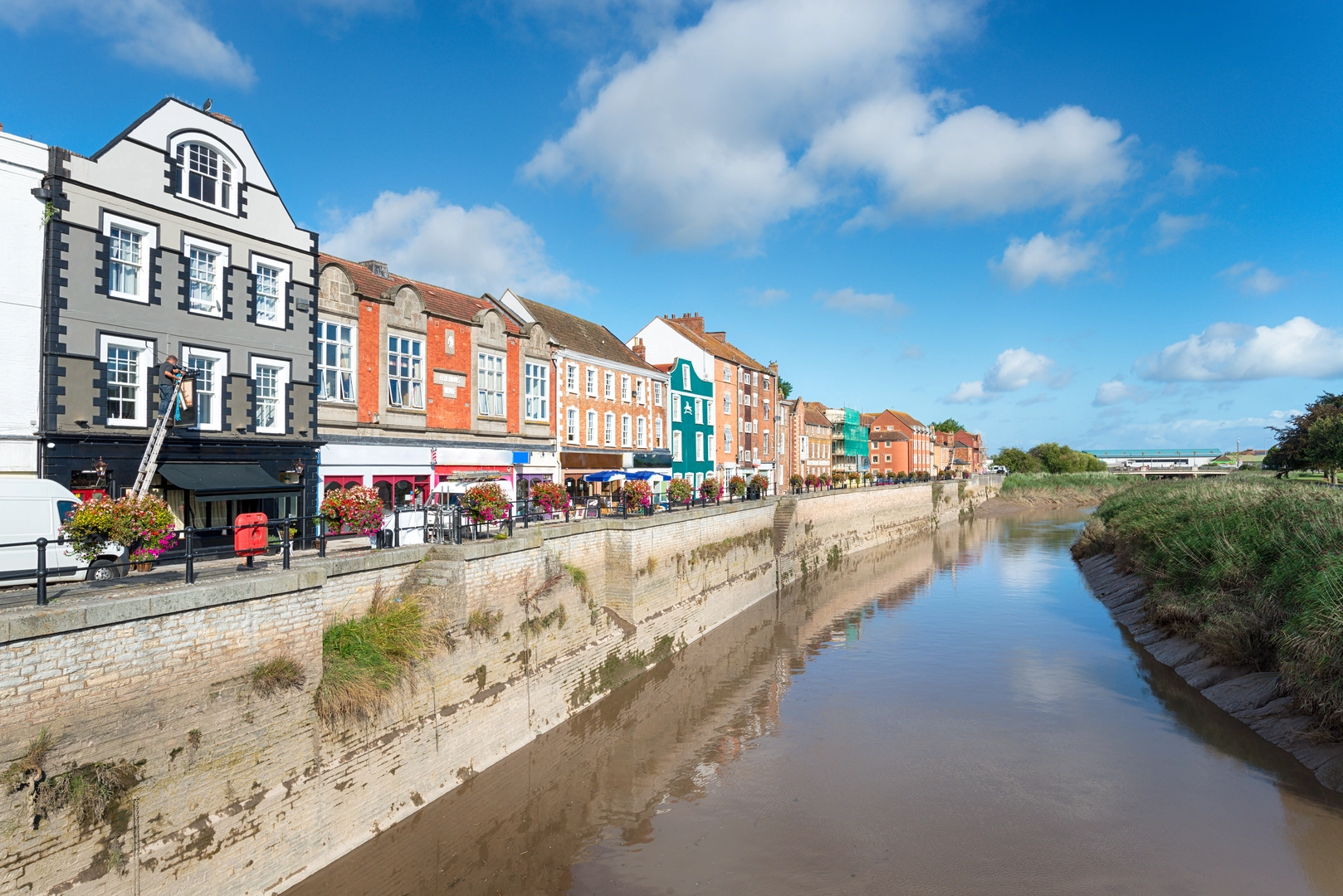
The trail follows the River Parrett's course, allowing hikers to witness the river's changing character as it flows from the rolling hills near Dorset to the Bristol Channel. Along the way, you'll pass through the market town of Bridgwater, approximately 16 kilometers (10 miles) from the start. Bridgwater is steeped in history, with its origins dating back to the Domesday Book, and it played a significant role during the English Civil Wars.
Further along, at about the halfway mark, you'll reach the town of Langport, another historic settlement with roots reaching back to Roman times. Here, the trail offers views of the Somerset Levels, an area known for its rich wildlife, especially bird species like the iconic Kingfisher and the elusive Bittern.
Nature and Wildlife
The River Parrett Trail is a haven for nature enthusiasts. The Somerset Levels, through which a significant portion of the trail passes, are a mosaic of wetlands, peat moors, and floodplains. This unique habitat supports a diverse array of flora and fauna. In spring and summer, the meadows burst with wildflowers, while the wetlands are a crucial stopover for migratory birds.
Historical Significance
The region's history is palpable throughout the hike. The trail crosses the site of the Battle of Sedgemoor, the last pitched battle on English soil, which took place in 1685. As you walk, you'll be treading the same ground where the Monmouth Rebellion reached its tragic conclusion.
Trail End and Return Journey
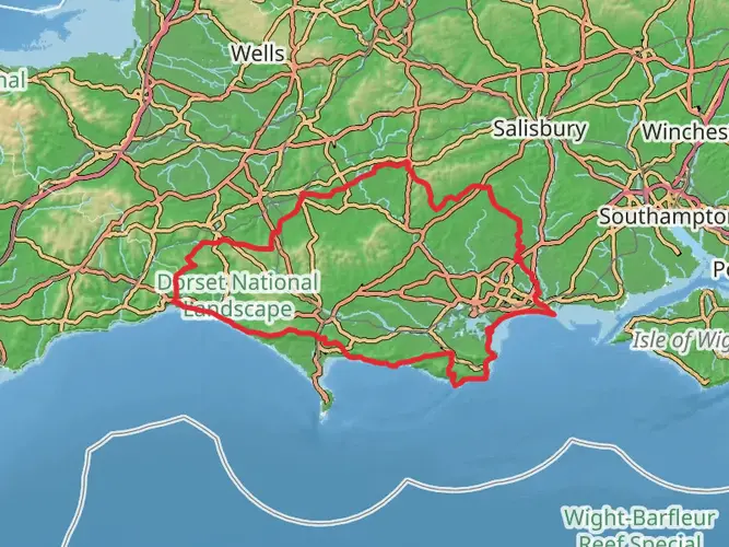
The trail concludes near the coastal town of Bridgwater, Somerset. From here, you can catch a bus or train back to your starting point or arrange for a pick-up. The end of the trail is also near the Steart Marshes, a managed wetland reserve that offers additional opportunities for birdwatching and exploration.
Remember to plan your hike with consideration for the time of year, as the trail can be muddy and prone to flooding in wetter seasons. Always check the weather forecast and trail conditions before setting out, and ensure you have appropriate gear for the terrain and climate.

What to expect?
Activity types
Frequently asked questions
How long does it take to walk the River Parrett Trail from Chedington to Bridgwater Bay?
The River Parrett Trail is 73.78 km, or about 46 miles, so most walkers split it over 3 to 5 days. With only 376 m of total climbing and an easy overall grade, the route is more about steady mileage than steep terrain, running from the springs near Chedington to Bridgwater Bay.
Where does the River Parrett Trail start and finish?
The River Parrett Trail starts near Chedington in Dorset, close to the river’s source springs, and follows the Parrett north and west to Bridgwater Bay on the Bristol Channel. The route passes through places including South Petherton, Langport, Burrowbridge, and Bridgwater before reaching the coast.
Is the River Parrett Trail difficult, and is it suitable for beginners?
The River Parrett Trail is generally considered an easy long-distance walk. Over 73.78 km it gains just 376 m, so it suits walkers looking for a low-gradient multi-day route, although the full distance still calls for basic stamina, route planning, and comfort with consecutive days on foot.
Can dogs go on the River Parrett Trail?
Dogs are allowed on many parts of the River Parrett Trail, but the route uses public rights of way through farmland and riverside ground where livestock, gates, and stiles can be an issue. That means dogs may need to be kept under close control, especially on sections across the Somerset Levels and near grazing land.
What are the main towns and landmarks on the River Parrett Trail?
The River Parrett Trail follows the river from the Dorset hills into the Somerset Levels, passing settlements such as South Petherton, Langport, Burrowbridge, and Bridgwater. Notable points along the wider route include the low-lying Levels landscape and the finish at Bridgwater Bay National Nature Reserve, a major saltmarsh area on the Severn Estuary.
Is the River Parrett Trail well waymarked?
The River Parrett Trail is waymarked, but it is still a long point-to-point route with junctions onto local footpaths and rights of way. Navigation is usually straightforward on the easier riverside stretches, though extra care helps around farmland crossings, settlement edges, and the more intricate path network on the Levels.
Can the River Parrett Trail be reached by public transport?
Public transport access is possible at both ends of the River Parrett Trail, but it is easier in sections than as a single out-and-back day. Crewkerne and Yeovil are the nearest rail hubs for the Chedington end, while Bridgwater has stronger rail and bus connections for the coastal end, making the trail practical for a one-way walk.
Comments and Reviews
User comments, reviews and discussions about the River Parrett Trail, England.
5.0
average rating out of 5
5 rating(s)