Download
Preview
Add to list
More
99.4 km
~5 days
566 m
Multi-Day
“Experience the England Coast Path's Southeast jewels, blending 61 miles of coastal splendor, wildlife, and rich history into an unforgettable hike.”
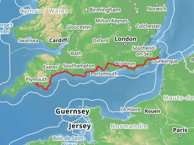
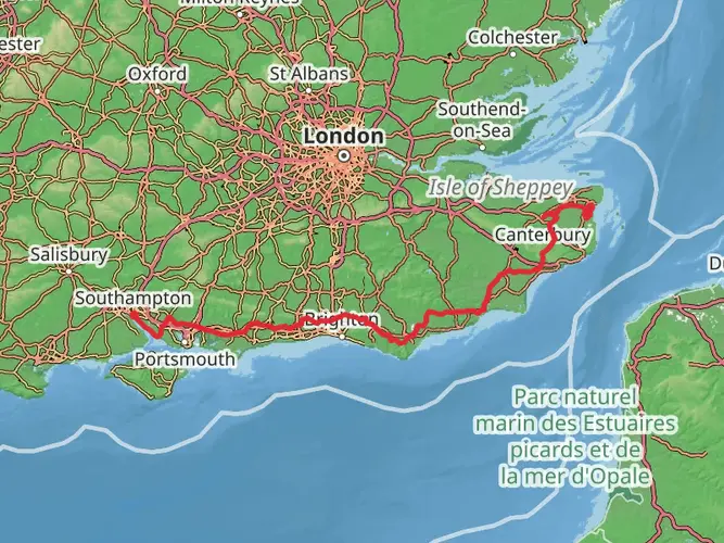
Embarking on the England Coast Path - Southeast section, hikers will traverse approximately 99 kilometers (about 61 miles) of diverse landscapes, with an elevation gain of around 500 meters (approximately 1640 feet). This point-to-point trail, rated medium in difficulty, offers a rich tapestry of coastal scenery, wildlife, and historical sites.
Getting to the Trailhead The trailhead is located near East Sussex, England. For those opting for public transport, the nearest train stations are typically within a short bus ride or taxi journey to the starting point. If driving, parking is available in the towns near the trailhead, but it's advisable to check for any parking restrictions or fees.
Navigating the Trail The route is well-marked, but hikers should consider using the HiiKER app for detailed maps and navigation assistance. The app provides offline maps, which are particularly useful in areas with limited mobile reception.
Coastal Wonders and Wildlife As you set off from the trailhead, the path meanders along rugged cliffs, offering breathtaking views of the English Channel. The trail passes through a mosaic of habitats, including sandy beaches, salt marshes, and rocky shores. Birdwatchers will delight in the variety of seabirds, such as gannets and kittiwakes, while the occasional seal might be spotted bobbing in the waves.
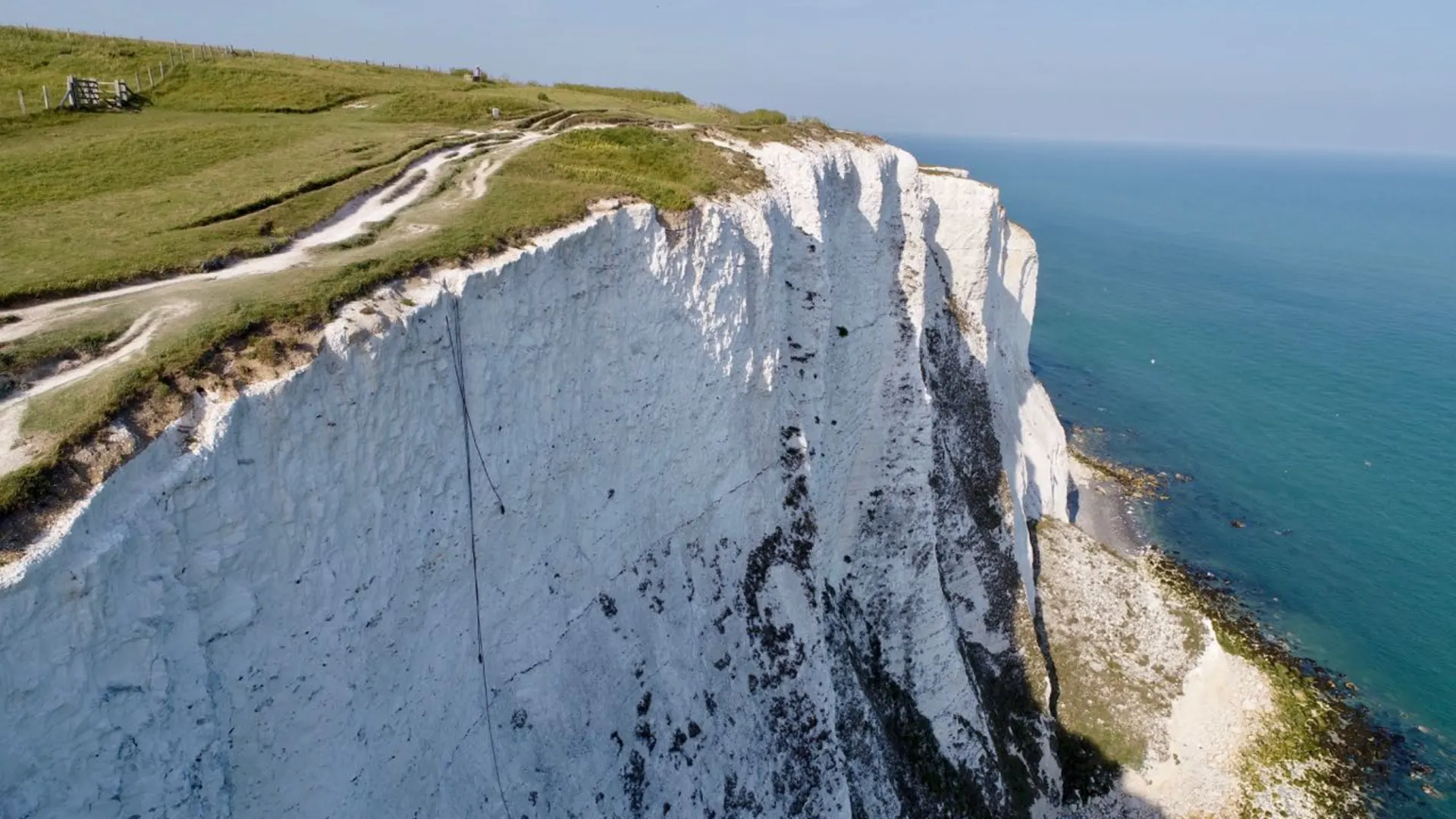
Historical Highlights The Southeast section of the England Coast Path is steeped in history. Hikers will encounter ancient ports, historic battle sites, and centuries-old castles. Notable landmarks include the Battle of Hastings site, where in 1066, the course of English history changed dramatically. The trail also winds past the iconic white chalk cliffs of the Seven Sisters, a natural wonder with a history dating back millions of years.
Challenges and Considerations While the elevation gain is moderate, the trail includes some steep sections and uneven terrain, which can be challenging. Weather conditions along the coast can change rapidly, so it's essential to be prepared with appropriate clothing and gear. Tides can affect certain parts of the trail, so checking tide times is crucial to avoid getting cut off by the incoming sea.
Local Amenities and Accommodations Along the route, there are numerous towns and villages where hikers can find accommodation, ranging from campsites to bed and breakfasts. Local eateries provide opportunities to sample regional cuisine, and shops are available for resupplying essentials.
Environmental Stewardship Hikers are encouraged to follow Leave No Trace principles to preserve the natural beauty and wildlife of the area. This includes sticking to the designated path, disposing of waste properly, and being considerate of other trail users and local communities.
End of the Trail The trail concludes in a different town from the start, so hikers should plan their return journey in advance. Public transport options are available at the end of the trail for a return trip to the starting point or onward travel.

What to expect?
Activity types
Frequently asked questions
How long does it take to walk England Coast Paths - Southeast S in East Sussex?
England Coast Paths - Southeast S is 99.44 km long, so most walkers treat it as a multi-day route rather than a single outing. With only 566 m of total climbing and an easy rating, a typical pace is about 3 to 5 days depending on daily mileage, weather, and how much time is spent in places such as Eastbourne, Bexhill, Hastings, and Rye Harbour.
Where does England Coast Paths - Southeast S start and finish?
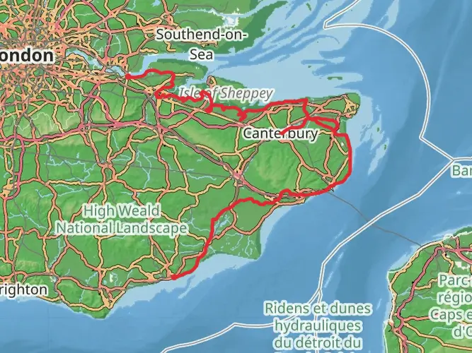
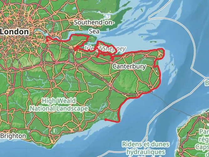
This East Sussex section of the coast path runs between Eastbourne and Rye Harbour Nature Reserve, following the county’s shoreline eastward. Official East Sussex information describes the wider East Sussex stretch as running from Telscombe to Rye Harbour Nature Reserve, and Natural England notes the Eastbourne to Rye Harbour section as a newly opened 28-mile coastal link.
Is England Coast Paths - Southeast S an easy walk or are there steep sections?
England Coast Paths - Southeast S is rated easy overall, with 566 m of elevation gain spread across 99.44 km, so the route is not especially demanding by long-distance standards. The main hillier ground is around the cliff sections near Eastbourne and the Seven Sisters area, while long stretches farther east pass through flatter promenades, shingle frontage, and low-lying coast.
What landmarks are on England Coast Paths - Southeast S in East Sussex?
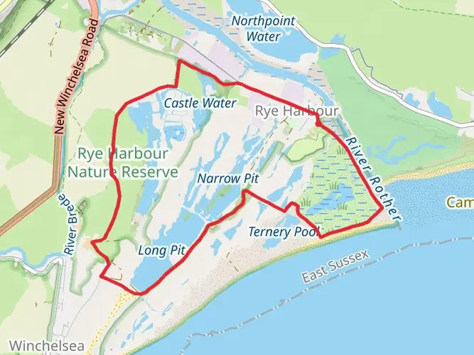
The route links several of East Sussex’s best-known coastal landmarks. Natural England highlights Eastbourne Pier, Sovereign Harbour, Pevensey Bay, Normans Bay, Cooden Beach, Bexhill Promenade, the Grade I-listed De La Warr Pavilion, Hastings Country Park, and Rye Harbour Nature Reserve, giving the walk a mix of cliff scenery, towns, beaches, and wildlife habitat.
Can dogs go on England Coast Paths - Southeast S?
Dogs are generally allowed on the King Charles III England Coast Path, which includes this East Sussex section, and public guidance for the coast path confirms that people may walk dogs on coastal margin land. That said, local restrictions can apply in sensitive wildlife areas, on some beaches, or where signs require dogs to be on a lead, especially near bird habitat and grazing land.
Can England Coast Paths - Southeast S be reached by train and public transport?
Yes. The route is one of the easier long coastal walks in Sussex to access without a car because it connects towns on the rail network. Eastbourne has a mainline station close to the seafront, and there are additional stations along or near the route at places including Bexhill, Hastings, St Leonards, and Rye, making it practical to walk it in sections.
What kind of scenery does England Coast Paths - Southeast S pass through?
England Coast Paths - Southeast S covers a broad cross-section of the East Sussex coast. The route includes cliff-top walking near Eastbourne, urban seafront promenades, shingle beaches around Pevensey Bay and Normans Bay, the wooded and dramatic coastline of Hastings Country Park, and the bird-rich wetlands and coastal habitats around Rye Harbour Nature Reserve.
Comments and Reviews
User comments, reviews and discussions about the England Coast Paths - Southeast S, England.
4.71
average rating out of 5
7 rating(s)