Download
Preview
Add to list
More
330.6 km
~17 days
5870 m
Multi-Day
“Embark on the Sabrina Way to discover England's heart, traversing historic landscapes and diverse terrains.”
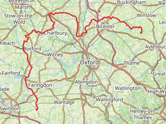
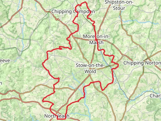
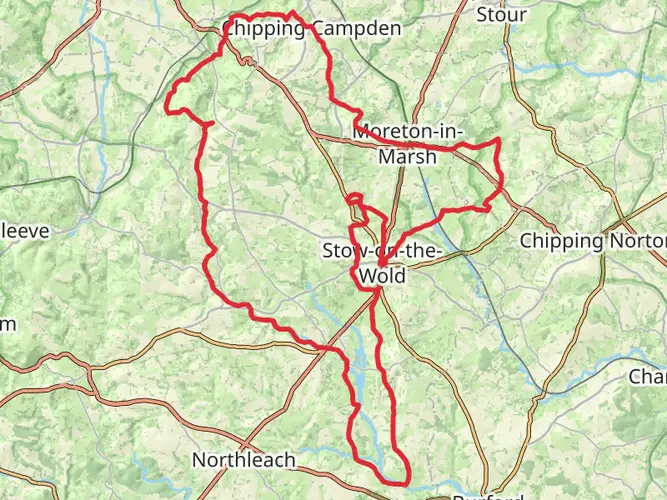
The Sabrina Way is a long-distance bridleway that offers a unique blend of picturesque landscapes, historical sites, and a variety of terrains for hikers and horse riders alike. Spanning approximately 331 kilometers (about 206 miles) with an elevation gain of around 5800 meters (approximately 19,000 feet), this trail stretches from the heart of Gloucestershire, England, and winds its way through the Midlands before reaching its endpoint.
Getting to the Trailhead
To begin your journey on the Sabrina Way, you'll want to make your way to the starting point near Gloucestershire. If you're traveling by car, you can navigate to the vicinity of the trailhead using a GPS or a navigation app like HiiKER. For those relying on public transport, there are train and bus services that can get you close to the starting location, from where you may need to arrange a taxi or a local shuttle to reach the exact trailhead.
Navigating the Trail
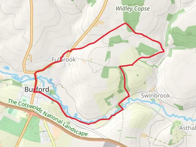
As you embark on the Sabrina Way, you'll traverse through a variety of landscapes including rolling hills, woodlands, and open countryside. The trail is marked, but carrying a detailed map or using a digital navigation tool like HiiKER is recommended to ensure you stay on the correct path, especially at points where the trail intersects with others or crosses through farmland.
Landmarks and Historical Significance
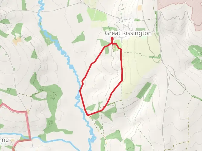
The Sabrina Way takes its name from the River Severn, known as "Sabrina" in Latin, and the trail often parallels this iconic river. Along the route, hikers will encounter historical landmarks such as ancient Roman roads, medieval castles, and traditional English villages. One of the notable historical sites is the Sudeley Castle near Winchcombe, which dates back over a thousand years and is steeped in royal history.
Flora and Fauna
The trail offers an opportunity to witness the diverse British wildlife and plant species. Depending on the season, you may see a variety of birds, including birds of prey, as well as smaller mammals like badgers and foxes. The plant life along the trail is equally varied, with wildflowers, ancient woodlands, and hedgerows that change with the seasons.
Terrain and Difficulty
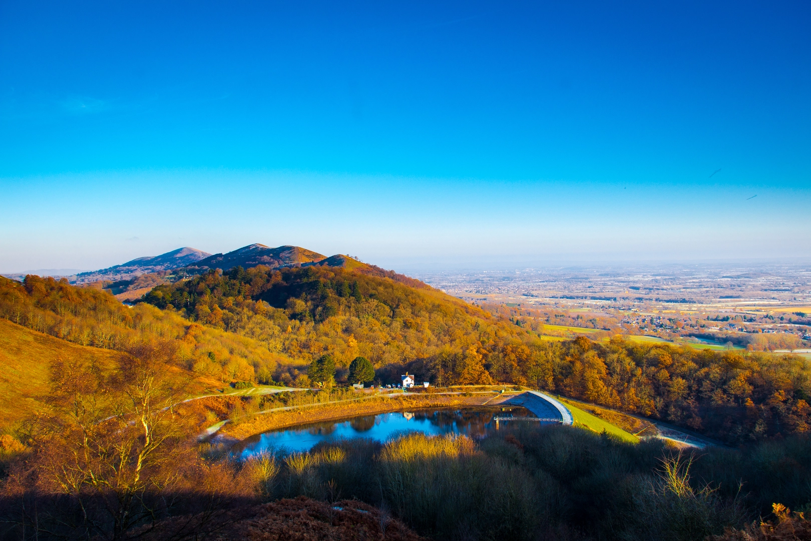
The Sabrina Way is rated as medium difficulty, which means it's accessible to hikers with a reasonable level of fitness. The trail includes some challenging sections with steep climbs and descents, particularly as it passes through the Cotswolds. However, these are interspersed with flatter, more gentle stretches that provide a respite and allow hikers to enjoy the scenery.
Preparation and Planning
Before setting out, it's important to plan your hike carefully. Consider the distance and elevation gain, and break the route into manageable sections if you're not planning to complete it in one go. Ensure you have appropriate gear for the varied British weather, and carry enough food and water, as services along the trail may be limited in some areas.
Conclusion
The Sabrina Way is a trail rich in natural beauty and historical intrigue. Whether you're looking for a multi-day adventure or a series of day hikes, this trail offers a rewarding experience for those who are prepared for its challenges and eager to explore the English countryside.

What to expect?
Activity types
Frequently asked questions
How long is the Sabrina Way and how many days does it usually take to walk?
The Sabrina Way is 330.56 km, or about 206 miles, so it is firmly a multi-day long-distance route rather than a weekend hike. A full walk is commonly split into roughly two to three weeks on the trail, depending on daily mileage, accommodation stops, and how much time is allowed for navigation and rest.
Is the Sabrina Way difficult, and is the Sabrina Way suitable for beginner long-distance hikers?
The Sabrina Way is generally rated easy, which reflects its moderate gradients and bridleway character rather than a short or effortless outing. The main challenge is its scale: 330.56 km with 5,870 m of total ascent, so it suits beginners who already have the fitness and planning needed for consecutive long walking days.
What type of trail is the Sabrina Way and can the Sabrina Way be walked in sections?
The Sabrina Way is a multi-day long-distance bridleway, and it is well suited to being completed in sections rather than in one continuous trip. Because it links into a wider network of named routes including the Cotswold Way, Severn Way, Gloucestershire Way, Worcestershire Way, and Pennine Bridleway, many walkers break it into manageable regional stages.
Where does the Sabrina Way go and what landscapes does the Sabrina Way pass through?
The Sabrina Way runs for about 203 to 206 miles through central England, linking Gloucestershire northward through Worcestershire, Shropshire, Staffordshire, and into Derbyshire. The route is named for Sabrina, the Latin name for the River Severn, and it passes through a mix of river country, farmland, woodland, rolling hills, and sections of the Cotswolds and Midlands bridleway network.
Is the Sabrina Way only for horse riders, or can walkers use the Sabrina Way too?
The Sabrina Way is a long-distance bridleway created as part of the National Bridleroute Network, so it was designed with horse riders in mind, but it is also used by walkers. For hikers, that usually means broad rights of way, mixed surfaces, and a route that is more about steady progress across the landscape than technical mountain terrain.
How much climbing is there on the Sabrina Way?
The Sabrina Way has 5,870 m of total elevation gain across its 330.56 km length. Spread over the whole route, that climbing is moderate for a trail of this distance, but it still adds up over multiple days, especially on longer stage days through hillier stretches.
Comments and Reviews
User comments, reviews and discussions about the Sabrina Way, England.
4.4
average rating out of 5
10 rating(s)