Download
3D Flyover
Add to list
More
75.4 km
~4 days
2155 m
Multi-Day
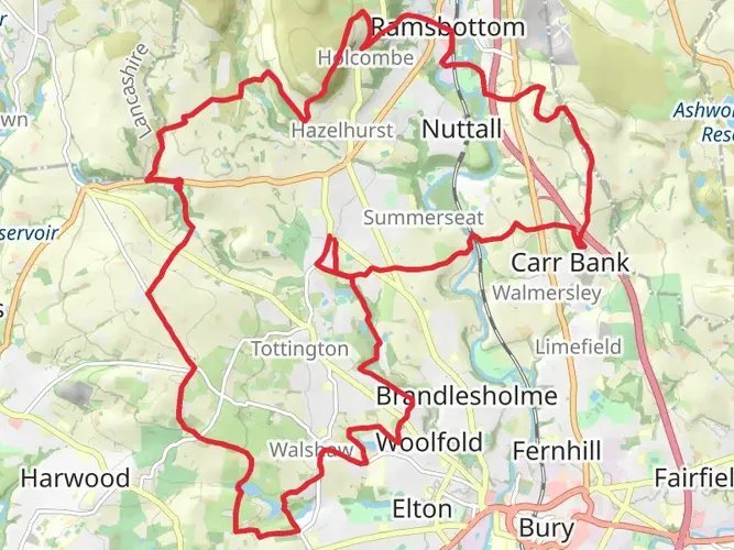
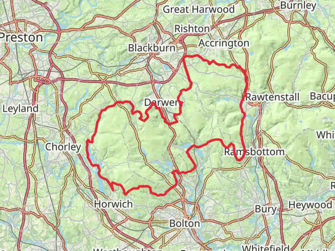
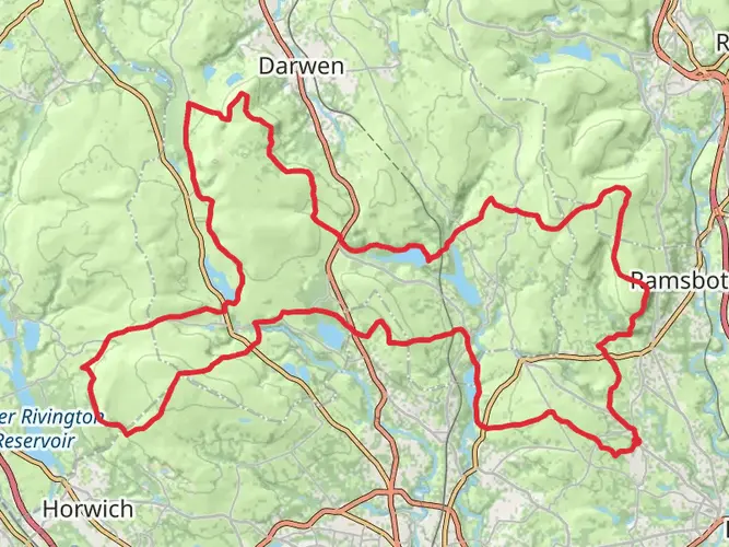
The West Pennine Way is a 75.4 km trail that starts in , Greater Manchester, England. Based on our data, the hike is graded as Easy. For information on how we grade trails, please read measuring the difficulty of a hiking trail on hiiker. Also, check our latest community posts for trail updates. This hike can be completed in approx 3 days. Caution is advised on trail times as this depends on multiple variables. For more info read about how we calculate hike time.

What to expect?
Activity types
Frequently asked questions
How long does it take to hike the West Pennine Way?
The West Pennine Way is 75.35 km long with 2,155 m of climbing, so most hikers treat it as a 4 to 6 day route rather than a single-day walk. The route is commonly broken into four main sections, including Jumbles to Rivington Hall Barn at 13.3 miles, which makes it practical to split into manageable stages.
Is the West Pennine Way a difficult long-distance walk?
The West Pennine Way is generally rated easy, but that does not mean flat. Over 75.35 km it still packs in 2,155 m of ascent, with moorland stretches around Winter Hill, Darwen Moor, and Holcombe Moor that can feel more demanding in wind, rain, or boggy ground.
Where can you park for the West Pennine Way?
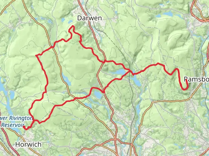
Common parking points on the West Pennine Way include Jumbles Country Park and Rivington Hall Barn. The southern section lists parking at Jumbles Café and at Rivington Hall Barn car park, postcode BL6 7SB, and the northern section also notes parking at Roddlesworth Information Centre, postcode BB3 0PA.
Can you do the West Pennine Way in sections?
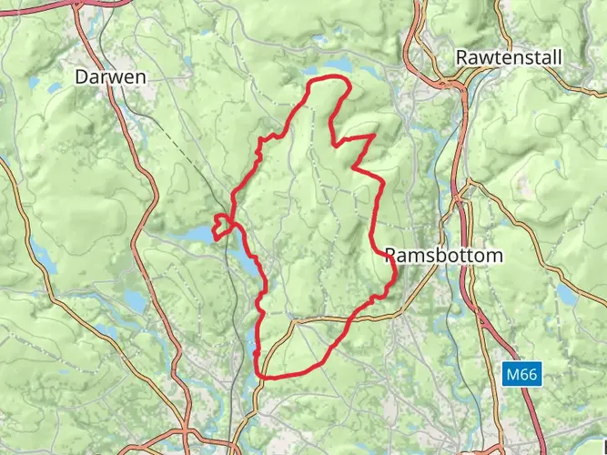
Yes. The West Pennine Way is regularly walked in stages, and the official route materials split it into southern, western, northern, and eastern sections. One example is the southern section from Jumbles Information Centre and Café to Rivington Hall Barn, which is 13.3 miles and can be shortened by routing more directly from Winter Hill.
What are the main landmarks on the West Pennine Way?
The West Pennine Way passes some of the best-known landmarks in the West Pennine Moors, including Winter Hill, Rivington Pike, Rivington Terraced Gardens, Darwen Tower, Great Hill, Peel Tower, Jumbles Reservoir, and Roddlesworth. The route also links moorland, reservoirs, wooded cloughs, and villages around Bolton, Rivington, and Darwen.
Is the West Pennine Way dog friendly?
Dogs can be taken on the West Pennine Way, but control matters because much of the route crosses open moorland and farmland. On open access land in England, dogs must be on a short lead between March 1 and July 31, and they should also be kept under close control near livestock at any time of year.
Can you reach the West Pennine Way by public transport?
Yes, some sections of the West Pennine Way can be reached by bus, especially around Jumbles, Egerton, Belmont, and the Bolton side of the route. The southern section notes bus links near Jumbles on the A676, services at Egerton on the A666, and a Bolton to Belmont service, although frequencies can be limited.
Comments and Reviews
User comments, reviews and discussions about the West Pennine Way, England.
average rating out of 5
0 rating(s)