Download
3D Flyover
Add to list
More
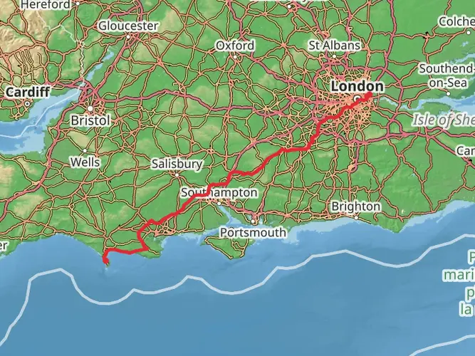
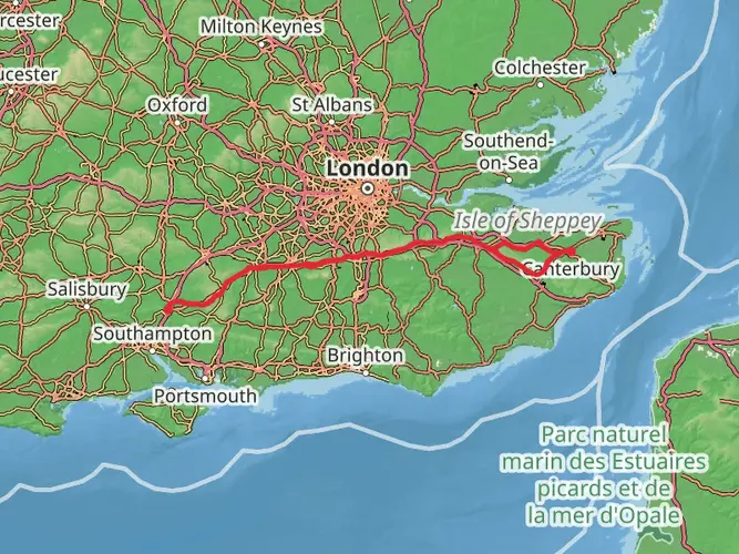
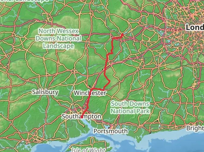
161.6 km
~7 days
2699 m
Multi-Day
“Traverse the historic and scenic South Downs Way, a journey through England's rolling hills and rich heritage.”
Spanning approximately 100 miles (162 kilometers) across the rolling hills of southeastern England, the South Downs Way invites hikers into a landscape rich with history and natural beauty. With an elevation gain of around 8,530 feet (2,600 meters), this long-distance footpath offers a medium difficulty challenge, suitable for those with some hiking experience and a desire to immerse themselves in the English countryside.
Getting to the Trailhead
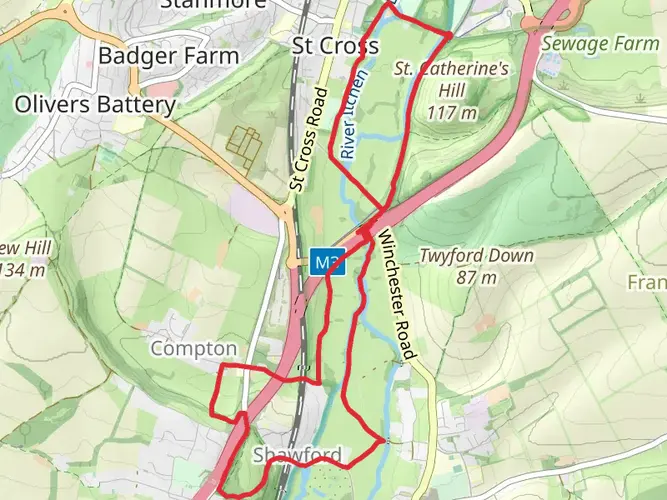
The trailhead, located near the village of Winchester in Hampshire, is accessible by public transport. Hikers can take a train to Winchester Railway Station and then a short bus or taxi ride to the trail's starting point. For those driving, parking is available in Winchester, with the trailhead being a short distance from the city center.
Navigating the Trail
The South Downs Way is well-marked with signposts and acorn symbols, indicative of a National Trail. For additional navigation support, hikers can use the HiiKER app, which provides detailed maps and GPS tracking to ensure you stay on the right path.
Historical Significance and Landmarks
As you embark on the trail, you'll be walking a path that has been trodden for thousands of years. The route is steeped in history, passing Iron Age hill forts, ancient burial mounds, and Roman roads. Notable historical landmarks include the ancient city of Winchester, once the capital of England, and the Long Man of Wilmington, a mysterious hill figure etched into the landscape.
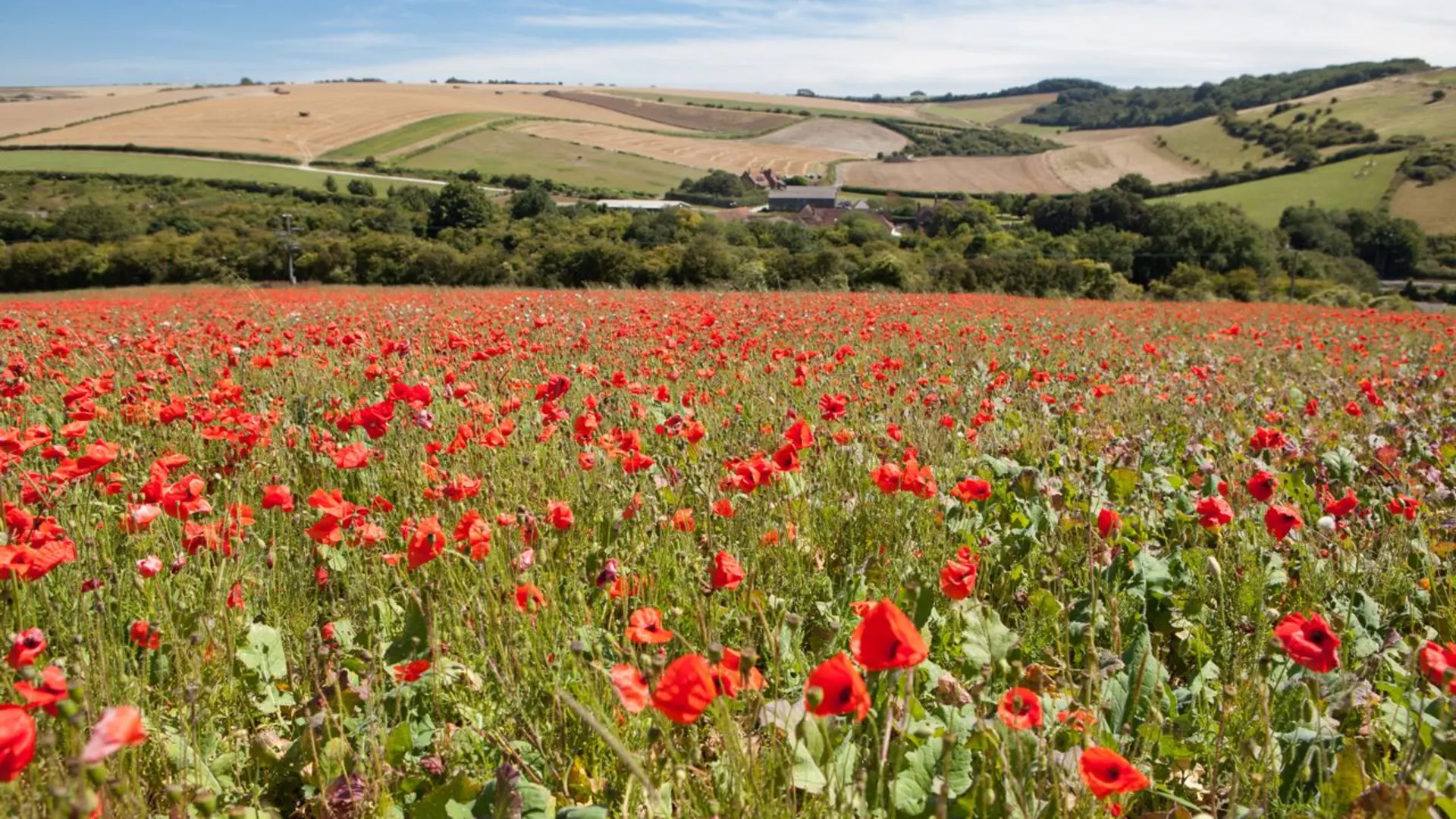
Natural Beauty and Wildlife
The trail traverses the South Downs National Park, showcasing quintessential English scenery: chalk cliffs, expansive heathland, and woodlands. The route offers panoramic views of the English Channel and the Isle of Wight from atop the chalk ridges. Wildlife is abundant, with opportunities to spot rare birds, butterflies, and other native species.
Key Sections of the Trail
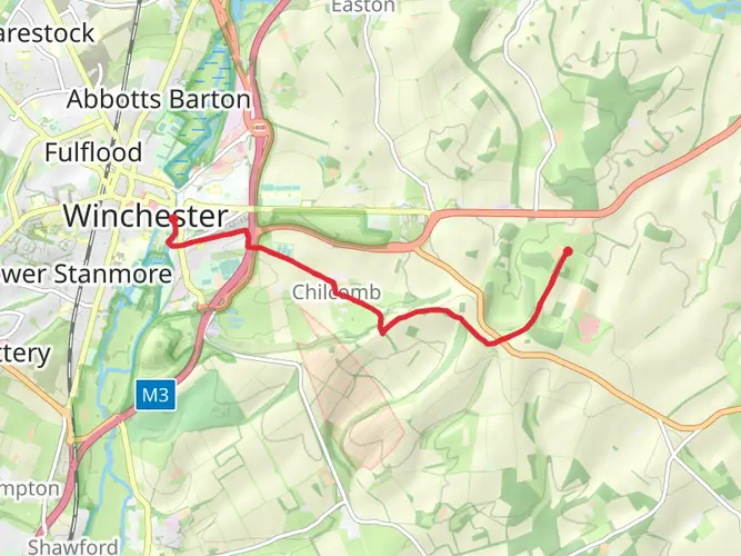
Winchester to Exton (12 miles / 19 km): The trail begins gently, passing through the Itchen Valley and ascending to Old Winchester Hill, providing expansive views.
Exton to South Harting (21 miles / 34 km): This section includes the ascent of Butser Hill, the highest point on the trail at 889 feet (271 meters), before descending into the quaint village of South Harting.
South Harting to Amberley (18 miles / 29 km): Hikers will cross several river valleys and enjoy the sights of the historic market town of Amberley.
Amberley to Pyecombe (20 miles / 32 km): This stretch features the iconic chalk pinnacles of Devil's Dyke and stunning vistas across the Weald.
Pyecombe to Southease (13 miles / 21 km): The trail meanders through the Ditchling Beacon, an area of rich biodiversity and the highest point in East Sussex at 814 feet (248 meters).
Southease to Eastbourne (22 miles / 35 km): The final leg includes the dramatic Seven Sisters chalk cliffs and ends at the seaside town of Eastbourne, where the trail concludes at the foot of the Beachy Head cliffs.
Preparation and Planning
Hikers should be prepared for the variable British weather by packing waterproof gear and layers. Water sources and refreshments are available in the villages along the route, but carrying sufficient water and snacks is recommended. Accommodations range from campgrounds to bed and breakfasts, allowing for a variety of overnight options.
The South Downs Way can be hiked in sections or as a whole, typically taking around 8 to 9 days to complete. It's a trail that offers not just a physical journey but a passage through time, connecting walkers with the landscape and history of this storied region.

What to expect?
Activity types
Frequently asked questions
How long does it take to hike the South Downs Way from Winchester to Eastbourne?
The South Downs Way is 161.58 km, or about 100 miles, from Winchester in Hampshire to Eastbourne in East Sussex. Most end-to-end walkers take around 7 to 10 days, depending on daily mileage, weather, and how many stops are built in for places such as Petersfield, Amberley, Lewes, or Alfriston.
Where does the South Downs Way start and finish?
The South Downs Way runs west to east between Winchester and Eastbourne. The western end is in Winchester, Hampshire, and the eastern end is at Eastbourne on the Sussex coast, with the route crossing the length of the South Downs National Park and finishing near the dramatic chalk coast around Beachy Head.
Is the South Downs Way difficult?
The South Downs Way is generally rated difficult as a full route because it covers 161.58 km with about 2,699 meters of climbing. The trail follows rolling chalk ridges rather than sustained mountain ascents, but the repeated ups and downs, exposed sections, and multi-day distance make it a serious long-distance walk.
Can the South Downs Way be walked in sections using public transport?
Yes. The South Downs Way is one of the easier National Trails in England to break into stages because both ends are served by rail, and there are useful intermediate stations near the route at places including Petersfield, Amberley, Hassocks, and Lewes. That makes it practical to walk day sections without committing to the full Winchester-to-Eastbourne crossing.
How is the South Downs Way marked on the trail?
The South Downs Way is waymarked as a National Trail, so the main route is signed with the acorn symbol used across England’s National Trails. On the ground, those acorn markers and signposts help guide walkers along the ridge between Winchester and Eastbourne, including through villages, road crossings, and open downland.
Are dogs allowed on the South Downs Way?
Dogs are generally allowed on the South Downs Way, but control is important because the route crosses farmland, grazing areas, and sensitive countryside within the South Downs National Park. Livestock are common on the downs, so dogs may need to be kept on a short lead, especially near sheep, cattle, and ground-nesting wildlife habitat.
Where can you park for the South Downs Way in Winchester?
Parking for the South Downs Way is available in and around Winchester, which is the usual western trailhead. Long-stay parking takes more planning than short visits, and official trail guidance notes that long-term parking in Winchester or Eastbourne is harder to find, so many walkers use city parking, a drop-off, or public transport for the start.
Comments and Reviews
User comments, reviews and discussions about the South Downs Way, England.
4.81
average rating out of 5
125 rating(s)