Download
Preview
Add to list
More
154.3 km
~9 days
4425 m
Multi-Day
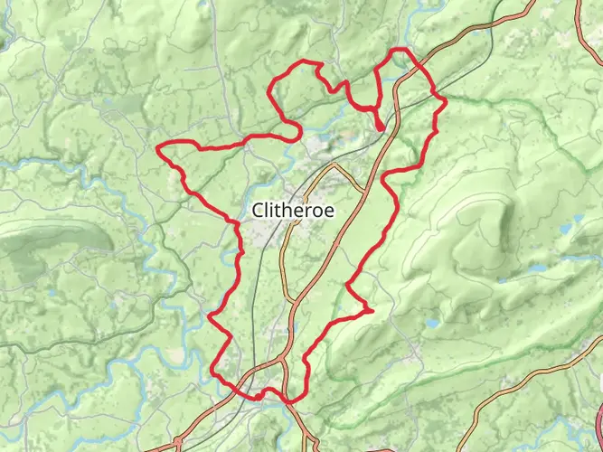
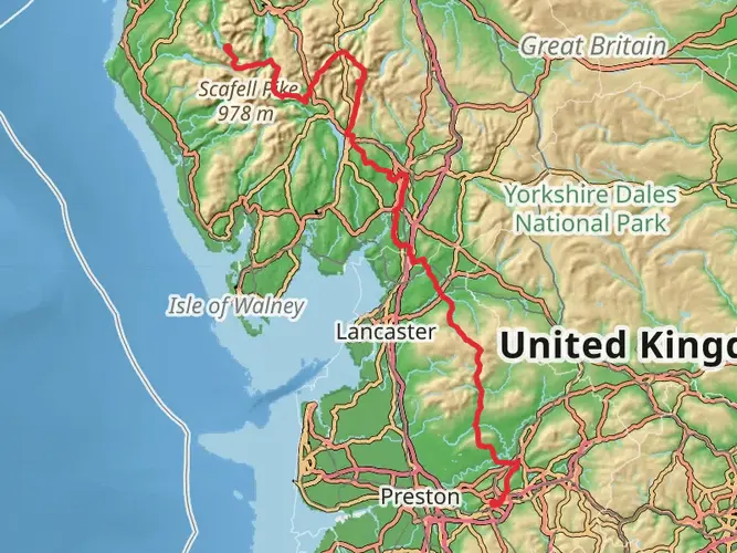
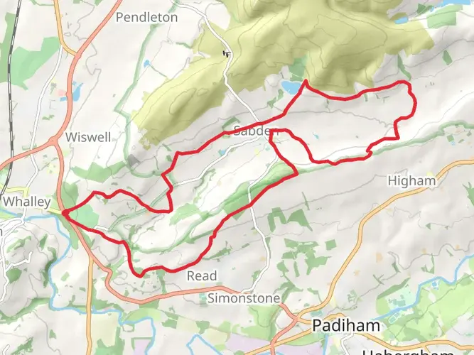
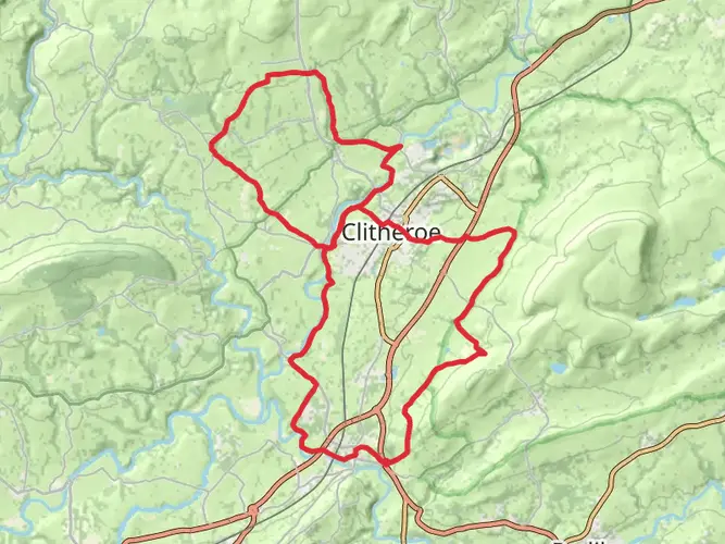
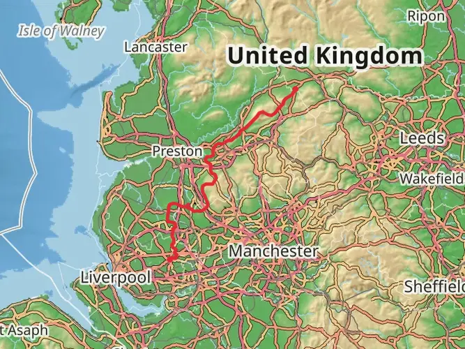
The Forest of Bowland and Yorkshire Dales Loop via Gisburn is a 154.3 km trail that starts in Ribble Valley, Lancashire, England. Based on our data, the hike is graded as Medium. For information on how we grade trails, please read measuring the difficulty of a hiking trail on hiiker. Also, check our latest community posts for trail updates. This hike can be completed in approx 7 days. Caution is advised on trail times as this depends on multiple variables. For more info read about how we calculate hike time.

What to expect?
Activity types
Frequently asked questions
How long does the Forest of Bowland and Yorkshire Dales Loop via Gisburn take to hike?
The Forest of Bowland and Yorkshire Dales Loop via Gisburn is 154.28 km long with 4,425 m of climbing, so it is usually planned as a multi-day walk rather than a single long outing. A typical schedule is around 7 to 10 days, depending on daily mileage, weather, and how comfortably steep moorland and upland sections are handled.
Is the Forest of Bowland and Yorkshire Dales Loop via Gisburn a difficult hike?
This route is rated medium, but the numbers make it a serious undertaking. At 154.28 km with 4,425 m of elevation gain, it suits hikers who are comfortable with repeated long days, sustained climbs, and back-to-back walking across the Forest of Bowland and the edge of the Yorkshire Dales.
Where do you start the Forest of Bowland and Yorkshire Dales Loop via Gisburn and is there parking?
The loop is based around Gisburn in Lancashire, so many hikers begin and end near the village or at Gisburn Forest depending on how they break up the route. Gisburn Forest has pay-and-display parking, and the forest hub area also has public toilets, which makes it a practical place for a loop start or finish.
Can you do the Forest of Bowland and Yorkshire Dales Loop via Gisburn by public transport?
Public transport is possible, but it needs planning because this is a rural part of Lancashire. Gisburn is the logical access point for the loop, and local bus links serve the wider Ribble Valley area, while some Bowland services are limited and can be infrequent, especially outside peak periods.
Is the Forest of Bowland and Yorkshire Dales Loop via Gisburn dog friendly?
Dogs can be taken on much of the Forest of Bowland and Yorkshire Dales Loop via Gisburn, but control matters because this landscape includes farmland, open access land, and areas with livestock and sensitive wildlife. In the Forest of Bowland, dogs should be kept on a short lead near livestock, and on open access land they are required to be on a 2-meter lead from March 1 to July 31.
What is the best time of year to hike the Forest of Bowland and Yorkshire Dales Loop via Gisburn?
Late spring through early fall is usually the most straightforward time for this loop. Longer daylight and generally drier ground help on a 154.28 km route with 4,425 m of ascent, while winter can bring boggier moorland, colder winds on exposed sections, and slower progress across higher ground.
What kind of terrain is on the Forest of Bowland and Yorkshire Dales Loop via Gisburn?
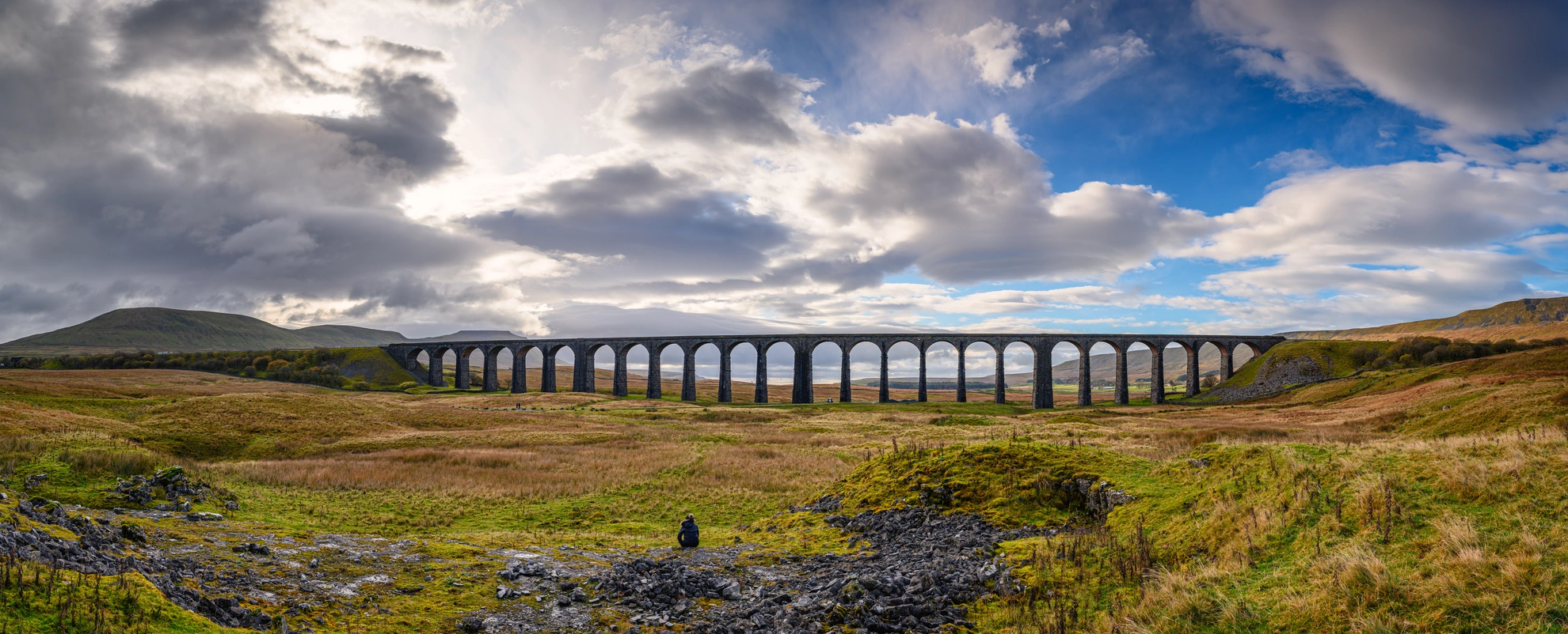
The route combines a long-distance loop format with the varied ground typical of Lancashire uplands and the fringe of the Yorkshire Dales. Expect a mix of moorland tracks, farm lanes, rougher upland paths, forest roads around Gisburn Forest, and exposed sections where climbing and footing can feel much harder than the medium rating first suggests.
Comments and Reviews
User comments, reviews and discussions about the Forest of Bowland and Yorkshire Dales Loop via Gisburn, England.
5.0
average rating out of 5
2 rating(s)