Download
Preview
Add to list
More
59.0 km
~3 days
765 m
Multi-Day
“Ivanhoe Way enchants with historical allure and natural splendor across rolling English countryside.”
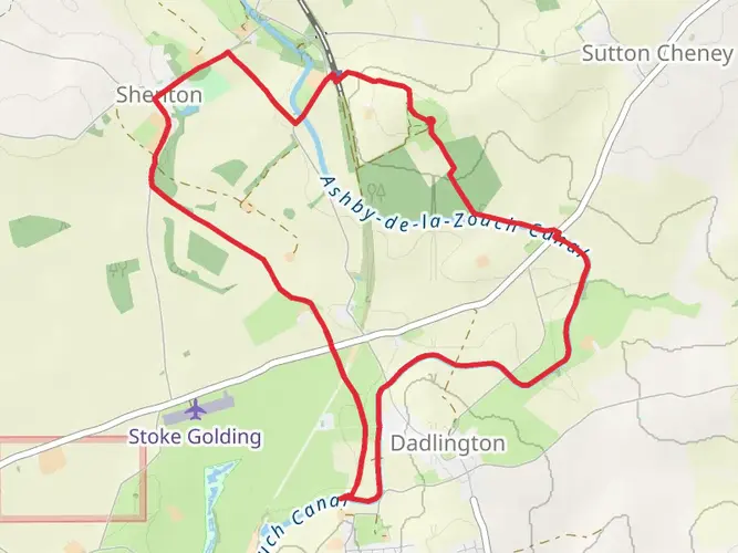
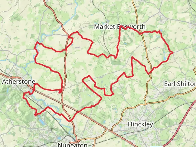
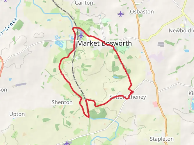
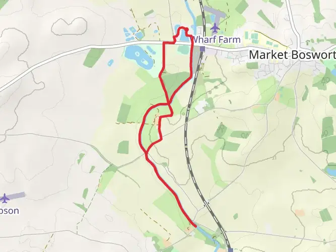
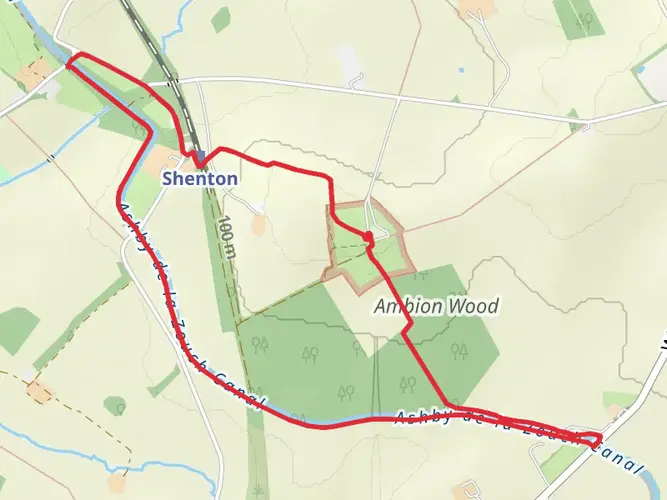
Spanning approximately 59 kilometers (about 36.7 miles) with an elevation gain of around 700 meters (approximately 2296 feet), Ivanhoe Way is a captivating loop trail situated near Leicestershire, England. This medium-difficulty hike offers a blend of historical intrigue and natural beauty, making it a rewarding experience for both seasoned hikers and enthusiastic beginners.
Getting to the Trailhead
The starting point of Ivanhoe Way is accessible from the town of Ashby-de-la-Zouch, which is well-connected by public transport. Visitors can take a bus or train to Ashby-de-la-Zouch and then a short taxi ride to the trailhead. For those driving, parking is available near the town center, from where the trail can be easily reached.
Navigating the Trail
Hikers can rely on the HiiKER app for detailed maps and navigation assistance throughout the journey. The app provides real-time location tracking and route guidance, ensuring that hikers can stay on the correct path without the need for physical maps.
Historical Significance and Landmarks
Ivanhoe Way takes its name from Sir Walter Scott's novel "Ivanhoe," reflecting the rich medieval history that permeates the region. As you traverse the trail, you'll encounter historical landmarks such as the ruins of Ashby de la Zouch Castle, which dates back to the 12th century. This castle played a significant role during the English Civil War and now serves as a fascinating ruin for visitors to explore.
Natural Features and Wildlife
The trail meanders through a variety of landscapes, including rolling hills, woodlands, and open countryside. Along the way, hikers will be treated to picturesque views of the Leicestershire countryside, with opportunities to spot local wildlife such as foxes, badgers, and a variety of bird species. The woodlands are particularly enchanting, with ancient oaks and serene bluebell carpets in the spring.
Trail Experience
The loop can be completed in sections or as a multi-day hike, with local accommodations available for those wishing to extend their adventure. The terrain is a mix of footpaths, bridleways, and minor roads, with the occasional steep section contributing to the overall elevation gain. Hikers should be prepared for typical English weather, which can be unpredictable, and pack accordingly.
Preparation and Safety
Proper hiking boots and weather-appropriate clothing are essential for a comfortable experience on Ivanhoe Way. It's also advisable to carry sufficient water and snacks, as well as a first-aid kit for emergencies. Always inform someone of your hiking plans and expected return time, especially if hiking alone.
Seasonal Considerations
Ivanhoe Way can be hiked year-round, but each season offers a unique experience. Spring brings blossoming flora and mild temperatures, summer provides longer daylight hours for extended hikes, autumn showcases a palette of changing leaves, and winter, while colder, offers a stark beauty and fewer crowds.
Accessibility and Amenities
Parts of the trail are accessible to those with moderate fitness levels, and there are several points along the route where hikers can access local amenities, including pubs, cafes, and shops in the villages dotted along the way. These stops provide perfect opportunities to rest and refuel before continuing on the journey.
Whether you're seeking a historical adventure, a nature escape, or simply a long walk through the English countryside, Ivanhoe Way offers a memorable hiking experience with a touch of medieval charm.

What to expect?
Activity types
Frequently asked questions
How long is the Ivanhoe Way and how many days does it take to walk?
The Ivanhoe Way is 58.99 km long, or about 36.7 miles, with around 765 m of total ascent. Most walkers split it over 2 to 3 days, although strong hikers can cover it in a long single day if daylight and logistics are well planned.
Is the Ivanhoe Way a circular walk or a point-to-point route?
The Ivanhoe Way is a loop trail in Leicestershire, so it can be walked as a circular route rather than requiring a finish in a different town. That makes logistics simpler for multi-day walkers who want to return to the same base or parking area.
Where does the Ivanhoe Way start and where can you park for the Ivanhoe Way?
The route is commonly accessed from Ashby-de-la-Zouch in northwest Leicestershire. Parking is available near the town center, which makes Ashby a practical place to begin and end the loop, especially for walkers breaking the route into shorter stages.
Can you get to the Ivanhoe Way by public transport from Ashby-de-la-Zouch?
Yes. Ashby-de-la-Zouch is served by local bus routes, including services linking the town with Leicester, Coalville, Swadlincote, Burton-upon-Trent, and East Midlands Airport, so the Ivanhoe Way can be reached without a car. Ashby no longer has an active railway station, so the final approach is typically by bus or taxi.
How hard is the Ivanhoe Way and is it suitable for beginners?
The Ivanhoe Way is generally rated easy, which makes it one of the more approachable long-distance walks in Leicestershire. At nearly 59 km with 765 m of climbing, it still suits walkers who are comfortable spending several hours on foot across consecutive days.
What is the total elevation gain on the Ivanhoe Way?
The Ivanhoe Way has a total elevation gain of about 765 m, which is roughly 2,510 feet. Spread across a 58.99 km route, that points to a walk with steady undulation rather than sustained mountain-style climbing.
What is the best base town for walking the Ivanhoe Way?
Ashby-de-la-Zouch is the most practical base for the Ivanhoe Way because the loop is accessed from there and the town has bus connections to Leicester, Coalville, Swadlincote, Burton-upon-Trent, and East Midlands Airport. Using Ashby also makes it easier to organize overnight stays and return to the same starting point.
Comments and Reviews
User comments, reviews and discussions about the Ivanhoe Way, England.
4.0
average rating out of 5
1 rating(s)