Download
Preview
Add to list
More
43.7 km
~3 days
697 m
Multi-Day
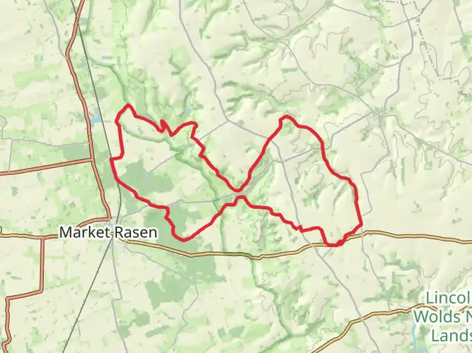
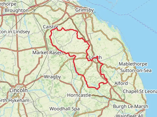
The Caistor Loop via the Viking Way Alt Route is a 43.7 km trail that starts in West Lindsey, Lincolnshire, England. Based on our data, the hike is graded as Easy. For information on how we grade trails, please read measuring the difficulty of a hiking trail on hiiker. Also, check our latest community posts for trail updates. This hike can be completed in approx 2 days. Caution is advised on trail times as this depends on multiple variables. For more info read about how we calculate hike time.

What to expect?
Frequently asked questions
How long does the Caistor Loop via the Viking Way Alt Route take to hike?
The Caistor Loop via the Viking Way Alt Route is 43.69 km with 697 m of climbing, so it is usually treated as a 2 to 3 day walk rather than a short day hike. A practical split is about 22.3 km on the first day, with the route staying in the Caistor and Walesby area of Lincolnshire before returning to the start.
Is the Caistor Loop via the Viking Way Alt Route hard?
The Caistor Loop via the Viking Way Alt Route is graded Easy, but it is still a substantial outing at 43.69 km. The total ascent is 697 m, so the challenge comes more from the overall distance and time on foot than from steep mountain terrain.
Where does the Caistor Loop via the Viking Way Alt Route start and finish?
The loop starts and finishes in the Caistor area of West Lindsey, Lincolnshire, on the Viking Way network in the Lincolnshire Wolds. Stage information places the route around LN7 6UF to LN7 6UE, which puts the walk close to central Caistor and makes it practical as a circular multi-day route.
Can the Caistor Loop via the Viking Way Alt Route be done as a weekend hike?
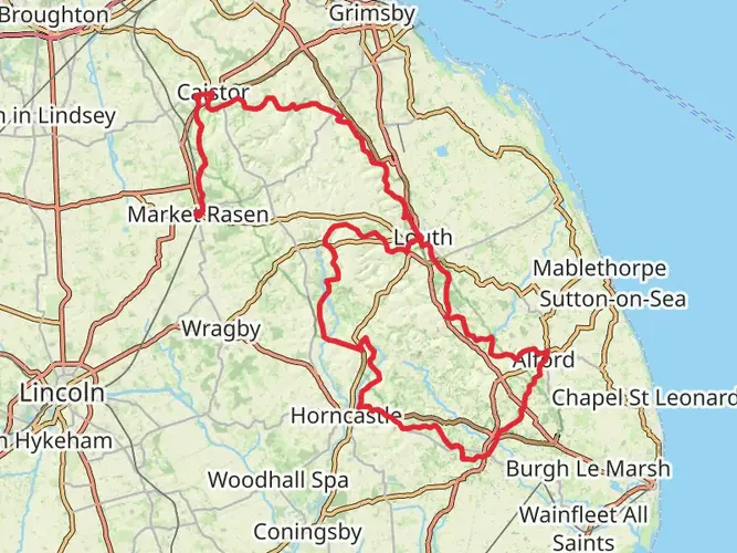
Yes. At 43.69 km, the Caistor Loop via the Viking Way Alt Route fits well into a weekend itinerary for most walkers. The route is commonly estimated at roughly 2 days overall, with one stage listed at 22.3 km and another longer option of about 30.2 km, so an overnight stop near the middle works well.
Is the Caistor Loop via the Viking Way Alt Route dog friendly?
Dogs are commonly taken on sections of the Viking Way in Lincolnshire, and nearby promoted Viking Way walks around Caistor are described as dog friendly. Conditions can still change on public rights of way, especially where fields contain livestock, so control is important on farmland sections in the Wolds.
Are there any closures or access issues on the Caistor Loop via the Viking Way Alt Route?
The Caistor and Nettleton section of the Viking Way had improvement works and a temporary closure in 2025, but Lincolnshire County Council reported that the new path and crossing were completed early and reopened. As with any rights of way route in Lincolnshire, temporary closures can still happen, so current access should be checked before setting out.
What kind of scenery is on the Caistor Loop via the Viking Way Alt Route?
The Caistor Loop via the Viking Way Alt Route runs through the Lincolnshire Wolds, an area known for rolling chalk hills, open farmland, woodland patches, and broad escarpment views. The Caistor to Tealby stretch of the Viking Way is especially noted for high ground and wide scenery, which helps explain the route’s steady 697 m of ascent.
Comments and Reviews
User comments, reviews and discussions about the Caistor Loop via the Viking Way Alt Route, England.
4.0
average rating out of 5
1 rating(s)