Download
Preview
Add to list
More
53.3 km
~3 days
183 m
Multi-Day
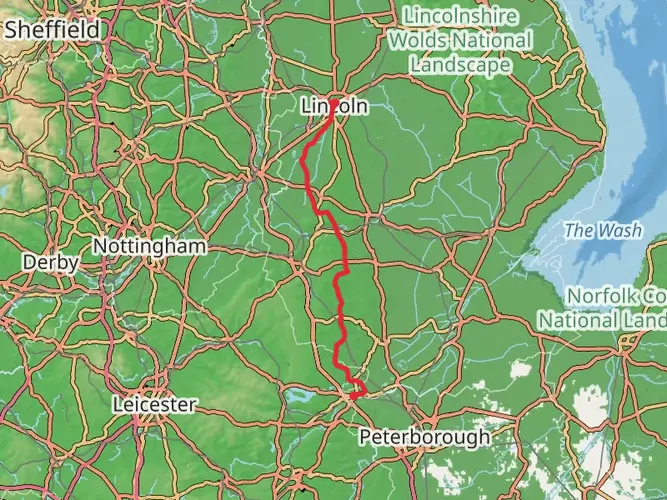
The Water Rail Way is a 53.3 km trail that starts in Lincoln, Lincolnshire, England. Based on our data, the hike is graded as Easy. For information on how we grade trails, please read measuring the difficulty of a hiking trail on hiiker. Also, check our latest community posts for trail updates. This hike can be completed in approx 2 days. Caution is advised on trail times as this depends on multiple variables. For more info read about how we calculate hike time.

What to expect?
Activity types
Frequently asked questions
How long does it take to walk the Water Rail Way in Lincolnshire?
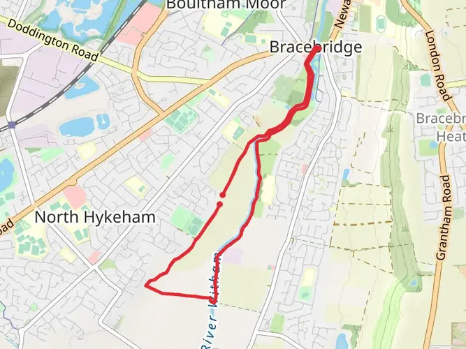
The Water Rail Way is 53.31 km long with only 183 m of climbing, so it is usually tackled as an easy two-day walk rather than a strenuous single-day outing. Its flat profile along the River Witham and former railway line makes steady mileage realistic, with places such as Bardney, Southrey, Kirkstead Bridge, and Boston breaking up the route.
Is the Water Rail Way a difficult walk or is the Water Rail Way suitable for beginners?
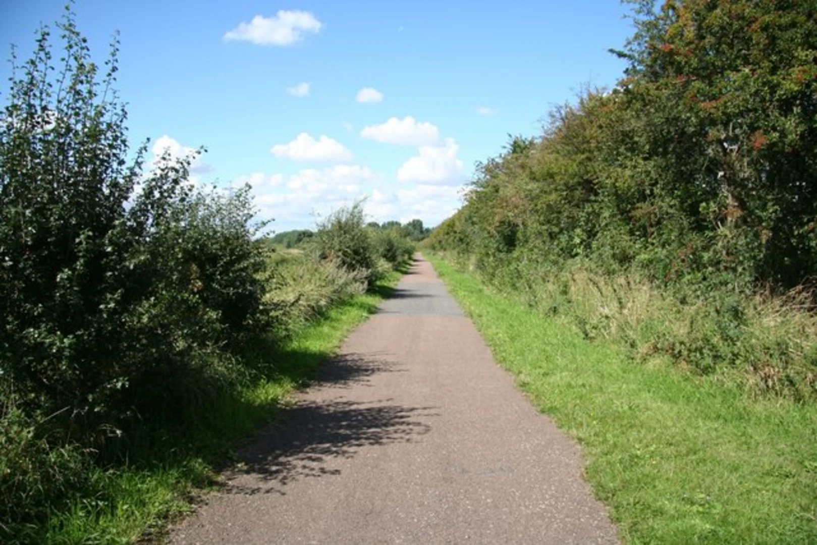
The Water Rail Way is rated easy and gains just 183 m over 53.31 km, which is very gentle for a multi-day route. The route is widely described as flat and almost entirely traffic-free, following the River Witham corridor and the former Lincoln to Boston railway, so the main challenge is distance rather than steep terrain.
What towns and landmarks does the Water Rail Way pass on the way from Lincoln to Boston?
The Water Rail Way starts in Lincoln and follows the River Witham past Washingborough, Bardney, Southrey, Kirkstead Bridge, Langrick Bridge, and on toward Boston. The route is known for wide fenland views, viewing platforms over the river, and a sculpture trail that includes works such as Lincoln Reds, Lincoln Longwool Sheep, and Curly Coat Pigs.
Can the Water Rail Way be done in sections instead of walking the full Water Rail Way?
Yes. The Water Rail Way is well suited to section walking because it is flat, linear, and has several natural break points including Bardney, Southrey, Kirkstead Bridge, and Langrick Bridge. Its easy grade and long traffic-free stretches make shorter out-and-back walks practical without committing to the full 53.31 km from Lincoln to Boston.
Where do most people start the Water Rail Way and is there rail access at the ends of the Water Rail Way?
Most end-to-end outings begin in Lincoln and finish in Boston, since the route links those two towns directly. Lincoln station is on St Marys Street and Boston also has a National Rail station, so both ends are workable for a linear walk without needing a car at the finish.
What is the terrain like on the Water Rail Way and is the Water Rail Way mostly off-road?
The Water Rail Way is a flat route that follows the former Lincoln to Boston railway and the River Witham through the Lincolnshire fens. It is described as almost entirely traffic-free, so it feels more like a long green corridor than a road walk, with open skies, riverside stretches, and straightforward gradients for most of the distance.
Comments and Reviews
User comments, reviews and discussions about the Water Rail Way, England.
4.0
average rating out of 5
1 rating(s)