Download
Preview
Add to list
More
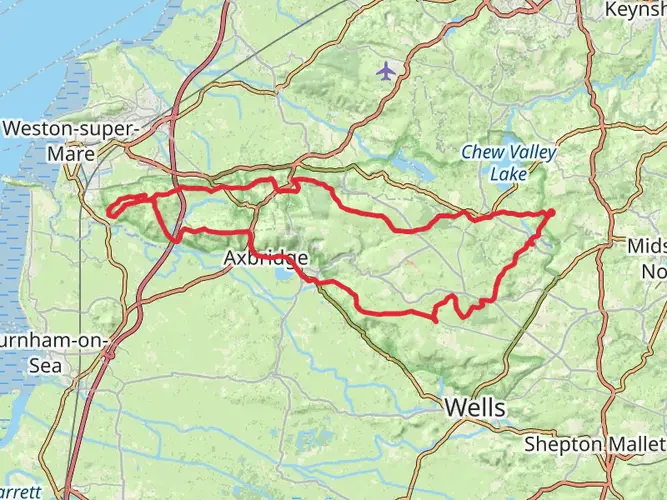
33.5 km
~2 days
389 m
Multi-Day
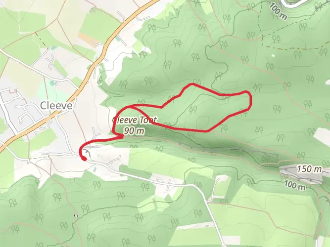
The Two Rivers Way is a 33.5 km trail that starts in , North Somerset, England. Based on our data, the hike is graded as Easy. For information on how we grade trails, please read measuring the difficulty of a hiking trail on hiiker. Also, check our latest community posts for trail updates. This hike can be completed in approx 7 hrs 20 mins. Caution is advised on trail times as this depends on multiple variables. For more info read about how we calculate hike time.

What to expect?
Activity types
Frequently asked questions
How long does the Two Rivers Way take to walk in North Somerset?
The Two Rivers Way is 33.47 km long and is generally treated as a 2-day walk. HiiKER’s estimated moving time is about 7 hours 20 minutes, but most walkers split it into shorter stages to allow for gates, field paths, village stops, and navigation through the Yeo and Chew valleys.
Is the Two Rivers Way an easy walk or a hard hike?
The Two Rivers Way is graded Easy, with 389 m of total elevation gain over 33.47 km. That points to a long but relatively gentle multi-day route rather than a steep hill walk, with the main challenge coming from distance and time on foot rather than sustained climbing.
Where does the Two Rivers Way start and finish in Somerset?
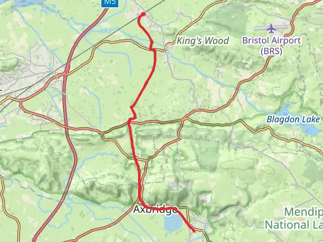
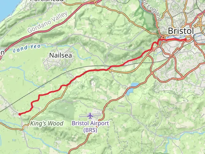
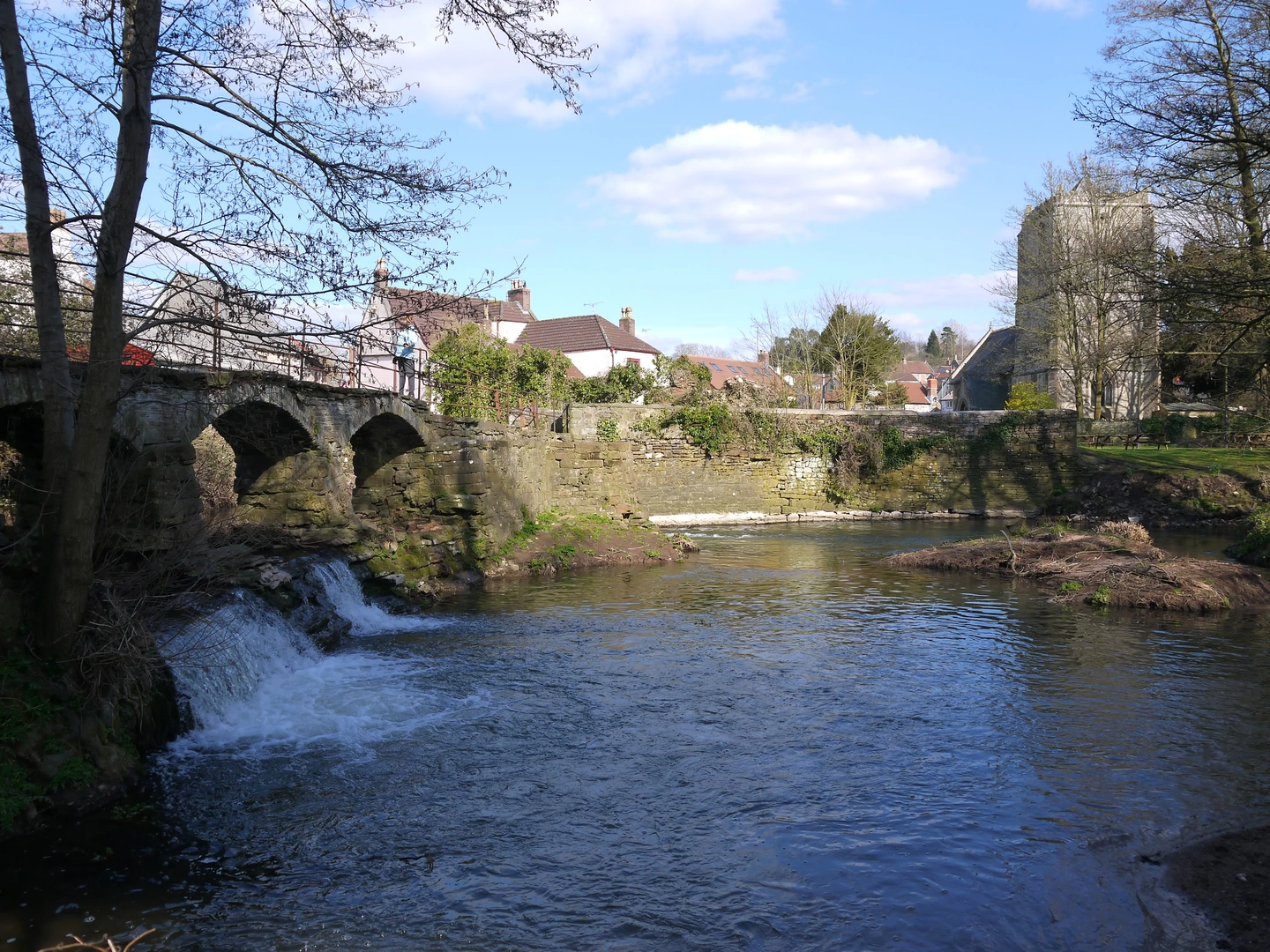
The Two Rivers Way runs between Congresbury and Keynsham in Somerset. The route follows the River Yeo from Congresbury, then continues through the Chew Valley toward Keynsham, where it meets the River Avon and links with the River Avon Trail.
What towns and villages does the Two Rivers Way pass through?
The Two Rivers Way passes through a string of Somerset settlements including Congresbury, Chew Stoke, Chew Magna, Compton Dando, and Keynsham. That makes it practical for breaking the walk into sections, with several points where road access and village facilities are closer to the route.
Is the Two Rivers Way good for a 2-day walk?
Yes. At 33.47 km with 389 m of ascent, the Two Rivers Way is well suited to a 2-day itinerary. The route is long enough to feel like a proper short break, but its easy grading and valley-based line make it more manageable than many upland multi-day trails of similar length.
What kind of scenery can hikers expect on the Two Rivers Way?
The Two Rivers Way follows river landscapes through North Somerset, linking the River Yeo, the River Chew, and finally the River Avon at Keynsham. Walkers can expect lowland countryside, farmland, riverside sections, bridges, and historic villages rather than exposed moorland or mountain terrain.
Comments and Reviews
User comments, reviews and discussions about the Two Rivers Way, England.
5.0
average rating out of 5
1 rating(s)