Download
3D Flyover
Add to list
More
15.3 km
~3 hrs 39 min
357 m
Loop
“A windswept moorland ridge and peaceful riverside dale make this loop varied, vivid and quietly stirring.”
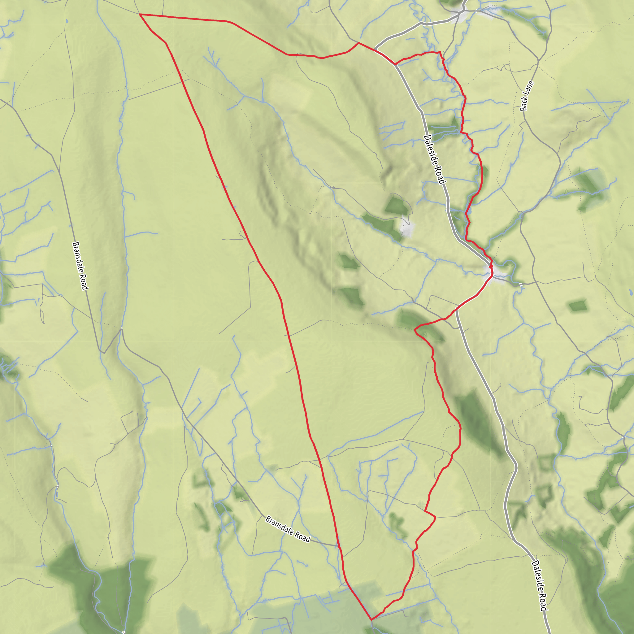
This medium-grade loop in the North York Moors combines a long, airy ridge walk with a gentler return through Farndale, giving you a varied day of around 15 km / 9.3 miles with roughly 400 m / 1,312 ft of ascent. The route is usually associated with Low Mill in Farndale, where the nearest practical start point is Low Mill Car Park, Daleside Road, Farndale, Kirkbymoorside, North Yorkshire YO62 7UY. That car park has public toilets, and the National Park notes that spaces are very limited during wild daffodil season. (northyorkmoors.org.uk)
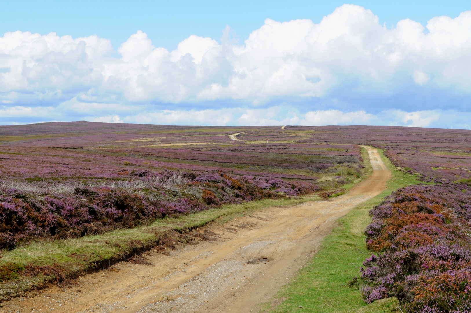
The character of the walk changes noticeably as you go. The lower valley section is pastoral and sheltered, with riverside meadows, woodland and stone farmsteads, while the upper section on Rudland Rigg is broad, exposed and open to wind from every direction. Although the overall difficulty is moderate, the route feels harder in poor weather because the ridge is high, open and committing, with long stretches where there is little shelter. Expect a mix of minor lanes, farm tracks, moorland paths and riverside footpaths, with some steeper climbing on the way up to the rigg and a sustained descent back toward Farndale. (yorkshiremoors.co.uk)
Most walkers begin from Low Mill and head out through the dale before climbing toward Monket House and Dickon Howe, then joining the long ridge of Rudland Rigg. Another commonly described variation climbs the ridge earlier from Low Mill and returns by the River Dove, but either way the same landscape themes appear: a steepening pull onto open moor, a long high-level traverse, then a quieter finish beside the river. If you are planning the route in detail, it is worth checking the line carefully in HiiKER, especially around junctions on the moor where multiple tracks can split away across the heather. (yorkshiremoors.co.uk)
What the route feels like on the ground
From the valley floor, the first few kilometres are usually the easiest underfoot. Around Low Mill and the River Dove, the walking is straightforward and scenic, with stone buildings, pasture and wooded edges softening the landscape. Once you begin the climb toward Monket House and Dickon Howe, the route becomes more serious. The ascent is not alpine-steep, but it is enough to raise the heart rate, and in wet conditions the ground can be greasy on field paths and moorland approaches. One source describing the nearby line from Monket House notes about 400 ft / 122 m of climbing just from that point up onto the moor, which gives a good sense of how abruptly the valley side rises. (nydwalks.co.uk)
On Rudland Rigg itself, the walking becomes more rhythmic. The ridge is long and elevated, with wide views into Farndale and Bransdale and south toward the Tabular Hills. The gradient eases compared with the initial climb, but the exposure increases. In clear weather this is one of the great strengths of the route; in mist, it is where good navigation matters most. The trig point on Rudland Rigg sits at about 376 m / 1,234 ft, and the broader ridge reaches a little over 400 m / 1,312 ft in places, so even though this is not a mountain walk, it has a distinctly upland feel. (yorkshiremoors.co.uk)
The descent back toward Low Mill and the riverside return are often the most relaxed part of the day. The path near High Mill and Low Mill follows the River Dove through meadows and woodland, and this section is especially popular in spring when the famous Farndale wild daffodils are in bloom, usually from mid-March to mid-April depending on conditions. That popularity is worth planning around: roads are narrow, parking fills quickly, and the valley can be much busier than the moor above. (visitnorthyorkshire.com)
Landmarks, history and landscape interest
Dickon Howe is one of the route’s most evocative names, and the word “howe” in this landscape usually points to a mound or barrow. This part of the North York Moors is rich in prehistoric remains, and the old routeways across the moor are closely associated with Bronze Age burial monuments. Sources describing the Rudland Rigg area mention barrows such as the Three Howes, Dickon Howe, Golden Heights and Cockan Cross, showing that this is not just a scenic ridge but an ancient ceremonial and travel landscape.
Surfaces
Gravel
Paved
Dirt
Asphalt
Grass
Unknown
Comments and Reviews
User comments, reviews and discussions about the Dickon Howe, Rudland Rigg and Low Mill Loop, England.
average rating out of 5
0 rating(s)
