Download
Preview
Add to list
More
86.7 km
~5 days
2095 m
Multi-Day
“Embark on the Nidderdale Way, a scenic and historic 54-mile Yorkshire hike with diverse landscapes and wildlife.”
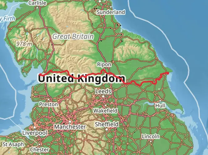
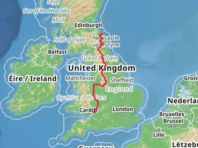
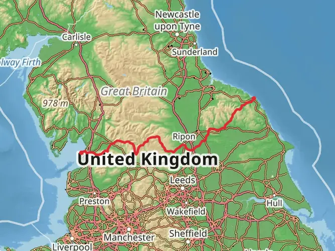
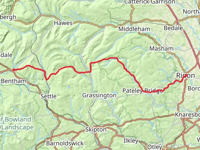
The Nidderdale Way is a captivating loop trail that meanders through the heart of the Yorkshire Dales, an Area of Outstanding Natural Beauty. Spanning approximately 87 kilometers (54 miles) with an elevation gain of around 2000 meters (6562 feet), this trail offers a medium difficulty rating, making it accessible to hikers with a reasonable level of fitness.
Starting near the quaint village of Pateley Bridge in North Yorkshire, England, the trail head can be reached by public transport with buses running from Harrogate, which is well-connected by train from major cities. For those driving, Pateley Bridge offers parking facilities from which the trail can be directly accessed.
Navigating the Trail
As you embark on the Nidderdale Way, you'll find that the trail is well-marked, but carrying a reliable navigation tool like HiiKER is advisable to keep track of your progress and ensure you don't miss any of the fascinating detours or landmarks along the way.
Landmarks and Natural Beauty
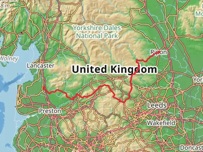
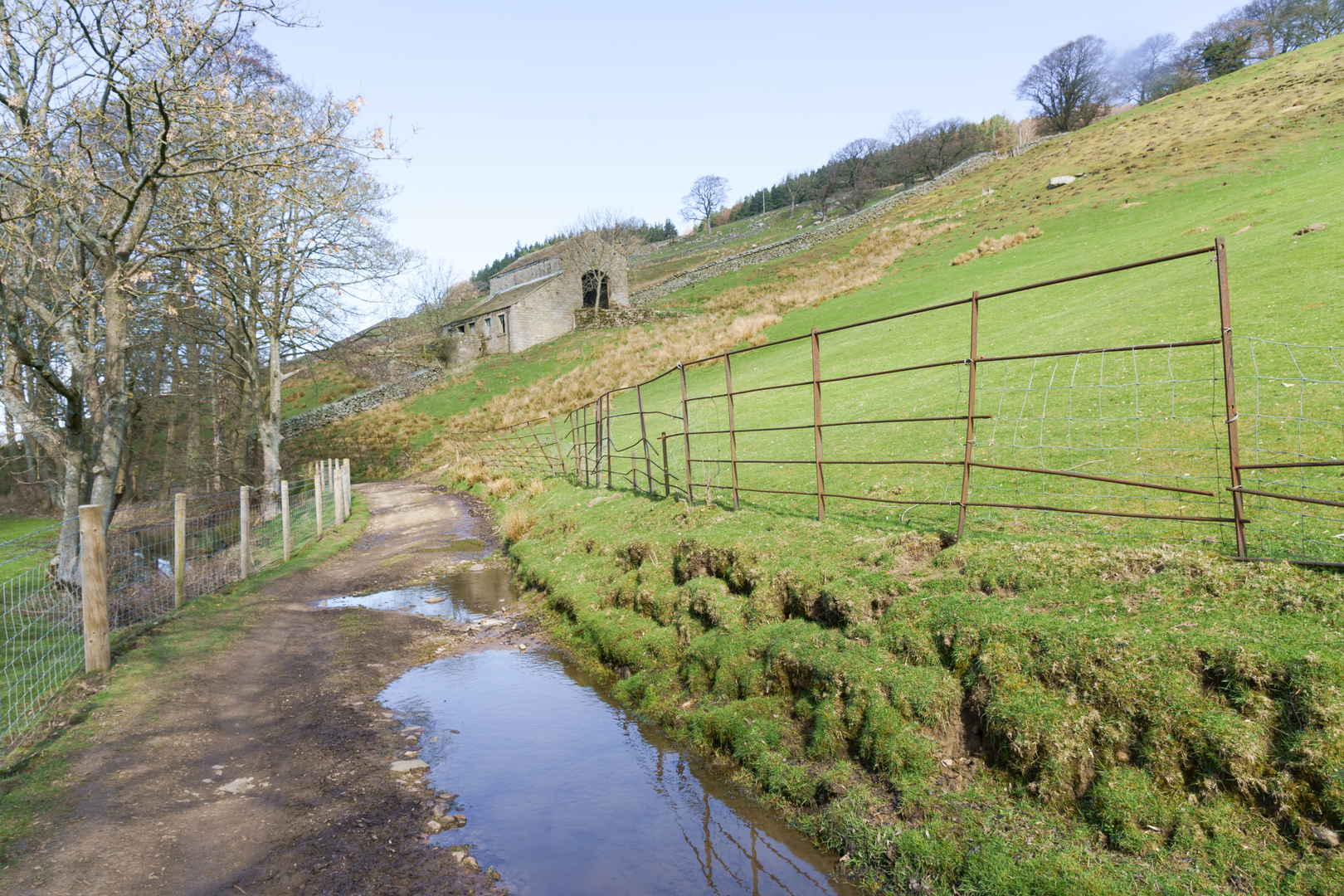
The trail takes you through a variety of landscapes, from the lush riverbanks of the River Nidd to the sweeping moorlands that offer panoramic views of the valley. You'll encounter the charming village of Lofthouse, a perfect spot to rest and perhaps enjoy a traditional Yorkshire tea.
Further along, the trail passes through the dramatic How Stean Gorge, a limestone ravine that is a natural spectacle not to be missed. Here, the trail can be quite rugged, so careful footing is necessary.
Wildlife and Flora
Nature enthusiasts will appreciate the diverse wildlife and flora throughout the Nidderdale Way. The area is home to a variety of bird species, including curlews and red kites, which can often be seen soaring above the moorlands. The heather-clad moors themselves are a sight to behold, especially when they bloom into a sea of purple in late summer.
Historical Significance
The region is steeped in history, with evidence of ancient settlements and industrial heritage. You'll pass by remnants of the area's lead mining past and might even spot the ruins of old peat stores. The trail also features historic landmarks such as Ripley Castle, near the village of Ripley, which is a short detour from the main path.
Preparation and Planning
Hikers should be prepared for the unpredictable Yorkshire weather by packing waterproof gear and dressing in layers. The trail can be completed in sections or as a multi-day hike, with accommodation options available in the villages along the route. It's recommended to plan your stops in advance, especially during peak seasons.
Access to the Trail
To reach the start of the trail, public transport users can take a bus from Harrogate to Pateley Bridge. For those driving, Pateley Bridge is situated off the B6265, and parking is available in the town center. The trail is circular, so you will finish your hike where you started, making the return journey convenient.
Remember to respect the natural environment and the local communities you pass through, leaving no trace and taking only memories. The Nidderdale Way is a journey through some of Yorkshire's most enchanting landscapes, rich in history and natural beauty, promising an unforgettable hiking experience.

What to expect?
Activity types
Frequently asked questions
How long does it take to walk the Nidderdale Way?
The Nidderdale Way is 86.67 km, or about 54 miles, with 2,095 m of climbing, so most walkers split it over 4 days. A common breakdown is Pateley Bridge to Middlesmoor, Middlesmoor to Bewerley, Bewerley to Ripley, and Ripley back to Pateley Bridge.
Where does the Nidderdale Way start and finish?
The Nidderdale Way is a circular long-distance trail that starts and finishes in Pateley Bridge in North Yorkshire. From there it loops through upper Nidderdale past places including Lofthouse, Scar House Reservoir, Middlesmoor, Bewerley, Ripley, Darley, and Hampsthwaite before returning to the same town.
Can you get to the Nidderdale Way by public transport from Harrogate?
Yes. Pateley Bridge, the usual start point for the Nidderdale Way, is served year-round by Harrogate Bus Company route 24 from Harrogate. In the summer season, additional DalesBus services also reach Pateley Bridge and parts of Nidderdale including Ramsgill, Lofthouse, and Scar House.
What are the main landmarks on the Nidderdale Way?
The Nidderdale Way follows the River Nidd for long stretches and passes major landmarks including Gouthwaite Reservoir, Scar House Reservoir, Middlesmoor, Ramsgill, Bewerley, and Ripley Castle. One of the best-known natural features near the route is How Stean Gorge in upper Nidderdale, close to Lofthouse and Middlesmoor.
Is the Nidderdale Way difficult?
The Nidderdale Way is generally considered an easier long-distance walk, but the full circuit still covers 86.67 km with 2,095 m of ascent. The toughest ground is usually in the upper dale around Scar House Reservoir, Middlesmoor, and the moorland sections, where the trail is hillier and more exposed.
Is the Nidderdale Way good for a multi-day walk?
Yes. The Nidderdale Way is designed as a multi-day circular route and is commonly walked in four back-to-back stages. Because it returns to Pateley Bridge, it works well for hikers who want a long route without arranging transport at a separate finish point.
What towns and villages does the Nidderdale Way pass through?
The Nidderdale Way links a string of Nidderdale settlements, including Pateley Bridge, Wath, Bouthwaite, Lofthouse, Middlesmoor, Ramsgill, Bewerley, Darley, Hampsthwaite, and Ripley. That makes it easier to break the walk into shorter sections and reach services at several points around the loop.
Comments and Reviews
User comments, reviews and discussions about the Nidderdale Way, England.
4.5
average rating out of 5
8 rating(s)