Download
Preview
Add to list
More
171.9 km
~11 days
6608 m
Multi-Day
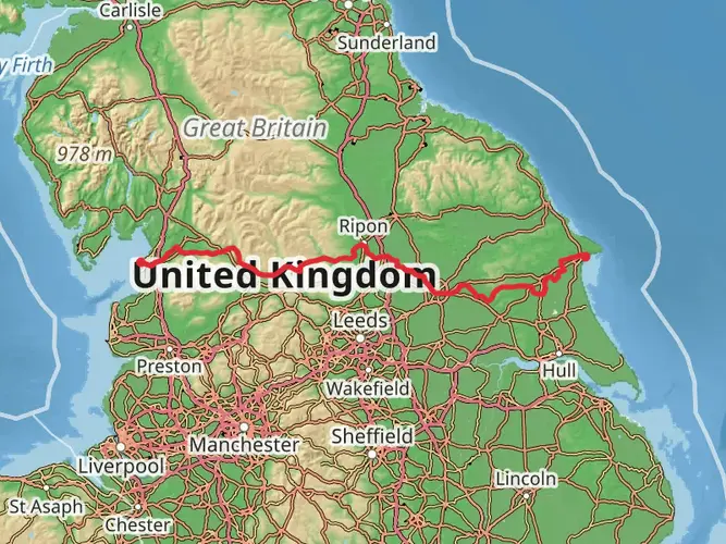
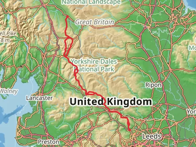
The Settle to Carlisle Walk is a 171.9 km trail that starts in Craven, North Yorkshire, England. Based on our data, the hike is graded as Difficult. For information on how we grade trails, please read measuring the difficulty of a hiking trail on hiiker. Also, check our latest community posts for trail updates. This hike can be completed in approx 8 days. Caution is advised on trail times as this depends on multiple variables. For more info read about how we calculate hike time.

What to expect?
Activity types
Frequently asked questions
How long is the Settle to Carlisle Walk and how many days does the Settle to Carlisle Walk take?
The Settle to Carlisle Walk is 171.92 km long with 6,608 m of total ascent, so it is firmly a multi-day route rather than a weekend walk. Most hikers split a route of this length and difficulty into about 8 to 12 days, depending on pace, weather, and how much time is spent around stations and viaduct viewpoints along the way.
Where does the Settle to Carlisle Walk start and finish?
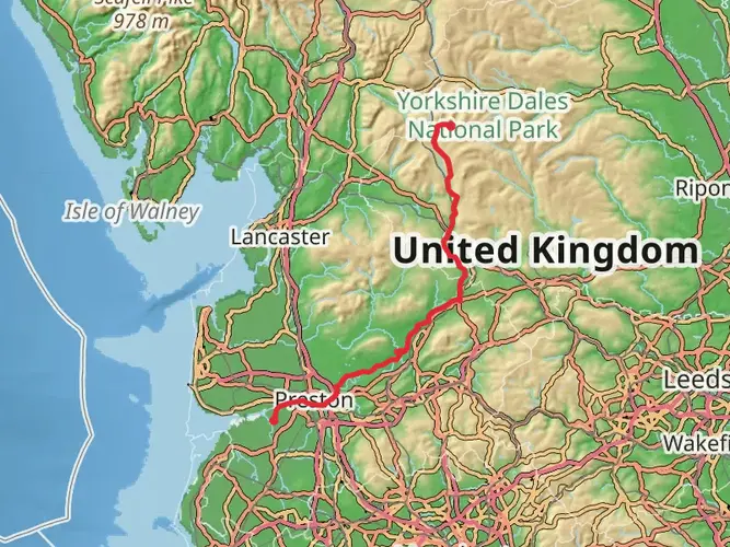
The Settle to Carlisle Walk begins in the Settle area, with the staged route starting at Giggleswick in North Yorkshire, and it finishes in Carlisle. The walk broadly follows the corridor of the famous Settle-Carlisle railway north through the Yorkshire Dales and onward into Cumbria.
What are the main landmarks on the Settle to Carlisle Walk?
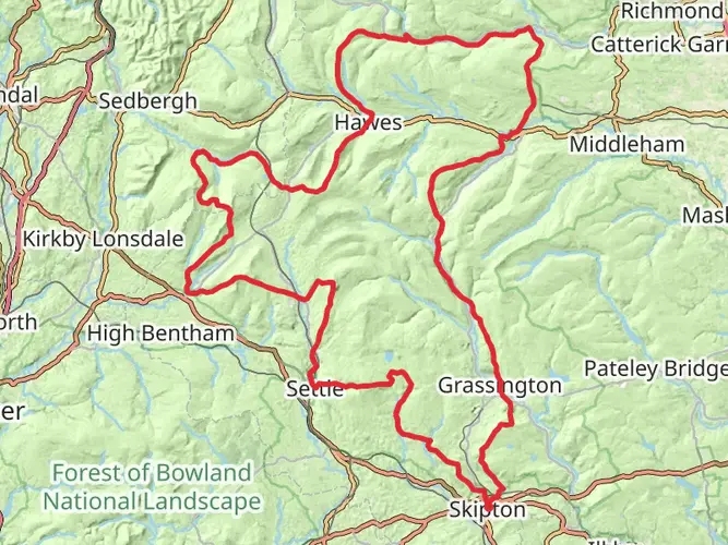
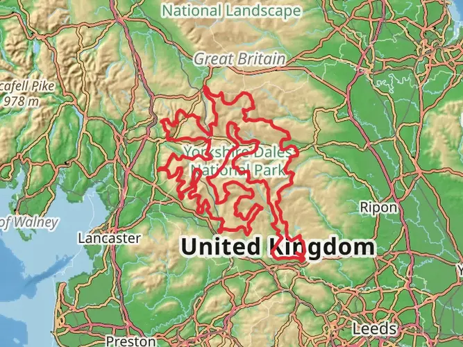
The best-known landmark on the Settle to Carlisle Walk is Ribblehead Viaduct, the dramatic 24-arch railway viaduct in the Ribblehead area. The route also follows the wider Settle-Carlisle railway corridor through classic Pennine scenery, passing places linked with stations such as Dent, Garsdale, Kirkby Stephen, Appleby, and Armathwaite before reaching Carlisle.
Is the Settle to Carlisle Walk difficult?
Yes, the Settle to Carlisle Walk is a difficult long-distance hike. Its 171.92 km length and 6,608 m of climbing make it a demanding route that suits experienced hikers who are comfortable with repeated ascent and descent over many days in exposed northern upland terrain.
Can the Settle to Carlisle Walk be done using the train for access or shorter sections?
Yes. One of the practical advantages of the Settle to Carlisle Walk is that it follows the Settle-Carlisle railway corridor, so rail access is available at or near places including Settle, Ribblehead, Dent, Garsdale, Kirkby Stephen, Appleby, Armathwaite, and Carlisle. That makes it realistic to hike the route in shorter sections as well as in one continuous trip.
What kind of scenery does the Settle to Carlisle Walk pass through?
The Settle to Carlisle Walk crosses some of northern England’s most dramatic upland country, following the railway line through the Yorkshire Dales and the North Pennines before descending toward Carlisle. Expect limestone country near Settle, big open moorland around Ribblehead and Ais Gill, major Victorian railway structures, and long valley views through places such as Ribblesdale and the Eden Valley.
Comments and Reviews
User comments, reviews and discussions about the Settle to Carlisle Walk, England.
5.0
average rating out of 5
1 rating(s)