Download
Preview
Add to list
More
181.2 km
~9 days
1137 m
Multi-Day
“Embark on the Nene Way, an enchanting trek through England's historical landscapes and vibrant wildlife.”
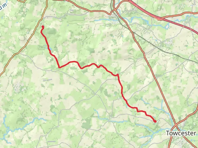
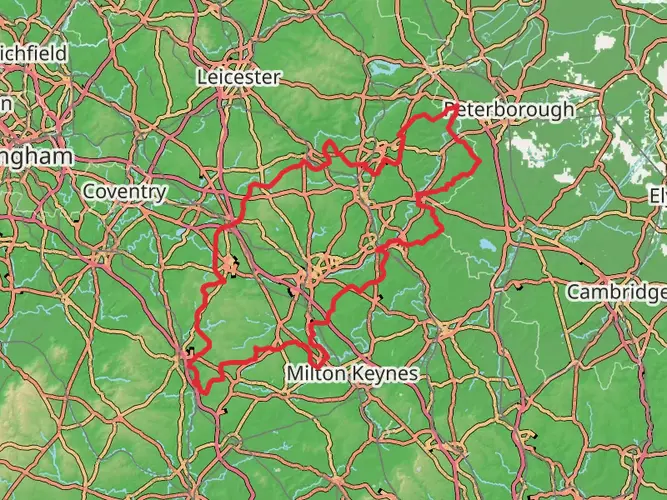
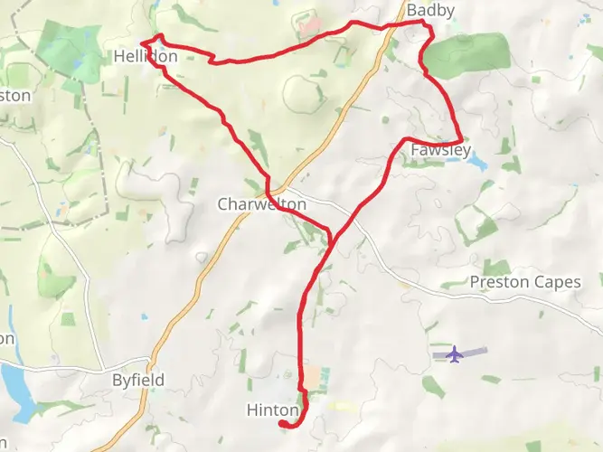
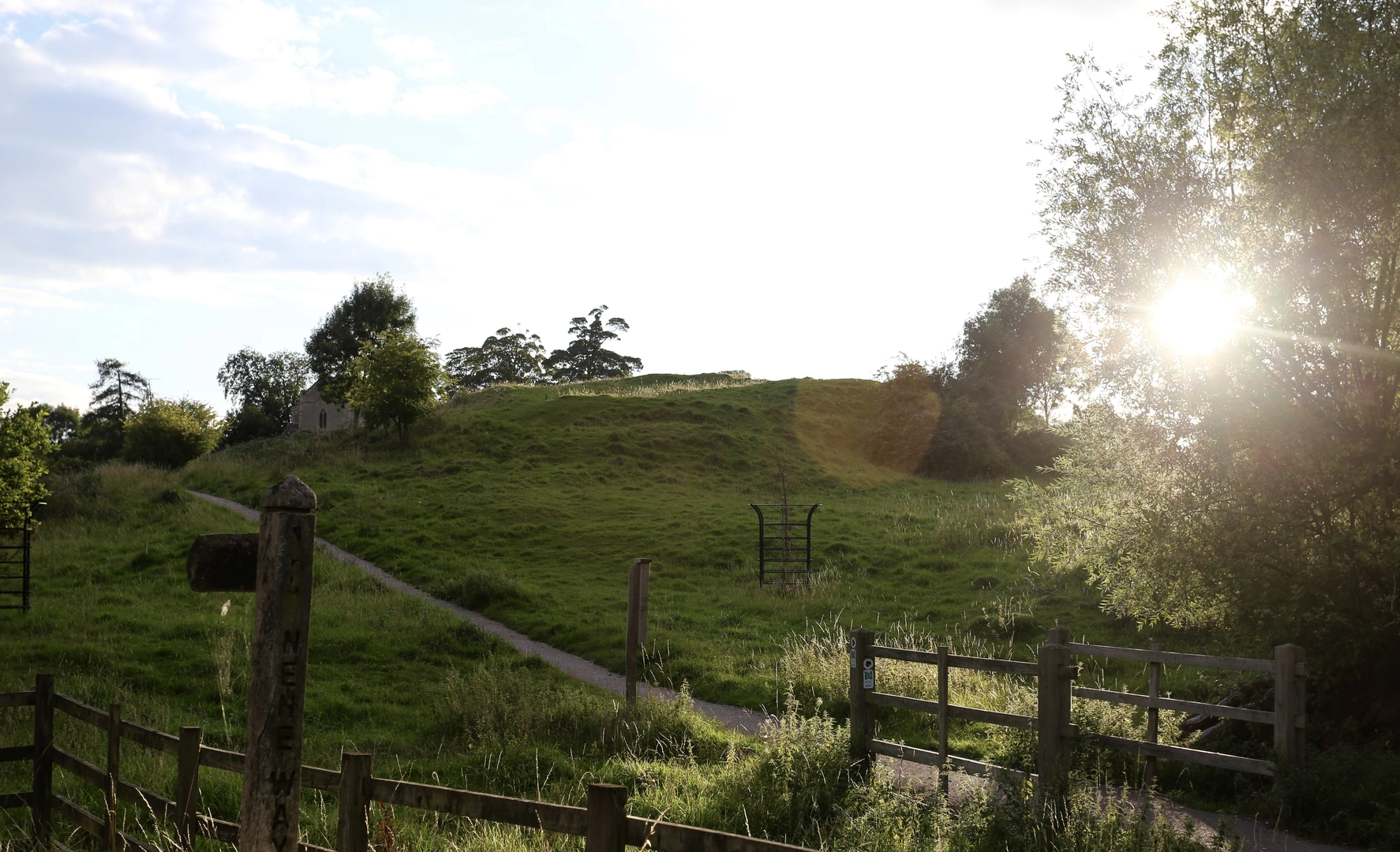
The Nene Way is a captivating long-distance footpath that meanders alongside the River Nene, starting near the historic town of Badby in Northamptonshire, England, and concluding at the Wash near Sutton Bridge in Lincolnshire. Covering approximately 181 kilometers (about 112 miles) and with an elevation gain of around 1100 meters (approximately 3600 feet), this trail offers a medium difficulty level, making it accessible to hikers with a reasonable level of fitness.
Getting to the Trailhead
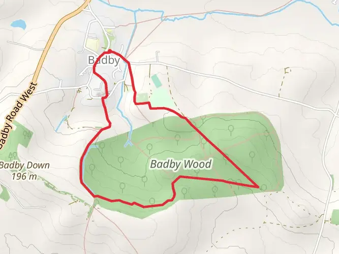
To reach the starting point of the Nene Way, hikers can use public transport or drive. The nearest significant landmark to the trailhead is Badby, which is well-connected by local bus services. For those driving, parking is available in the vicinity of Badby, from where you can begin your journey on foot.
Navigating the Trail
The Nene Way is well-marked with distinctive signs featuring the name of the trail, ensuring hikers can follow the route without difficulty. For additional navigation support, the HiiKER app provides detailed maps and GPS coordinates to keep you on the right path.
Historical Significance and Landmarks
As you embark on the Nene Way, you'll be walking through a region steeped in history. The trail passes through several villages and towns, each with its own unique heritage. Notable historical landmarks include the ancient market town of Oundle, with its beautiful limestone buildings, and Fotheringhay Castle, the birthplace of Richard III and the site of Mary, Queen of Scots' execution.
Natural Beauty and Wildlife
The Nene Way offers a rich tapestry of English countryside, with rolling meadows, quiet woodlands, and serene wetlands. The trail provides an excellent opportunity to observe a variety of wildlife, especially bird species such as kingfishers, herons, and birds of prey. The river itself is a haven for fish, and you may spot otters playing in the water if you're lucky.
Trail Sections and Terrain
The terrain varies along the Nene Way, from flat and gentle sections alongside the river to slightly more challenging undulating landscapes as you move away from the riverbank. The trail can be broken down into manageable sections, allowing hikers to tackle it in stages. For example, the stretch from Badby to the historic town of Wellingborough covers about 48 kilometers (30 miles), while the segment from Wellingborough to Peterborough spans roughly 64 kilometers (40 miles).
Preparation and Safety
Hikers should prepare for a variety of weather conditions, as the English climate can be unpredictable. Waterproof gear and sturdy hiking boots are recommended. It's also wise to carry a first-aid kit, sufficient water, and snacks. Always inform someone of your hiking plans and expected return time, especially when tackling longer sections of the trail.
Conclusion
The Nene Way is a trail that offers more than just a walk; it's an exploration of England's heartland, its history, and the natural beauty that abounds along the River Nene. Whether you're seeking a leisurely day hike or the challenge of completing the entire trail, the Nene Way is a journey that will leave you with lasting memories.

What to expect?
Activity types
Frequently asked questions
How long is the Nene Way and how many days does it usually take to walk?
The Nene Way is 181.24 km long, or about 112.6 miles, so it is firmly a multi-day walk rather than a day hike. Many walkers break it into roughly 8 to 12 days depending on pace, overnight stops, and whether they walk the full route from Badby to Sutton Bridge or only a section.
Where does the Nene Way start and finish?
The Nene Way starts at Badby in Northamptonshire and follows the River Nene east to Sutton Bridge in Lincolnshire, where the river reaches the Wash. Along the way it passes through places including Northampton, Thrapston, Oundle, Peterborough, Whittlesey, and Wisbech.
Is the Nene Way difficult?
The Nene Way is generally rated easy, with 1,137 m of total elevation gain spread over its full 181.24 km length. That means it is more of an endurance walk than a steep mountain route, with the challenge coming from distance, repeated daily mileage, and mixed riverside and farmland terrain rather than big climbs.
Is the Nene Way waymarked and easy to follow?
The Nene Way is a waymarked long-distance footpath and is generally straightforward to follow because it tracks the River Nene for much of its course. Navigation is usually simplest on the riverside stretches near Northampton, Oundle, and Peterborough, though attention is still needed through towns, field paths, and road crossings.
What towns and landmarks does the Nene Way pass on the route?
The Nene Way passes a long list of well-known Nene Valley places, including Northampton, Thrapston, Oundle, Fotheringhay, Wansford, Peterborough, Whittlesey, Wisbech, and Sutton Bridge. Notable highlights on or near the route include the River Nene itself, the historic village of Fotheringhay, and the broad fenland landscapes east of Peterborough.
Can the Nene Way be walked in sections?
Yes. The Nene Way is commonly divided into shorter sections, and published stage breakdowns include stretches such as Badby to Kislingbury, Cogenhoe to Irthlingborough, and Barnwell to Wansford. That makes it practical for day walks as well as a full end-to-end trip across Northamptonshire, Cambridgeshire, and Lincolnshire.
Is the Nene Way dog friendly?
The Nene Way uses public footpaths through open countryside, riverside meadows, and farmland, so dogs are usually possible on many sections. The main limitation is livestock and field access: dogs need close control, especially around grazing animals, and some stiles or gates can make certain stretches less convenient than a simple park walk.
Comments and Reviews
User comments, reviews and discussions about the Nene Way, England.
5.0
average rating out of 5
3 rating(s)