Download
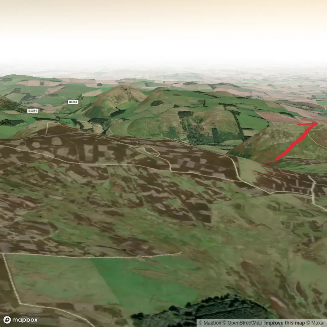
3D Flyover
Add to list
More
10.3 km
~2 hrs 49 min
462 m
Loop
“A windswept Cheviot circuit where grassy ridges, ancient hillforts, and big skies reward prepared walkers.”
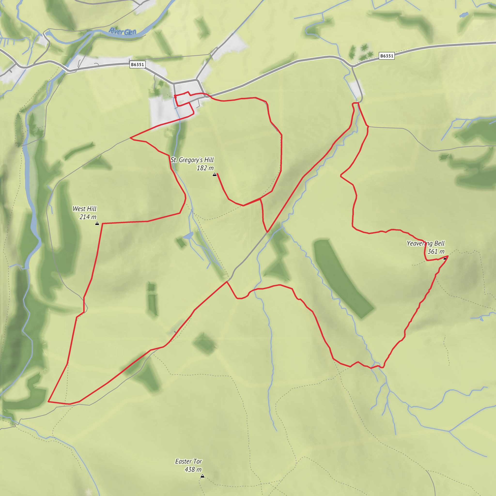
This is a compact but rewarding hill circuit in the northern Cheviots, linking three distinct tops—West Hill, Yeavering Bell, and St Gregory’s Hill—over roughly 10 km / 6.2 miles with about 500 m / 1,640 ft of ascent. Although the distance is modest, the climbing is steady and the ground can feel serious in poor weather, so the “medium” rating is fair: fit walkers will find it very manageable in good conditions, but the exposed ridges, steep grassy slopes, and often windy summit ground mean it deserves proper hillwalking preparation.
The route sits above the Yeavering area in Northumberland, just west of Wooler and close to the B6351 between Wooler and Kirknewton. For the start, the nearest clear landmark is the Gefrin lay-by on the north side of the B6351, just west of Yeavering, beneath the slopes of Yeavering Bell. Northumberland National Park identifies this lay-by as the usual parking point for walks here. (northumberlandnationalpark.org.uk)
By car, Wooler is the most practical nearby service town, and from there it is a short drive west toward Yeavering on the B6351. If using public transport, Wooler is the most realistic hub to aim for first, then continue by local taxi to the lay-by or nearby Yeavering area, as the walk start itself is rural and not at a major transport interchange. The area is quiet, so it is wise to check return options in advance rather than assume a frequent service. For planning the route on the ground, HiiKER is the best tool to use alongside an OS map. (northumberlandnationalpark.org.uk)
The opening section is usually the most deceptive part of the day. From the roadside and lower fields, the hills look broad and grassy rather than dramatic, but the ascent quickly becomes more sustained. Expect farm and access tracks at first, then open hillside paths that can be faint in places depending on the exact line taken. After rain, the turf can be slick, and in mist the rounded shapes of the hills can make direction less obvious than the map suggests. Because the route is only around 10 km / 6.2 miles, many walkers underestimate it; in reality, the 500 m / 1,640 ft of climbing is packed into a relatively short outing.
Terrain and what to expect
West Hill gives an early sense of the character of the walk: open, grassy, airy, and exposed. The gradients are not technical, but they can be steep enough to raise the effort level quickly. Underfoot, expect a mix of cropped grass, sheep paths, occasional rougher sections, and potentially boggier patches in hollows. There is little shelter once you are committed to the higher ground, so windproof layers are important even on otherwise mild days.
The traverse toward Yeavering Bell is one of the highlights. As height is gained, the views widen across the Glen valley and toward the wider Cheviot landscape. On a clear day, this section feels expansive rather than rugged, with long sightlines and a strong sense of space. In poor visibility, however, the broad hilltops can feel featureless, so careful attention to bearings and junctions is useful.
Yeavering Bell itself rises to about 353 m / 1,158 ft and is the dominant landmark of the loop. It is a twin-peaked hill, and the summit area is far more than just a viewpoint: it is enclosed by the remains of a major prehistoric hillfort, the largest in Northumberland National Park. The stone ramparts once stood impressively high and thick, and within the enclosure archaeologists have identified the platforms of more than 100 timber roundhouses as well as an inner fort cut into the rock. (en.wikipedia.org)
From Yeavering Bell, the route on toward St Gregory’s Hill keeps the historical atmosphere going. Historic England records prehistoric enclosures on both West Hill and St Gregory’s Hill, showing that this entire skyline was important in later prehistory, not just the main summit of Yeavering Bell. (historicengland.org.uk)
History on the skyline
This is one of those walks where the landscape is inseparable from its archaeology. Yeavering Bell is best known for its Iron Age hillfort, but the wider area is also tied to the early medieval royal site of Gefrin (Yeavering) in the valley below. Excavations revealed a major Anglo-Saxon royal complex there, including large timber halls and a unique grandstand-like structure, making it one of the most important early medieval sites in Britain. Ad Gefrin notes that the site was identified from aerial photography in 1949 and excavated between 1953 and 1962 by Brian Hope-Taylor.
Comments and Reviews
User comments, reviews and discussions about the West Hill, Yeavering Bell and St Gregory's Hill Loop, England.
average rating out of 5
0 rating(s)
