Download
Preview
Add to list
More
146.5 km
~8 days
2328 m
Multi-Day
“Embark on the Cross Cotswold Pathway for a historic hike through England's rolling hills and charming villages.”
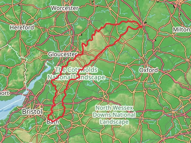
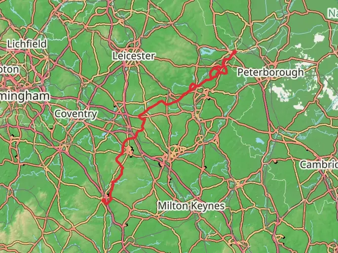
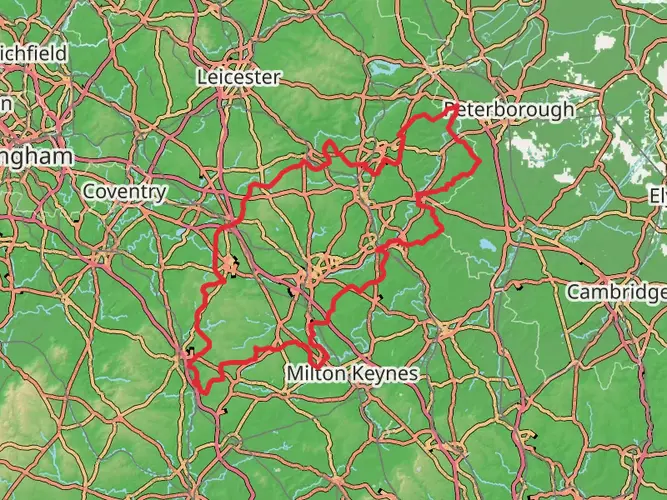
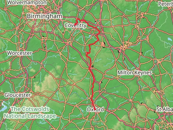
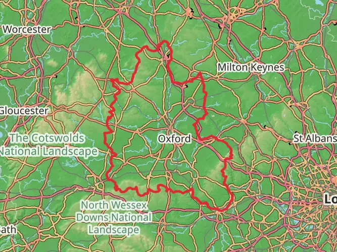
The Cross Cotswold Pathway, specifically the Macmillan Way section, offers hikers a quintessentially English walking experience, traversing the rolling hills and picturesque villages of the Cotswolds. Spanning approximately 147 kilometers (about 91 miles) with an elevation gain of around 2300 meters (approximately 7546 feet), this trail promises diverse landscapes and a moderate challenge suitable for hikers with some experience.
Getting to the Trailhead
The starting point of the trail is accessible from the historic city of Oxford, which is well-connected by public transport. From Oxford, hikers can take a bus or train to the nearby towns within Oxfordshire, where the trailhead is located. For those driving, parking is available in the towns near the starting point. It's advisable to check local parking regulations and fees.
Navigating the Trail
The Cross Cotswold Pathway is well-marked, but carrying a reliable navigation tool like HiiKER is recommended to stay on track and be aware of upcoming waypoints. The trail is a point-to-point route, so planning for transportation back from the end of the trail or arranging a pick-up is essential.
Landmarks and Scenery
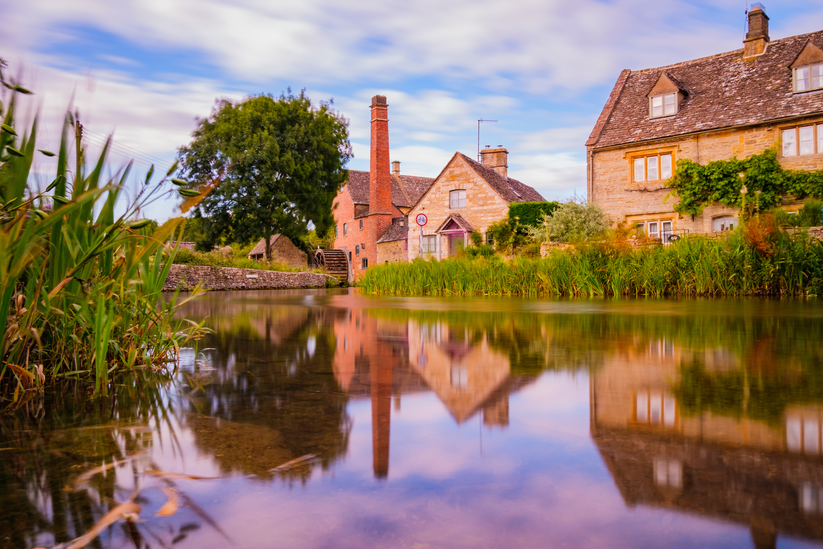
As you embark on the journey, you'll be greeted by the charm of the Cotswolds, known for its distinctive limestone-built villages and lush greenery. The trail meanders through a variety of terrains, including open farmland, woodlands, and river valleys.
One of the early highlights is the passage through the ancient market town of Chipping Norton, a perfect spot to appreciate the region's rich history and perhaps enjoy a rest at a local café. Further along, the trail offers panoramic views from Dover's Hill and passes through Broadway, often referred to as the "Jewel of the Cotswolds."
Wildlife and Nature
The Cotswolds is a haven for wildlife enthusiasts. Keep an eye out for a variety of bird species, including skylarks and buzzards. The hedgerows and woodlands are home to badgers, foxes, and deer. The region's flora is equally impressive, with wildflowers adorning the trail in spring and summer.
Historical Significance
The Cotswolds has a rich tapestry of history, from its Roman and Medieval roots to its prominence in the wool trade during the Middle Ages. Many of the villages and landmarks along the trail have stories to tell, with historical sites such as the Broadway Tower offering insights into the area's past.
Preparation and Planning
Given the trail's length and varied terrain, it's important to prepare adequately. Ensure you have suitable footwear, clothing for changeable weather, and enough food and water. Accommodations along the route range from campsites to bed and breakfasts, so plan according to your preferences and budget.
Seasonal Considerations
The trail can be hiked year-round, but the best conditions are typically from late spring to early autumn when the weather is milder and the days are longer. Always check the weather forecast before setting out and be prepared for the possibility of rain or cooler temperatures, even in summer.
By taking the time to plan and prepare for the Cross Cotswold Pathway, hikers can look forward to an enriching experience that combines natural beauty, wildlife, and a journey through England's storied past.

What to expect?
Activity types
Frequently asked questions
How long does it take to hike the Cross Cotswold Pathway - Macmillan way section?
The Cross Cotswold Pathway - Macmillan way section covers 146.54 km with 2,328 m of climbing, so most walkers split it into about 6 to 10 days. Strong long-distance hikers may move faster, but the point-to-point format from the Banbury area toward Bath usually makes it more practical as a multi-day trip.
Where does the Cross Cotswold Pathway - Macmillan way section start and finish?
This route is generally described as running from Banbury Cross in Oxfordshire west across the Cotswolds to Bath. Along the way it passes places including Broughton, Epwell, Long Compton, Lower Slaughter, Chedworth, Westonbirt, Castle Combe, Slaughterford, Box, Bathford, and Bathampton before reaching Bath.
What kind of scenery is on the Cross Cotswold Pathway - Macmillan way section?
The Cross Cotswold Pathway - Macmillan way section crosses classic Cotswold country, with rolling hills, farmland, woodland, river valleys, and villages built from local limestone. Named places on the route include Broughton, Chastleton, Lower Slaughter, Chedworth, Westonbirt, Castle Combe, and Box, so the scenery changes regularly rather than staying in one landscape type.
Is the Cross Cotswold Pathway - Macmillan way section difficult?
The Cross Cotswold Pathway - Macmillan way section is rated easy overall, but it is still a 146.54 km multi-day walk with 2,328 m of total ascent. That means the challenge comes more from sustained daily mileage and repeated ups and downs across the Cotswold hills than from technical terrain.
Can the Cross Cotswold Pathway - Macmillan way section be done as a multi-day walk?
Yes. The Cross Cotswold Pathway - Macmillan way section is a multi-day point-to-point route, and its length makes an overnight itinerary the normal way to walk it. Villages and small settlements such as Long Compton, Lower Slaughter, Chedworth, Westonbirt, Castle Combe, and Box help break the route into manageable stages across Oxfordshire, Gloucestershire, Wiltshire, and into Bath.
What are some highlights on the Cross Cotswold Pathway - Macmillan way section?
Highlights on the Cross Cotswold Pathway - Macmillan way section include the early passage near Broughton Castle, the run through villages such as Epwell and Long Compton, and later classic Cotswold stops including Lower Slaughter, Chedworth, Westonbirt, Castle Combe, and Box. The route is known for linking a long chain of historic villages rather than focusing on one summit or single landmark.
Comments and Reviews
User comments, reviews and discussions about the Cross Cotswold Pathway - Macmillan way section, England.
5.0
average rating out of 5
5 rating(s)