Download
Preview
Add to list
More
278.5 km
~14 days
2811 m
Multi-Day
“Journey through history and nature on the Roman Way, a medium-difficulty hike revealing England's ancient roots and bucolic landscapes.”
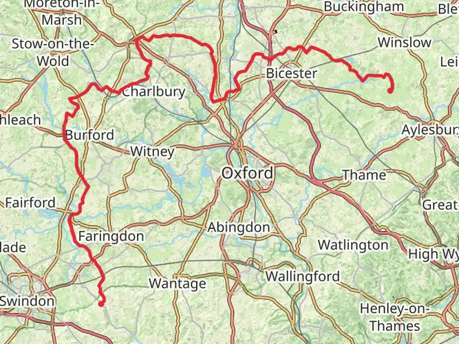
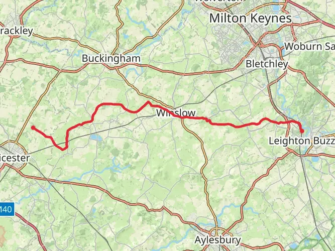
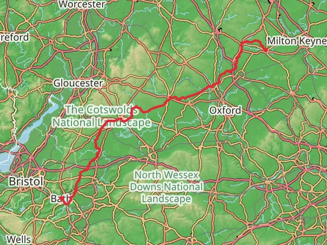
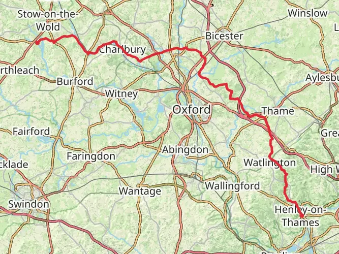
Embarking on the Roman Way, hikers will traverse approximately 279 kilometers (173 miles) of varied landscapes, starting near the historical Oxfordshire, England. This point-to-point trail, with an elevation gain of around 2800 meters (9186 feet), is steeped in history and offers a medium difficulty rating, making it accessible to hikers with a reasonable level of fitness.
Getting to the Trailhead
The trailhead is conveniently located near Oxfordshire, and hikers can reach this starting point by either public transport or car. For those opting for public transport, there are regular bus and train services to Oxford, from where local buses can take you closer to the trailhead. If driving, parking is available in the vicinity of the starting point, which is typically near the village of Chipping Norton.
Historical Significance
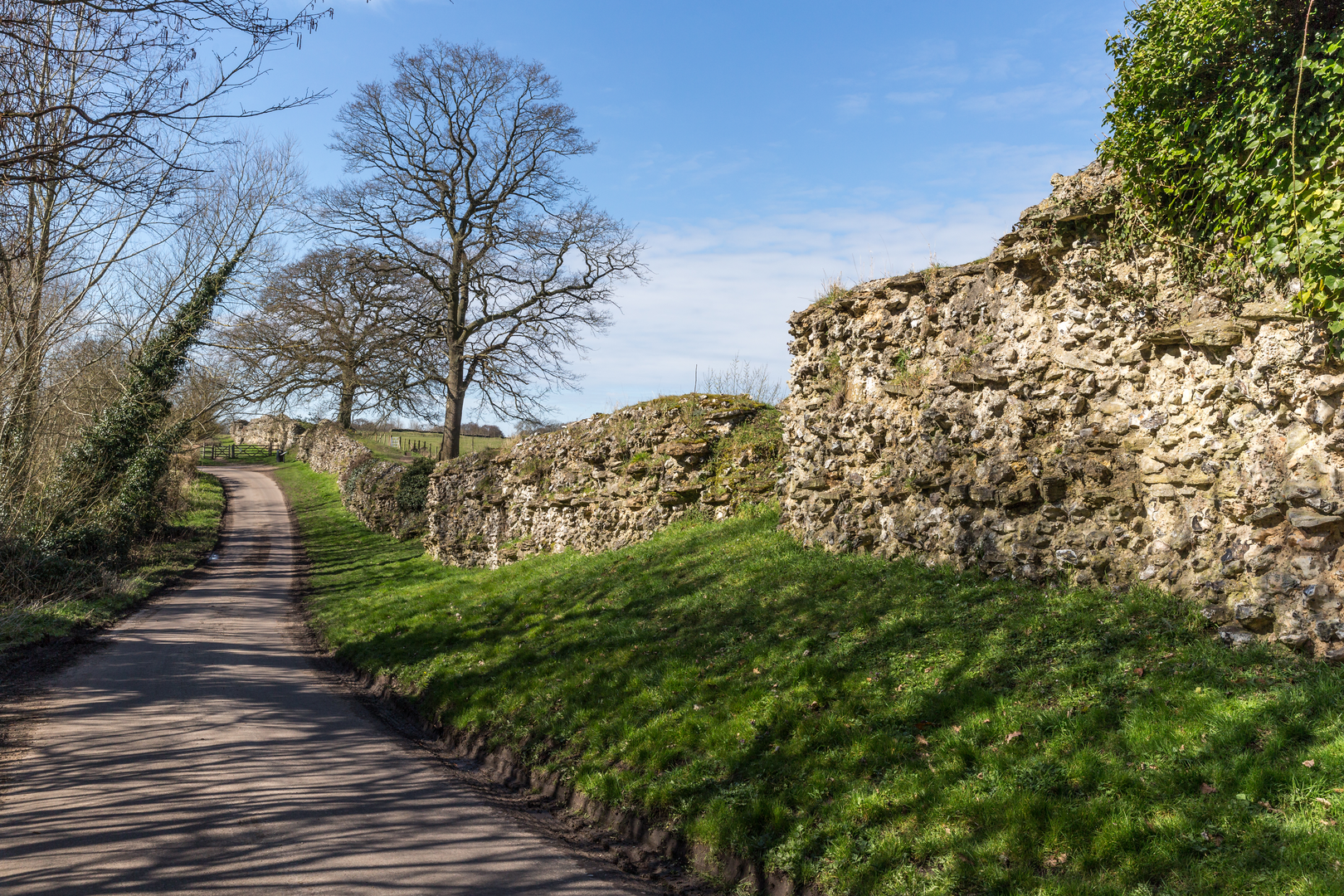
The Roman Way follows a route that is believed to have been used by the Romans, connecting various historical sites and Roman roads. As hikers progress along the trail, they will encounter remnants of Roman Britain, including ancient forts, villas, and sections of Roman roads that have withstood the test of time. This path is not just a journey through natural landscapes but also a walk through history, offering insights into the Roman legacy in the English countryside.
Trail Highlights and Landmarks
The trail meanders through the heart of the English countryside, showcasing a tapestry of rolling hills, woodlands, and picturesque villages. One of the early landmarks is the Roman villa at North Leigh, which provides a glimpse into the domestic life of the Romans with its well-preserved mosaic floors.
As the trail approaches the halfway mark, hikers will reach the historic city of Bath, known for its Roman-built baths. The city itself is a UNESCO World Heritage Site and offers a perfect opportunity for a rest day to explore its rich heritage and architecture.
Further along, the path intersects with the famous Fosse Way, another Roman road that once stretched across Roman Britain. This intersection is a significant point on the trail, symbolizing the connection between past and present routes.
Nature and Wildlife
The Roman Way is not only a historical journey but also a haven for nature enthusiasts. The trail passes through several nature reserves and areas of outstanding natural beauty. Hikers can expect to see a diverse range of flora and fauna, including wildflowers, birds of prey, and possibly even deer in the more secluded sections.
Navigation and Preparation
To navigate the trail, hikers are advised to use the HiiKER app, which provides detailed maps and essential information about the route. It's important to be prepared for the British weather, which can be unpredictable, so packing waterproof gear and layers is essential. Additionally, hikers should carry enough food and water, although there are opportunities to resupply in the towns and villages along the route.
Accommodation and Resupply Points
There are various accommodation options available, from camping sites to bed and breakfasts, allowing for a comfortable journey. Resupply points are conveniently located in the towns along the trail, where hikers can restock on provisions and enjoy local hospitality.
Safety and Etiquette
Hikers should be mindful of the Countryside Code, respecting the environment and local wildlife. It's also important to stay on marked paths to preserve the trail and its surroundings. In case of emergency, having a means to contact local authorities is crucial, so ensure your mobile phone is charged and you have backup power sources.
By following these guidelines and being prepared, hikers can fully immerse themselves in the experience of the Roman Way, enjoying the blend of historical discovery and natural beauty that this trail uniquely offers.

What to expect?
Activity types
Frequently asked questions
How long is the Roman Way in Oxfordshire and how many days does the full hike take?
The Roman Way is 278.51 km long, or about 173 miles, with 2,811 m of total ascent. Most hikers treat that as a multi-day point-to-point walk and break it into roughly 10 to 14 days, depending on daily mileage, weather, and how much time is spent at villages and historic sites along the route.
Is the Roman Way in Oxfordshire a difficult long-distance walk?
The Roman Way is generally rated easy, which makes it more approachable than many hill-heavy long-distance routes. The challenge comes more from its overall length of 278.51 km than from steep climbing, although the cumulative elevation gain still adds up to 2,811 m over the full route.
Where do hikers usually start the Roman Way in Oxfordshire?
The Roman Way is commonly approached from the Oxfordshire side near Chipping Norton, which works well as a practical access point for a long-distance walk through the county. Chipping Norton is a market town in north Oxfordshire, so it is a sensible place to organize transport, supplies, and an overnight stay before setting out.
Is there parking for the Roman Way near Chipping Norton?
Yes. Chipping Norton has several free town-center car parks as well as limited free on-street parking on High Street and Market Street, making it a practical place to leave a car before joining the Roman Way. For a 278.51 km point-to-point hike, many walkers still prefer a drop-off or onward transport plan rather than returning to the same parking spot.
Can the Roman Way in Oxfordshire be reached by public transport?
Yes. Chipping Norton is served by public transport, and Oxford has regular rail connections with onward bus links into the surrounding Oxfordshire area, so the Roman Way can be reached without driving. That makes it easier to plan a point-to-point itinerary rather than arranging a car shuttle at both ends.
What kind of terrain should hikers expect on the Roman Way in Oxfordshire?
The Roman Way crosses classic Oxfordshire countryside, with a mix of rolling ground, farmland, tracks, lanes, and sections of woodland rather than sustained mountain terrain. Even with an easy rating, the full route covers 278.51 km, so sturdy footwear and planning for repeated long days are still important.
What is the best time of year to hike the Roman Way in Oxfordshire?
Late spring through early autumn is usually the best window for the Roman Way, when longer daylight hours make a 278.51 km itinerary easier to manage. In wetter periods, field paths and rural tracks in Oxfordshire can become muddy, so conditions are often more comfortable from around May to September.
Comments and Reviews
User comments, reviews and discussions about the Roman Way, England.
4.71
average rating out of 5
7 rating(s)