Download
Preview
Add to list
More
105.5 km
~6 days
1228 m
Multi-Day
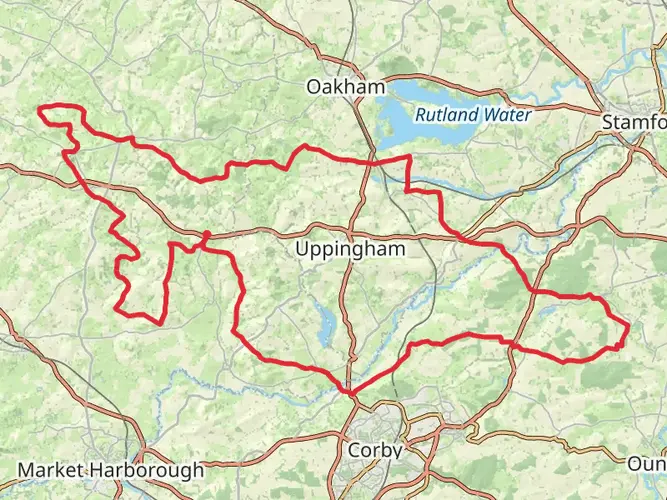
The Rutland Round is a 105.5 km trail that starts in , Rutland, England. Based on our data, the hike is graded as Easy. For information on how we grade trails, please read measuring the difficulty of a hiking trail on hiiker. Also, check our latest community posts for trail updates. This hike can be completed in approx 4 days. Caution is advised on trail times as this depends on multiple variables. For more info read about how we calculate hike time.

What to expect?
Frequently asked questions
How long is the Rutland Round and how many days does the Rutland Round take to walk?
The Rutland Round is 105.48 km long with 1,228 m of total ascent, so it is usually treated as a multi-day walk rather than a single-day outing. At a moderate pace, many walkers split it into about 4 to 6 days, depending on daily mileage, weather, and how much time is spent in places such as Oakham, Uppingham, and the Rutland Water section.
Is the Rutland Round an easy long-distance walk or a tough challenge?
The Rutland Round is generally rated easy, which makes it more approachable than many long-distance trails of similar length. The challenge comes more from the overall distance of 105.48 km than from steep climbing, with total elevation gain of 1,228 m spread across the route rather than concentrated in mountain terrain.
Does the Rutland Round go through Oakham and around Rutland Water?
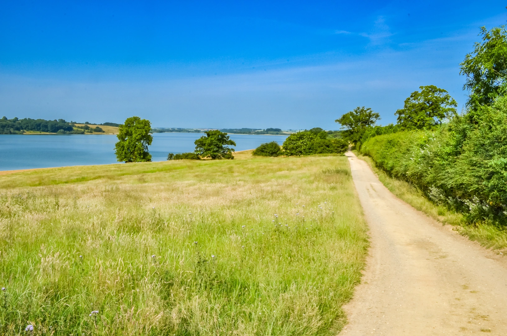
Yes. The route is known for circling much of Rutland’s perimeter while also making deliberate diversions to include Oakham and the Rutland Water area near Empingham. That gives the walk a mix of county-edge countryside, reservoir scenery, and access to Rutland’s main market town.
Can dogs go on the Rutland Round?
Dogs can generally be taken on public rights of way in Rutland, provided they are kept under close control. That matters on the Rutland Round because it uses countryside footpaths and farmland access, so leads may be needed around livestock, gates, and field sections.
Where can walkers start the Rutland Round and is there public transport for the Rutland Round?
Oakham is one of the most practical starting points for the Rutland Round because the route visits the county town and local bus links connect Oakham with places including Uppingham, Stamford, and Melton Mowbray. Empingham is also used as a route point on staged versions of the walk, especially for the Rutland Water section.
Is the Rutland Round waymarked, and what places does the Rutland Round pass?
The Rutland Round is a waymarked long-distance trail. Places commonly associated with the route include Oakham, Uppingham, Empingham, Rutland Water, Eyebrook Reservoir, Ketton, Harringworth Welland Viaduct, and Thistleton, giving the walk a varied mix of villages, open countryside, and landmark viewpoints.
Comments and Reviews
User comments, reviews and discussions about the Rutland Round, England.
average rating out of 5
0 rating(s)